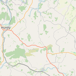
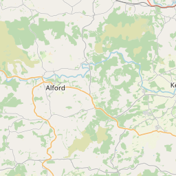
Mill of Pitcaple Map, Satellite view of Mill of Pitcaple, Aberdeenshire, Scotland
Mill of Pitcaple is located in Aberdeenshire County, Aberdeenshire, Scotland, Scotland, United Kingdom.
Location informations of Mill of Pitcaple
Latitude of city of Mill of Pitcaple is 57.32826 and longitude of city of Mill of Pitcaple is -2.44175. Mill of Pitcaple has 1 postcode / zip code, in county of Aberdeenshire.The County of Mill of Pitcaple is Aberdeenshire.
Postcode / zip code of Mill of Pitcaple
AB51 5Administrative division of Mill of Pitcaple
County :AberdeenshireGPS coordinates of Mill of Pitcaple
Latitude : 57.32826Longitude : -2.44175
Online Map of Mill of Pitcaple - road map, satellite view and street view


Leaflet | © OpenStreetMap contributors
Search distance between two cities
The weather for Mill of Pitcaple in the United Kingdom
Get today and tomorrow's weather forecasts for Mill of Pitcaple. Find out the weather forecast for the week ahead and the weekend for Mill of Pitcaple in the UK.Mill of Pitcaple weather forecast 15 days
What is the nearest train station to Mill of Pitcaple?
List of Railway Stations near to Mill of PitcapleThe nearest railway stations to Mill of Pitcaple are listed below. Tickets are available at the train station ticket office or ticket machines.
| Name | Distances from Mill of Pitcaple |
|---|---|
| Inverurie Station | 6.21 Km |
| Insch Station | 10.57 Km |
| Dyce Station | 20.27 Km |
| Huntly Station | 23.83 Km |
| Aberdeen Station | 29.11 Km |
What is the nearest Public Transport Stops to Mill of Pitcaple?
List of Stops near to Mill of PitcapleGetting there by public transport (nearest train, tube, overground line station and bus stops). The nearest stops to Mill of Pitcaple are listed below.
| Stop Name | Distances from Mill of Pitcaple |
|---|---|
| Skellarts Bus Stop (adj) | 1.24 Km |
| Mains of Glack Bus Stop (at) | 1.39 Km |
| Whiteford Road Bus Stop (opp) | 1.41 Km |
| Whiteford Road Bus Stop (at) | 1.42 Km |
| Home Farm Bus Stop (opp) | 1.45 Km |
| Gunhill Crossroads Bus Stop (Unclassified Road) | 1.49 Km |
| Auchencleith Bus Stop (SE bound) | 1.50 Km |
| Home Farm Bus Stop (adj) | 1.52 Km |
| Dockendale Road-end Bus Stop (A96) | 1.66 Km |
| Milton of Inveramsay Bus Stop (opp) | 1.66 Km |
Historic Places to Visit near Mill of Pitcaple
List of Historic places near to Mill of Pitcaple
| Name | Distances from Mill of Pitcaple |
|---|---|
| Loanhead of Daviot Stone Circle | 2.69 Km |
| Maiden Stone | 3.65 Km |
| Brandsbutt Symbol Stone | 4.70 Km |
| East Aquhorthies Stone Circle | 5.70 Km |
| Mither Tap OBennachie | 6.60 Km |
| Inverurie Symbol Stones | 7.39 Km |
| Inverurie Bass | 7.45 Km |
| Newton Stone | 7.92 Km |
| Kinkell Church | 8.99 Km |
| Bennachie | 9.00 Km |
| Lang Stane oCraigearn | 11.58 Km |
| Fyvie Symbol Stones | 11.74 Km |
| Kintore Symbol Stone | 11.78 Km |
| Dunnideer Castle | 12.32 Km |
| Monymusk Church | 12.35 Km |
| Picardy Symbol Stone | 13.09 Km |
| Fyvie Castle | 13.18 Km |
| Tolquhon Castle | 13.83 Km |
| Castle Fraser | 13.94 Km |
| Tarves Medieval Tomb | 14.16 Km |
| Logie Newton Cairns | 14.71 Km |
Cities or Towns near Mill of Pitcaple
List of places near to
| Name | Distance |
|---|---|
| Damhead | 0.00 Km |
| Whiteford | 1.55 Km |
| Pitcaple | 1.81 Km |
| Daviot | 2.39 Km |
| Durno | 2.52 Km |
| Drimmies | 3.05 Km |
| Chapel of Garioch | 3.06 Km |
| Balhalgardy | 3.31 Km |
| Meikle Wartle | 4.05 Km |
| Fingask | 4.19 Km |
| Whitemyres | 4.39 Km |
| Kirkton of Oyne | 5.08 Km |
| Jackstown | 5.13 Km |
| Kirkton of Rayne | 5.18 Km |
| Eastertown | 5.50 Km |
| Westertown | 5.51 Km |
| Whitefield | 5.86 Km |
| Old Westhall | 6.06 Km |
| Cross of Jackston | 6.08 Km |
| Oyne | 6.26 Km |
| Old Rayne | 6.30 Km |
| Inverurie | 6.34 Km |
| Hillbrae | 6.35 Km |
| North Rayne | 6.53 Km |
| Folla Rule | 6.57 Km |
| Pitmachie | 6.58 Km |
| New Rayne | 6.63 Km |
| Burnhervie | 7.06 Km |
| Bonnyton | 7.16 Km |
| Oldmeldrum | 7.32 Km |
| Tocher | 7.39 Km |
| Mosshead | 7.41 Km |
| Bograxie | 7.44 Km |
| Kirkton of Bourtie | 7.53 Km |
| Port Elphinstone | 7.95 Km |
| Ardoyne | 8.04 Km |
| Aquhythie | 8.19 Km |
| St Katherines | 9.10 Km |
| Rothienorman | 9.23 Km |
| Kirkton | 9.33 Km |
| Cairnhill | 9.40 Km |
| Cromlet | 9.50 Km |
| Blairdaff | 9.56 Km |
| Clovenstone | 9.76 Km |
| Grantlodge | 9.79 Km |
| South Flobbets | 9.79 Km |
| Upper Woodend | 9.88 Km |
| North Flobbets | 9.98 Km |
| Rothney | 10.02 Km |
| Nether Crimond | 10.04 Km |