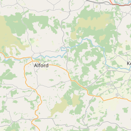
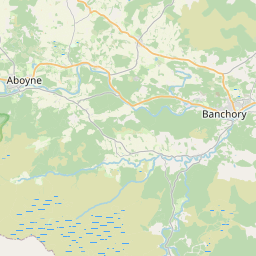
Midmar Map, Satellite view of Midmar, Aberdeenshire, Scotland
Midmar is located in Aberdeenshire County, Aberdeenshire, Scotland, Scotland, United Kingdom.
Location informations of Midmar
Latitude of city of Midmar is 57.15835 and longitude of city of Midmar is -2.52705. Midmar has 1 postcode / zip code, in county of Aberdeenshire.The County of Midmar is Aberdeenshire.
Postcode / zip code of Midmar
AB51 7Administrative division of Midmar
County :AberdeenshireGPS coordinates of Midmar
Latitude : 57.15835Longitude : -2.52705
Online Map of Midmar - road map, satellite view and street view


Leaflet | © OpenStreetMap contributors
Search distance between two cities
The weather for Midmar in the United Kingdom
Get today and tomorrow's weather forecasts for Midmar. Find out the weather forecast for the week ahead and the weekend for Midmar in the UK.Midmar weather forecast 15 days
What is the nearest train station to Midmar?
List of Railway Stations near to MidmarThe nearest railway stations to Midmar are listed below. Tickets are available at the train station ticket office or ticket machines.
| Name | Distances from Midmar |
|---|---|
| Inverurie Station | 16.96 Km |
| Insch Station | 20.64 Km |
| Dyce Station | 20.85 Km |
| Aberdeen Station | 25.89 Km |
| Portlethen Station | 26.47 Km |
| Stonehaven Station | 28.04 Km |
What is the nearest Public Transport Stops to Midmar?
List of Stops near to MidmarGetting there by public transport (nearest train, tube, overground line station and bus stops). The nearest stops to Midmar are listed below.
| Stop Name | Distances from Midmar |
|---|---|
| Road End Bus Stop (at) | 927 m |
| Road End Bus Stop (opp) | 931 m |
| Auchorie Bus Stop | 2.15 Km |
| Auchorie Bus Stop | 2.15 Km |
| Dockenwell Bus Stop (opp) | 2.89 Km |
| Dockenwell Bus Stop (at) | 2.89 Km |
| Hillview Bus Stop (opp) | 3.37 Km |
| Hillview Bus Stop (at) | 3.38 Km |
| Learney Lodge Bus Stop (E bound) | 3.59 Km |
| Learney Lodge Bus Stop (W bound) | 3.60 Km |
Historic Places to Visit near Midmar
List of Historic places near to Midmar
| Name | Distances from Midmar |
|---|---|
| Midmar Kirk Stone Circle | 2.09 Km |
| Sunhoney Stone Circle | 3.86 Km |
| Castle Fraser | 6.41 Km |
| Whitehill Stone Circle | 7.08 Km |
| Monymusk Church | 7.58 Km |
| Lang Stane oCraigearn | 8.41 Km |
| Glassel Dam Wood Stone Circle | 8.59 Km |
| Cullerlie Stone Circle | 10.81 Km |
| Peel Ring Of Lumphanan | 11.31 Km |
| Craigievar Castle | 11.71 Km |
| Banchory Museum | 12.08 Km |
| Kincardine ONeil Auld Kirk | 12.14 Km |
| Crathes Castle | 12.33 Km |
| Falls of Feugh | 12.76 Km |
| Drum Castle | 13.42 Km |
| Grampian Transport Museum | 13.62 Km |
| Kintore Symbol Stone | 14.06 Km |
| East Aquhorthies Stone Circle | 14.08 Km |
| Bennachie | 14.11 Km |
| Bucharn Cairn | 14.82 Km |
| Mither Tap OBennachie | 14.82 Km |
Cities or Towns near Midmar
List of places near to
| Name | Distance |
|---|---|
| Tillybirloch | 0.59 Km |
| Comers | 0.91 Km |
| Bankhead | 2.22 Km |
| Marionburgh | 2.54 Km |
| Ordhead | 3.38 Km |
| Millbank | 3.87 Km |
| Sauchen | 3.90 Km |
| Old Kinnernie | 4.67 Km |
| Mill of Echt | 5.68 Km |
| South Kirkton | 5.68 Km |
| Tillyfourie | 6.05 Km |
| Echt | 6.05 Km |
| Moor of Balvack | 6.11 Km |
| Tornaveen | 6.36 Km |
| Landerberry | 6.73 Km |
| Dunecht | 7.25 Km |
| Craigearn | 7.72 Km |
| Monymusk | 7.76 Km |
| Milton of Campfield | 8.02 Km |
| Pitmunie | 8.05 Km |
| Letter | 8.23 Km |
| Torphins | 8.28 Km |
| Lyne of Skene | 8.73 Km |
| Kirkton of Tough | 8.75 Km |
| Torries | 8.85 Km |
| Pitfichie | 8.90 Km |
| Hirn | 8.95 Km |
| Mid Beltie | 9.10 Km |
| Glassel | 9.17 Km |
| Brathens | 9.47 Km |
| Whitehouse | 9.66 Km |
| Schoolhill | 9.69 Km |
| Grantlodge | 9.80 Km |
| Ord Mill | 9.89 Km |
| Kemnay | 9.93 Km |
| Leylodge | 10.13 Km |
| Blairdaff | 10.17 Km |
| Garlogie | 10.18 Km |
| Lochton of Leys | 10.36 Km |
| Inchmarlo | 10.39 Km |
| Pinecrest | 10.67 Km |
| Upper Lochton | 10.72 Km |
| Bridge of Canny | 10.74 Km |
| Perkhill | 10.75 Km |
| Redhill | 10.78 Km |
| Brucklebog | 11.06 Km |
| The Neuk | 11.21 Km |
| Hill of Banchory | 11.34 Km |
| Lumphanan | 11.46 Km |
| Silverbank | 11.58 Km |