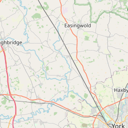
Menthorpe Map, Satellite view of Menthorpe, East Riding of Yorkshire, England
Menthorpe is located in East Riding of Yorkshire County, East Riding of Yorkshire, Yorkshire and the Humber, England, United Kingdom.
Location informations of Menthorpe
Latitude of city of Menthorpe is 53.80203 and longitude of city of Menthorpe is -0.93104. Menthorpe has 1 postcode / zip code, in county of East Riding of Yorkshire.The County of Menthorpe is East Riding of Yorkshire.
Postcode / zip code of Menthorpe
YO8 6Administrative division of Menthorpe
County :East Riding of YorkshireGPS coordinates of Menthorpe
Latitude : 53.80203Longitude : -0.93104
Online Map of Menthorpe - road map, satellite view and street view


Leaflet | © OpenStreetMap contributors
Search distance between two cities
The weather for Menthorpe in the United Kingdom
Get today and tomorrow's weather forecasts for Menthorpe. Find out the weather forecast for the week ahead and the weekend for Menthorpe in the UK.Menthorpe weather forecast 15 days
What is the nearest train station to Menthorpe?
List of Railway Stations near to MenthorpeThe nearest railway stations to Menthorpe are listed below. Tickets are available at the train station ticket office or ticket machines.
| Name | Distances from Menthorpe |
|---|---|
| Wressle Station | 3.27 Km |
| Howden Station | 6.22 Km |
| Selby Station | 8.98 Km |
| Eastrington Station | 10.77 Km |
| Goole Station | 11.43 Km |
| Saltmarshe Station | 11.97 Km |
| Rawcliffe Station | 12.72 Km |
| Snaith Station | 13.70 Km |
| Gilberdyke Station | 14.38 Km |
| Hensall Station | 16.67 Km |
What is the nearest Public Transport Stops to Menthorpe?
List of Stops near to MenthorpeGetting there by public transport (nearest train, tube, overground line station and bus stops). The nearest stops to Menthorpe are listed below.
| Stop Name | Distances from Menthorpe |
|---|---|
| Breighton Sand Lane Bus Stop (22001337) | 491 m |
| Breighton Sand Lane Bus Stop (22001338) | 532 m |
| Bubwith White Swan Bus Stop (22000673) | 1.99 Km |
| Bubwith White Swan Bus Stop (22001581) | 1.99 Km |
| Bubwith Main Street Bus Stop (22000045) | 2.05 Km |
| Bubwith Main Street Bus Stop (22000044) | 2.10 Km |
| Bubwith Highfield Rd Bus Stop (22001582) | 2.14 Km |
| Derwent Cottage Farm l e Bus Stop (W-bound) | 2.17 Km |
| Derwent Cottage Farm l e Bus Stop (E-bound) | 2.19 Km |
| Bubwith Vine Gardens Bus Stop (22000672) | 2.32 Km |
Historic Places to Visit near Menthorpe
List of Historic places near to Menthorpe
| Name | Distances from Menthorpe |
|---|---|
| Howden Minster | 7.54 Km |
| Howden Bishops Manor | 7.59 Km |
| Selby Abbey | 9.08 Km |
| Stillingfleet Lodge Gardens | 13.18 Km |
| Yorkshire Air Museum and Allied Air Forces Memorial | 13.76 Km |
Cities or Towns near Menthorpe
List of places near to
| Name | Distance |
|---|---|
| Breighton | 0.56 Km |
| Bubwith | 2.05 Km |
| South Duffield | 2.62 Km |
| Highfield | 2.71 Km |
| Wressle | 3.07 Km |
| North Duffield | 3.29 Km |
| Willitoft | 3.95 Km |
| Cliffe Common | 4.06 Km |
| Aughton | 4.15 Km |
| Harlthorpe | 4.56 Km |
| Hemingbrough | 4.99 Km |
| Cliffe | 4.99 Km |
| Brind | 5.04 Km |
| Newsholme | 5.17 Km |
| Ellerton | 5.40 Km |
| Spaldington | 5.49 Km |
| Lund | 5.58 Km |
| Gribthorpe | 5.58 Km |
| Newhay | 5.65 Km |
| Foggathorpe | 5.69 Km |
| Skipwith | 5.71 Km |
| Lakeside Cottages | 5.94 Km |
| Barmby on the Marsh | 6.06 Km |
| Osgodby Common | 6.07 Km |
| North Howden | 6.12 Km |
| Little Skipwith | 6.33 Km |
| Osgodby | 6.49 Km |
| Asselby | 6.59 Km |
| Long Drax / Langrick | 6.63 Km |
| Laytham | 6.67 Km |
| Thorganby Gale | 7.04 Km |
| Barlby | 7.13 Km |
| Knedlington | 7.22 Km |
| Howden | 7.51 Km |
| Thorganby | 7.61 Km |
| East Cottingwith | 7.80 Km |
| Barlow | 8.28 Km |
| Boothferry | 8.54 Km |
| East Common | 8.55 Km |
| Welham Bridge | 8.64 Km |
| Drax | 8.77 Km |
| Booth | 9.00 Km |
| Howdendyke | 9.11 Km |
| Water End | 9.15 Km |
| Riccall | 9.15 Km |
| Little Airmyn | 9.21 Km |
| Portington | 9.26 Km |
| Kilpin Pike | 9.30 Km |
| Selby | 9.34 Km |
| Airmyn | 9.42 Km |