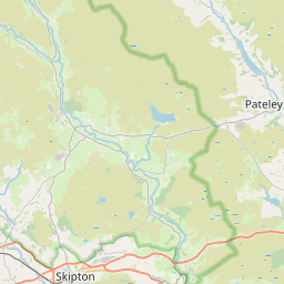
Manywells Height Map, Satellite view of Manywells Height, West Yorkshire, England
Manywells Height is located in West Yorkshire County, Bradford District, Yorkshire and the Humber, England, United Kingdom.
Location informations of Manywells Height
Latitude of city of Manywells Height is 53.81574 and longitude of city of Manywells Height is -1.90276. Manywells Height has 1 postcode / zip code, in county of West Yorkshire.The County of Manywells Height is West Yorkshire.
Postcode / zip code of Manywells Height
BD13 5Administrative division of Manywells Height
County :West YorkshireGPS coordinates of Manywells Height
Latitude : 53.81574Longitude : -1.90276
Online Map of Manywells Height - road map, satellite view and street view


Leaflet | © OpenStreetMap contributors
Search distance between two cities
The weather for Manywells Height in the United Kingdom
Get today and tomorrow's weather forecasts for Manywells Height. Find out the weather forecast for the week ahead and the weekend for Manywells Height in the UK.Manywells Height weather forecast 15 days
What is the nearest train station to Manywells Height?
List of Railway Stations near to Manywells HeightThe nearest railway stations to Manywells Height are listed below. Tickets are available at the train station ticket office or ticket machines.
| Name | Distances from Manywells Height |
|---|---|
| Bingley Station | 5.64 Km |
| Keighley Station | 5.81 Km |
| Crossflatts Station | 6.08 Km |
| Saltaire Station | 7.79 Km |
| Shipley Station | 8.70 Km |
| Frizinghall Station | 8.80 Km |
| Steeton and Silsden Station | 9.77 Km |
| Bradford Forster Square Station | 10.06 Km |
| Bradford Interchange Station | 10.43 Km |
| Baildon Station | 10.51 Km |
What is the nearest Public Transport Stops to Manywells Height?
List of Stops near to Manywells HeightGetting there by public transport (nearest train, tube, overground line station and bus stops). The nearest stops to Manywells Height are listed below.
| Stop Name | Distances from Manywells Height |
|---|---|
| Keighley Road Trough Ln Bus Stop | 146 m |
| Halifax Rd Trough Lane Bus Stop | 171 m |
| Keighley Rd Beech Drive Bus Stop (adj) | 388 m |
| Keighley Rd Beech Drive Bus Stop | 408 m |
| Manywells Brow Ind Estate Bus Stop (at) | 585 m |
| Manywells Brow Ind Estate Bus Stop (opp) | 669 m |
| Haworth Rd Turf Lane Bus Stop (opp) | 780 m |
| Haworth Rd Turf Lane Bus Stop | 786 m |
| Haworth Road Bus Stop | 833 m |
| Haworth Road Coldspring House Bus Stop | 844 m |
Historic Places to Visit near Manywells Height
List of Historic places near to Manywells Height
| Name | Distances from Manywells Height |
|---|---|
| Bronte Parsonage Museum | 3.92 Km |
| Haworth, St Michaels Church | 3.92 Km |
| East Riddlesden Hall | 6.74 Km |
| Top Withens | 8.34 Km |
| Colour Experience | 9.73 Km |
| Halifax, All Souls Church | 9.84 Km |
| National Media Museum | 10.02 Km |
| Hardcastle Crags | 10.08 Km |
| Gibsons Mill | 10.73 Km |
| Copley, St Stephens Church | 13.26 Km |
Cities or Towns near Manywells Height
List of places near to
| Name | Distance |
|---|---|
| Denholme Edge | 1.00 Km |
| Cullingworth | 1.29 Km |
| Denholme | 1.50 Km |
| Harecroft | 1.65 Km |
| Flappit Spring | 1.79 Km |
| Wilsden Hill | 2.23 Km |
| Bents Head | 2.23 Km |
| Sawood | 2.28 Km |
| Leeming | 2.48 Km |
| Barcroft | 2.76 Km |
| Denholme Clough | 2.82 Km |
| Cross Roads | 2.82 Km |
| Well Heads | 2.82 Km |
| Wilsden | 2.91 Km |
| Lingbob | 2.99 Km |
| Cradle Edge | 3.00 Km |
| Dean Lane Head | 3.15 Km |
| Whins Wood | 3.16 Km |
| Denholme Gate | 3.19 Km |
| Lees | 3.24 Km |
| Norr | 3.35 Km |
| Keelham | 3.35 Km |
| Oxenhope | 3.35 Km |
| Marsh Top | 3.50 Km |
| Hainworth Shaw | 3.51 Km |
| Harden | 3.53 Km |
| The Shay | 3.57 Km |
| Hainworth | 3.60 Km |
| Green Clough | 3.60 Km |
| Harewood Hill | 3.60 Km |
| Moor Edge | 3.60 Km |
| Sun Side | 3.64 Km |
| Hermit Hole | 3.75 Km |
| Damems | 3.85 Km |
| Marsh | 3.87 Km |
| Haworth | 3.91 Km |
| Shay Gate | 3.99 Km |
| Bracken Bank | 4.11 Km |
| Lee Lane | 4.18 Km |
| Cackleshaw | 4.18 Km |
| Dockroyd | 4.23 Km |
| Mytholmes | 4.23 Km |
| Upper Marsh | 4.26 Km |
| Moor Side | 4.32 Km |
| Ingrow | 4.36 Km |
| Thornton | 4.36 Km |
| Spring Bank | 4.40 Km |
| Bogthorn | 4.40 Km |
| Raggalds | 4.47 Km |
| Stony Lane | 4.47 Km |