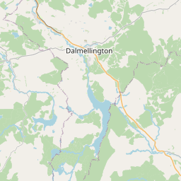
Mansfield Map, Satellite view of Mansfield, Ayrshire and Arran, Scotland
Mansfield is located in Ayrshire and Arran County, East Ayrshire, Scotland, Scotland, United Kingdom.
Location informations of Mansfield
Latitude of city of Mansfield is 55.40319 and longitude of city of Mansfield is -4.17990. Mansfield has 1 postcode / zip code, in county of Ayrshire and Arran.The County of Mansfield is Ayrshire and Arran.
Postcode / zip code of Mansfield
KA18 4Administrative division of Mansfield
County :Ayrshire and ArranGPS coordinates of Mansfield
Latitude : 55.40319Longitude : -4.17990
Online Map of Mansfield - road map, satellite view and street view


Leaflet | © OpenStreetMap contributors
Search distance between two cities
The weather for Mansfield in the United Kingdom
Get today and tomorrow's weather forecasts for Mansfield. Find out the weather forecast for the week ahead and the weekend for Mansfield in the UK.Mansfield weather forecast 15 days
What is the nearest train station to Mansfield?
List of Railway Stations near to MansfieldThe nearest railway stations to Mansfield are listed below. Tickets are available at the train station ticket office or ticket machines.
| Name | Distances from Mansfield |
|---|---|
| New Cumnock Station | 284 m |
| Auchinleck Station | 10.43 Km |
| Kirkconnel Station | 11.57 Km |
| Sanquhar Station | 16.54 Km |
| Ayr Station | 28.79 Km |
| Newton-On-Ayr Station | 29.21 Km |
| Prestwick Station | 29.55 Km |
| Prestwick Internat'nl Airport Station | 29.80 Km |
What is the nearest Public Transport Stops to Mansfield?
List of Stops near to MansfieldGetting there by public transport (nearest train, tube, overground line station and bus stops). The nearest stops to Mansfield are listed below.
| Stop Name | Distances from Mansfield |
|---|---|
| Polquheys Road Bus Stop (before) | 164 m |
| Polquheys Road Bus Stop (opp) | 210 m |
| New Cumnock Rail Station | 212 m |
| Afton Cottage Bus Stop (opp) | 269 m |
| Loch View Bus Stop (opp) | 343 m |
| Lochview Bus Stop (after) | 391 m |
| Lochview Bus Stop (opp) | 422 m |
| Castlehill Bus Stop (opp) | 643 m |
| Castlehill Bus Stop (before) | 653 m |
| Castle Primary school Bus Stop (at) | 1.02 Km |
Historic Places to Visit near Mansfield
List of Historic places near to Mansfield
| Name | Distances from Mansfield |
|---|---|
| Dumfries House | 9.97 Km |
| Sorn Castle | 14.56 Km |
Cities or Towns near Mansfield
List of places near to
| Name | Distance |
|---|---|
| Pathhead | 0.26 Km |
| New Cumnock | 0.75 Km |
| Afton Bridgend | 0.98 Km |
| Connel Park | 2.38 Km |
| Bankglen | 2.82 Km |
| Burnside | 4.32 Km |
| Dalblair | 5.50 Km |
| Craigens | 5.83 Km |
| Dalleagles | 6.06 Km |
| Netherthird | 6.28 Km |
| Barshare | 6.94 Km |
| Logan | 6.99 Km |
| Lugar | 7.59 Km |
| Cumnock | 7.96 Km |
| Cronberry | 8.43 Km |
| Holmhead | 8.52 Km |
| The Rigg | 9.08 Km |
| Birnieknowe | 9.36 Km |
| Skares | 9.50 Km |
| Back Rogerton | 10.48 Km |
| Auchinleck | 10.64 Km |
| Dalshalloch | 10.98 Km |
| Kelloholm | 12.01 Km |
| Kirkconnel | 12.10 Km |
| Ochiltree | 13.35 Km |
| Sorn | 13.86 Km |
| Smallburn | 13.90 Km |
| Kames | 14.39 Km |
| Pennyvenie | 14.68 Km |
| Whiteflat | 14.70 Km |
| Catrine | 14.77 Km |