Lower Wootton Map, Satellite view of Lower Wootton, Herefordshire, England
Lower Wootton is located in Herefordshire County, County of Herefordshire, West Midlands, England, United Kingdom.
Location informations of Lower Wootton
Latitude of city of Lower Wootton is 52.16960 and longitude of city of Lower Wootton is -2.98418. Lower Wootton has 1 postcode / zip code, in county of Herefordshire.The County of Lower Wootton is Herefordshire.
Postcode / zip code of Lower Wootton
HR3 6Administrative division of Lower Wootton
County :HerefordshireGPS coordinates of Lower Wootton
Latitude : 52.16960Longitude : -2.98418
Online Map of Lower Wootton - road map, satellite view and street view
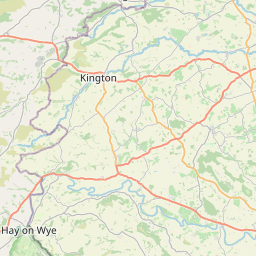


Leaflet | © OpenStreetMap contributors
Search distance between two cities
The weather for Lower Wootton in the United Kingdom
Get today and tomorrow's weather forecasts for Lower Wootton. Find out the weather forecast for the week ahead and the weekend for Lower Wootton in the UK.Lower Wootton weather forecast 15 days
What is the nearest train station to Lower Wootton?
List of Railway Stations near to Lower WoottonThe nearest railway stations to Lower Wootton are listed below. Tickets are available at the train station ticket office or ticket machines.
| Name | Distances from Lower Wootton |
|---|---|
| Leominster Station | 18.39 Km |
| Knighton Station | 19.91 Km |
| Bucknell Station | 21.03 Km |
| Hereford Station | 22.37 Km |
| Knucklas Station | 22.50 Km |
| Llangynllo Station | 23.37 Km |
| Dolau Station | 23.62 Km |
| Llanbister Road Station | 24.24 Km |
| Hopton Heath Station | 25.15 Km |
| Pen-Y-Bont Station | 25.77 Km |
Shobdon Aerodrome , UK (10.66 Km)
What is the nearest Public Transport Stops to Lower Wootton?
List of Stops near to Lower WoottonGetting there by public transport (nearest train, tube, overground line station and bus stops). The nearest stops to Lower Wootton are listed below.
| Stop Name | Distances from Lower Wootton |
|---|---|
| West View Bus Stop (adj) | 1.17 Km |
| West View Bus Stop (opp) | 1.18 Km |
| Church Bus Stop (opp) | 1.42 Km |
| Church Bus Stop (adj) | 1.43 Km |
| Shelter Bus Stop (adj) | 2.35 Km |
| Shelter Bus Stop (opp) | 2.36 Km |
| Almeley Turn Bus Stop (NW-bound) | 2.57 Km |
| Almeley Turn Bus Stop (adj) | 2.57 Km |
| Almeley Turn Bus Stop (opp) | 2.58 Km |
| Burnt Orchard Bus Stop (adj) | 2.81 Km |
Historic Places to Visit near Lower Wootton
List of Historic places near to Lower Wootton
Cities or Towns near Lower Wootton
List of places near to
| Name | Distance |
|---|---|
| Upper Wootton | 0.18 Km |
| Almeley Wootton | 0.58 Km |
| Almeley | 1.49 Km |
| Hopley's Green | 1.74 Km |
| Upcott | 1.95 Km |
| Holme Marsh | 2.27 Km |
| Woonton | 2.44 Km |
| Logaston | 2.59 Km |
| Woonton Ash | 2.63 Km |
| Kinnersley | 3.14 Km |
| Lyonshall | 3.16 Km |
| Woodbrook | 3.23 Km |
| Meer Common | 3.42 Km |
| Upper Welson | 3.54 Km |
| Kingswood | 3.58 Km |
| Dukes | 3.70 Km |
| Eardisley | 3.72 Km |
| Sallys | 3.76 Km |
| Upper Broxwood | 3.76 Km |
| New Street | 3.99 Km |
| Lower Broxwood | 4.13 Km |
| Lower Welson | 4.19 Km |
| Headbrook | 4.32 Km |
| Sunset | 4.32 Km |
| Moorcot | 4.34 Km |
| Hurstley | 4.40 Km |
| Chickward | 4.41 Km |
| Newman's Place | 4.67 Km |
| Nextend | 4.67 Km |
| Lower Green | 4.81 Km |
| Sarnesfield | 4.82 Km |
| Bredward | 4.86 Km |
| Kington | 4.87 Km |
| Lewis Wych | 5.01 Km |
| Weston | 5.20 Km |
| Woods Eaves | 5.28 Km |
| Pentre-Jack | 5.43 Km |
| Nutfield | 5.71 Km |
| Willersley | 5.75 Km |
| Lower Hergest | 5.77 Km |
| Flintsham | 5.81 Km |
| Mahollam | 5.82 Km |
| Bradnor Green | 5.88 Km |
| Rushock | 5.89 Km |
| Marston | 5.92 Km |
| Upper Marston | 5.94 Km |
| Brilley Mountain | 6.09 Km |
| Calver Hill | 6.19 Km |
| Shawl | 6.24 Km |
| Winforton | 6.28 Km |