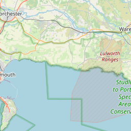
Lower Whatcombe Map, Satellite view of Lower Whatcombe, Dorset, England
Lower Whatcombe is located in Dorset County, North Dorset District, South West, England, United Kingdom.
Location informations of Lower Whatcombe
Latitude of city of Lower Whatcombe is 50.81046 and longitude of city of Lower Whatcombe is -2.22858. Lower Whatcombe has 1 postcode / zip code, in county of Dorset.The County of Lower Whatcombe is Dorset.
Postcode / zip code of Lower Whatcombe
DT11 0Administrative division of Lower Whatcombe
County :DorsetGPS coordinates of Lower Whatcombe
Latitude : 50.81046Longitude : -2.22858
Online Map of Lower Whatcombe - road map, satellite view and street view


Leaflet | © OpenStreetMap contributors
Search distance between two cities
The weather for Lower Whatcombe in the United Kingdom
Get today and tomorrow's weather forecasts for Lower Whatcombe. Find out the weather forecast for the week ahead and the weekend for Lower Whatcombe in the UK.Lower Whatcombe weather forecast 15 days
What is the nearest train station to Lower Whatcombe?
List of Railway Stations near to Lower WhatcombeThe nearest railway stations to Lower Whatcombe are listed below. Tickets are available at the train station ticket office or ticket machines.
| Name | Distances from Lower Whatcombe |
|---|---|
| Moreton (Dorset) Station | 13.55 Km |
| Wool Station | 14.33 Km |
| Holton Heath Station | 15.29 Km |
| Wareham Station | 15.31 Km |
| Hamworthy Station | 17.50 Km |
| Dorchester South Station | 18.49 Km |
| Dorchester West Station | 18.68 Km |
| Poole Station | 20.00 Km |
| Parkstone Station | 22.00 Km |
| Branksome Station | 23.62 Km |
What is the nearest Public Transport Stops to Lower Whatcombe?
List of Stops near to Lower WhatcombeGetting there by public transport (nearest train, tube, overground line station and bus stops). The nearest stops to Lower Whatcombe are listed below.
| Stop Name | Distances from Lower Whatcombe |
|---|---|
| Watcombe Bus Stop (SW-bound) | 665 m |
| Watcombe Bus Stop (N-bound) | 667 m |
| The Dairy Bus Stop (S-bound) | 912 m |
| The Dairy Bus Stop (N-bound) | 914 m |
| Blandford Hill Bus Stop (E-bound) | 1.02 Km |
| Blandford Hill Bus Stop (W-bound) | 1.05 Km |
| Dunbury School Bus Stop (SE-bound) | 1.08 Km |
| Whitechurch Caravan Park Bus Stop (NE-bound) | 1.47 Km |
| Whitechurch Caravan Park Bus Stop (SW-bound) | 1.50 Km |
| Kingston Cross Bus Stop (NE-bound) | 1.64 Km |
Historic Places to Visit near Lower Whatcombe
List of Historic places near to Lower Whatcombe
| Name | Distances from Lower Whatcombe |
|---|---|
| Winterborne Whitechurch, St Marys Church | 1.08 Km |
| Milton Abbey | 4.24 Km |
| Winterborne Tomson, St Andrews Church | 5.84 Km |
| Bere Regis, St Johns Church | 6.44 Km |
| Blandford Forum, St Peter & St Paul Church | 6.82 Km |
| Tarrant Crawford, St Marys Church | 8.29 Km |
| Tolpuddle, St Johns Church | 8.32 Km |
| Tarrant Keynston, All Saints Church | 8.94 Km |
| Tolpuddle Martyrs Museum | 9.34 Km |
| Royal Signals Museum | 9.73 Km |
| Athelhampton House | 9.82 Km |
| Clouds Hill | 10.39 Km |
| Puddletown, St Marys Church | 10.63 Km |
| Tarrant Rushton, St Marys Church | 10.86 Km |
| White Mill | 11.84 Km |
| Pimperne Long Barrow | 12.05 Km |
| Moreton, St Nicholas Church | 12.53 Km |
| Badbury Rings | 12.53 Km |
| Tank Museum | 12.84 Km |
| Fiddleford Manor | 12.96 Km |
| Kingston Lacy | 13.99 Km |
| Hardys Cottage | 14.42 Km |
Cities or Towns near Lower Whatcombe
List of places near to
| Name | Distance |
|---|---|
| Higher Whatcombe | 0.56 Km |
| Winterborne Whitechurch | 1.03 Km |
| Lower Street | 1.69 Km |
| Winterborne Clenston | 1.83 Km |
| Milton Abbas | 3.01 Km |
| Dunbury | 3.14 Km |
| Winterborne Stickland | 3.37 Km |
| Thornicombe | 3.44 Km |
| Winterborne Houghton | 3.80 Km |
| Winterborne Kingston | 4.14 Km |
| Quarleston | 4.91 Km |
| Winterborne Muston | 5.02 Km |
| Hedge End | 5.04 Km |
| Birch Close | 5.05 Km |
| Hopsfield | 5.09 Km |
| Shothole | 5.19 Km |
| Milborne St Andrew | 5.22 Km |
| Anderson | 5.55 Km |
| Winterborne Tomson | 5.81 Km |
| Shitterton | 6.10 Km |
| Hilton | 6.20 Km |
| Charlton on the Hill | 6.33 Km |
| Bere Regis | 6.38 Km |
| Bryanston | 6.45 Km |
| Blandford St Mary | 6.46 Km |
| Littleton | 6.47 Km |
| Bramblecombe | 6.51 Km |
| Newtown | 6.58 Km |
| Lower Blandford St Mary | 6.59 Km |
| Charlton Marshall | 6.71 Km |
| Bingham's Melcombe | 6.83 Km |
| Blandford Forum | 6.83 Km |
| West End | 6.86 Km |
| Winterborne Zelston | 6.87 Km |
| The Folly | 6.96 Km |
| Mapperton | 7.14 Km |
| Dewlish | 7.15 Km |
| Turnworth | 7.25 Km |
| Ansty Cross | 7.42 Km |
| Aller | 7.49 Km |
| Durweston | 7.56 Km |
| Almer | 7.64 Km |
| Langton Long Blandford | 7.68 Km |
| Lower Ansty | 7.70 Km |
| Higher Ansty | 7.71 Km |
| Hollow Oak | 7.75 Km |
| Little Ansty / Pleck | 7.80 Km |
| Cheselbourne | 7.83 Km |
| Bloxworth | 7.83 Km |
| Ansty | 7.84 Km |