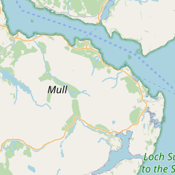
Lower Soroba Map, Satellite view of Lower Soroba, Argyll and Bute, Scotland
Lower Soroba is located in Argyll and Bute County, Argyll and Bute, Scotland, Scotland, United Kingdom.
Location informations of Lower Soroba
Latitude of city of Lower Soroba is 56.40020 and longitude of city of Lower Soroba is -5.46625. Lower Soroba has 1 postcode / zip code, in county of Argyll and Bute.The County of Lower Soroba is Argyll and Bute.
Postcode / zip code of Lower Soroba
PA34 4Administrative division of Lower Soroba
County :Argyll and ButeGPS coordinates of Lower Soroba
Latitude : 56.40020Longitude : -5.46625
Online Map of Lower Soroba - road map, satellite view and street view


Leaflet | © OpenStreetMap contributors
Search distance between two cities
The weather for Lower Soroba in the United Kingdom
Get today and tomorrow's weather forecasts for Lower Soroba. Find out the weather forecast for the week ahead and the weekend for Lower Soroba in the UK.Lower Soroba weather forecast 15 days
What is the nearest train station to Lower Soroba?
List of Railway Stations near to Lower SorobaThe nearest railway stations to Lower Soroba are listed below. Tickets are available at the train station ticket office or ticket machines.
| Name | Distances from Lower Soroba |
|---|---|
| Oban Station | 1.45 Km |
| Connel Ferry Station | 7.64 Km |
| Taynuilt Station | 14.35 Km |
| Falls Of Cruachan Station | 21.78 Km |
| Loch Awe Station | 26.11 Km |
| Dalmally Station | 29.70 Km |
Oban Airport , UK (8.14 Km)
What is the nearest Public Transport Stops to Lower Soroba?
List of Stops near to Lower SorobaGetting there by public transport (nearest train, tube, overground line station and bus stops). The nearest stops to Lower Soroba are listed below.
| Stop Name | Distances from Lower Soroba |
|---|---|
| Creran Gardens junct Bus Stop (opp) | 56 m |
| Creran Gardens junct Bus Stop (at) | 56 m |
| Coe Gardens junct Bus Stop (at) | 135 m |
| Coe Gardens junct Bus Stop (opp) | 162 m |
| Morvern Hill junct Bus Stop (opp) | 165 m |
| Lonan Drive junct Bus Stop (after) | 180 m |
| Morvern Hill junct Bus Stop (at) | 181 m |
| Lonan Drive junct Bus Stop (opp) | 186 m |
| Lower Soroba Bus Stop (at) | 281 m |
| Primary Campus Bus Stop (at) | 296 m |
Historic Places to Visit near Lower Soroba
List of Historic places near to Lower Soroba
| Name | Distances from Lower Soroba |
|---|---|
| McCaigs Tower | 1.75 Km |
| Dunstaffnage Castle | 5.44 Km |
| Ardchattan Priory | 12.65 Km |
| Duart Castle | 14.16 Km |
Cities or Towns near Lower Soroba
List of places near to
| Name | Distance |
|---|---|
| Soroba | 0.33 Km |
| Dalintart | 1.04 Km |
| Pulpit Hill | 1.22 Km |
| Oban | 1.37 Km |
| Glencruitten | 1.86 Km |
| Lerags | 3.07 Km |
| Dunollie | 3.08 Km |
| Cleigh | 3.26 Km |
| Kilmore | 3.70 Km |
| Barran | 3.77 Km |
| Ganavan | 3.84 Km |
| Ardentallen | 5.10 Km |
| Dunbeg | 5.29 Km |
| Knipoch | 5.48 Km |
| Achaleven | 7.27 Km |
| Connel / A'Choingheal | 7.44 Km |
| Kilninver | 7.75 Km |
| North Connel | 8.01 Km |
| Black Crofts | 8.79 Km |
| Bragleenbeg | 9.58 Km |
| Ledaig | 9.60 Km |
| Fearnoch | 10.80 Km |
| Benderloch | 11.11 Km |
| Kiel Crofts | 11.22 Km |
| Tralee | 11.35 Km |
| Baravullin | 11.86 Km |
| Baligrundle | 12.28 Km |
| Achnacroish | 12.50 Km |
| Ardchattan | 12.55 Km |
| Clachan Seil | 12.72 Km |
| Oban Seil | 13.41 Km |
| Inveresragan | 13.50 Km |
| Balliveolan | 13.64 Km |
| South Shian | 13.67 Km |
| Airds Bay | 13.92 Km |
| Lochdon | 14.21 Km |
| Taynuilt | 14.35 Km |
| Melfort | 14.55 Km |
| Achlonan | 14.79 Km |
| Brochroy | 14.80 Km |
| Narrachan | 14.94 Km |