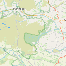
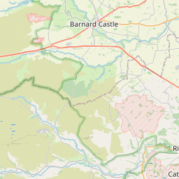
Low Etherley Map, Satellite view of Low Etherley, Durham, England
Low Etherley is located in Durham County, County Durham, North East, England, United Kingdom.
Location informations of Low Etherley
Latitude of city of Low Etherley is 54.65317 and longitude of city of Low Etherley is -1.74390. Low Etherley has 1 postcode / zip code, in county of Durham.The County of Low Etherley is Durham.
Postcode / zip code of Low Etherley
DL14 0Administrative division of Low Etherley
County :DurhamGPS coordinates of Low Etherley
Latitude : 54.65317Longitude : -1.74390
Online Map of Low Etherley - road map, satellite view and street view


Leaflet | © OpenStreetMap contributors
Search distance between two cities
The weather for Low Etherley in the United Kingdom
Get today and tomorrow's weather forecasts for Low Etherley. Find out the weather forecast for the week ahead and the weekend for Low Etherley in the UK.Low Etherley weather forecast 15 days
What is the nearest train station to Low Etherley?
List of Railway Stations near to Low EtherleyThe nearest railway stations to Low Etherley are listed below. Tickets are available at the train station ticket office or ticket machines.
| Name | Distances from Low Etherley |
|---|---|
| Bishop Auckland Station | 4.28 Km |
| Shildon Station | 7.53 Km |
| Newton Aycliffe Station | 10.85 Km |
| Heighington Station | 12.17 Km |
| Durham Station | 17.48 Km |
| North Road Station | 17.86 Km |
| Darlington Station | 19.45 Km |
| Dinsdale Station | 23.56 Km |
| Chester-Le-Street Station | 24.80 Km |
| Teesside Airport Station | 25.43 Km |
What is the nearest Public Transport Stops to Low Etherley?
List of Stops near to Low EtherleyGetting there by public transport (nearest train, tube, overground line station and bus stops). The nearest stops to Low Etherley are listed below.
Historic Places to Visit near Low Etherley
List of Historic places near to Low Etherley
| Name | Distances from Low Etherley |
|---|---|
| Escomb Saxon Church | 2.66 Km |
| Auckland Castle | 4.97 Km |
| Binchester Roman Fort | 4.99 Km |
| Raby Castle | 7.79 Km |
| Piercebridge Roman Fort and Bridge | 14.21 Km |
Cities or Towns near Low Etherley
List of places near to
| Name | Distance |
|---|---|
| Phoenix Row | 0.47 Km |
| High Etherley | 0.51 Km |
| Woodside | 1.38 Km |
| Toft Hill | 1.40 Km |
| Witton Park | 1.60 Km |
| California | 1.77 Km |
| Etherley Moor | 2.32 Km |
| High Escomb | 2.35 Km |
| Woodhouses | 2.35 Km |
| Escomb | 2.60 Km |
| Etherley Dene | 2.76 Km |
| West Auckland | 2.79 Km |
| Ramshaw | 2.99 Km |
| St Helen Auckland | 3.10 Km |
| High Grange | 3.21 Km |
| Witton-le-Wear | 3.36 Km |
| Tindale Crescent | 3.55 Km |
| Evenwood | 3.74 Km |
| Toronto | 3.82 Km |
| Morley | 3.94 Km |
| Hummerbeck | 3.97 Km |
| North Bitchburn | 4.14 Km |
| New Hunwick | 4.23 Km |
| Bishop Auckland | 4.34 Km |
| Evenwood Gate | 4.45 Km |
| Hunwick | 4.58 Km |
| High Lands | 4.61 Km |
| Howden-le-Wear | 4.68 Km |
| Low Lands | 4.70 Km |
| South Church | 5.16 Km |
| Esperley Lane Ends | 5.23 Km |
| Low Beechburn | 5.33 Km |
| High Beechburn | 5.62 Km |
| Hamsterley | 5.62 Km |
| Coronation | 5.80 Km |
| Bildershaw | 5.89 Km |
| Beech Terrace | 5.96 Km |
| Elm Terrace | 5.97 Km |
| Cockfield | 5.98 Km |
| Oak Street | 5.99 Km |
| Lime Terrace | 6.00 Km |
| Regent Street | 6.00 Km |
| Gray Street | 6.03 Km |
| Coundongate | 6.08 Km |
| Fir Tree | 6.16 Km |
| Eldon Lane | 6.19 Km |
| Newfield | 6.25 Km |
| Sunnybrow | 6.28 Km |
| Coundon Grange | 6.30 Km |
| Wackerfield | 6.32 Km |