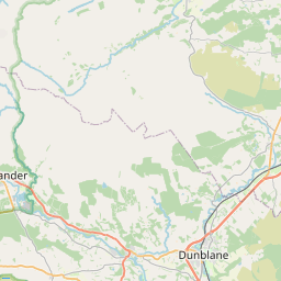
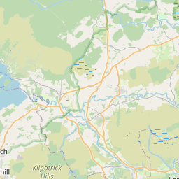
Letham Map, Satellite view of Letham, Stirling and Falkirk, Scotland
Letham is located in Stirling and Falkirk County, Falkirk, Scotland, Scotland, United Kingdom.
Location informations of Letham
Latitude of city of Letham is 56.05302 and longitude of city of Letham is -3.77332. Letham has 1 postcode / zip code, in county of Stirling and Falkirk.The County of Letham is Stirling and Falkirk.
Postcode / zip code of Letham
FK2 8Administrative division of Letham
County :Stirling and FalkirkGPS coordinates of Letham
Latitude : 56.05302Longitude : -3.77332
Online Map of Letham - road map, satellite view and street view


Leaflet | © OpenStreetMap contributors
Search distance between two cities
The weather for Letham in the United Kingdom
Get today and tomorrow's weather forecasts for Letham. Find out the weather forecast for the week ahead and the weekend for Letham in the UK.Letham weather forecast 15 days
What is the nearest train station to Letham?
List of Railway Stations near to LethamThe nearest railway stations to Letham are listed below. Tickets are available at the train station ticket office or ticket machines.
| Name | Distances from Letham |
|---|---|
| Larbert Station | 4.90 Km |
| Falkirk Grahamston Station | 5.65 Km |
| Camelon Station | 5.90 Km |
| Falkirk High Station | 6.91 Km |
| Alloa Station | 7.28 Km |
| Polmont Station | 8.41 Km |
| Stirling Station | 12.51 Km |
| Linlithgow Station | 13.93 Km |
| Bridge Of Allan Station | 16.21 Km |
| Cumbernauld Station | 17.83 Km |
What is the nearest Public Transport Stops to Letham?
List of Stops near to LethamGetting there by public transport (nearest train, tube, overground line station and bus stops). The nearest stops to Letham are listed below.
| Stop Name | Distances from Letham |
|---|---|
| Letham Cottages Bus Stop (at) | 66 m |
| Letham Cottages Bus Stop (opp) | 71 m |
| Letham Terraces Bus Stop (opp) | 404 m |
| Letham Terraces Bus Stop (at) | 409 m |
| Bowtrees Cottage Bus Stop (at) | 914 m |
| Bowtrees Cottage Bus Stop (opp) | 924 m |
| Castle Estate Bus Stop (at) | 1.31 Km |
| Castle Estate Bus Stop (opp) | 1.34 Km |
| Pine `n` Oak Bus Stop (at) | 1.50 Km |
| Pine `n` Oak Bus Stop (opp) | 1.50 Km |
Historic Places to Visit near Letham
List of Historic places near to Letham
| Name | Distances from Letham |
|---|---|
| The Dunmore Pineapple | 2.71 Km |
| Clackmannan Tower | 6.18 Km |
| Callendar House | 6.51 Km |
| Alloa Tower | 6.62 Km |
| Watling Lodge (Antonine Wall) | 6.92 Km |
| Westquarter Dovecot | 7.35 Km |
| Antonine Wall, Rough Castle | 8.55 Km |
| Culross Palace and Royal Burgh | 8.83 Km |
| Culross Abbey | 9.23 Km |
| Kinneil House | 10.09 Km |
| Kinneil Museum | 10.09 Km |
| Antonine Wall, Seabegs Wood | 10.75 Km |
| Battle of Bannockburn Heritage Centre | 10.90 Km |
| Cambuskenneth Abbey | 11.85 Km |
| Mars Wark | 12.95 Km |
| Antonine Wall, Castlecary Roman Fort | 12.96 Km |
| Church of the Holy Rude | 13.03 Km |
| Stirling Smith Art Gallery and Museum | 13.05 Km |
| Stirling Old Bridge | 13.13 Km |
| Argyll and Sutherland Highlanders Regimental Museum | 13.16 Km |
| Kings Knot | 13.24 Km |
| Wallace Monument | 13.32 Km |
| Stirling Castle | 13.58 Km |
| Annet House Museum and Garden | 13.59 Km |
| Linlithgow Palace | 13.60 Km |
| Church of St Michael, Linlithgow | 13.60 Km |
| Dollar Glen | 14.65 Km |
| Argylls Lodging | 14.72 Km |
| Castle Campbell | 14.89 Km |
Cities or Towns near Letham
List of places near to
| Name | Distance |
|---|---|
| Airth | 1.73 Km |
| Carronshore | 2.89 Km |
| Skinflats | 3.07 Km |
| Antonshill | 3.16 Km |
| Carron | 3.43 Km |
| Dunmore | 3.54 Km |
| Kincardine | 3.75 Km |
| Langlees | 3.93 Km |
| Stenhousemuir | 3.94 Km |
| Bainsford | 4.17 Km |
| Glensburgh | 4.30 Km |
| Bankside | 4.54 Km |
| Mungal | 4.58 Km |
| North Broomage | 4.77 Km |
| South Broomage | 4.85 Km |
| Grangemouth | 4.90 Km |
| Larbert | 4.96 Km |
| Middlefield | 5.02 Km |
| Merchiston | 5.16 Km |
| Grahamston | 5.26 Km |
| Ladysmill | 5.52 Km |
| Torwood | 5.77 Km |
| South Alloa | 5.84 Km |
| Kennet | 5.98 Km |
| Falkirk | 6.01 Km |
| Camelon | 6.05 Km |
| Clackmannan | 6.17 Km |
| Arnothill | 6.19 Km |
| Woodlands | 6.28 Km |
| Callendar Park | 6.38 Km |
| Bantaskin | 6.41 Km |
| Laurieston | 6.48 Km |
| Plean | 6.53 Km |
| Beancross | 6.63 Km |
| Summerford | 6.75 Km |
| Cowie | 6.77 Km |
| Carmuirs | 6.90 Km |
| Bowhouse | 6.93 Km |
| Tamfourhill | 7.06 Km |
| Alloa | 7.10 Km |
| Throsk | 7.10 Km |
| Westquarter | 7.18 Km |
| Greenbank | 7.28 Km |
| Wholeflats | 7.39 Km |
| Hallglen | 7.43 Km |
| Glen Village | 7.58 Km |
| Redding | 7.60 Km |
| Old Polmont | 7.64 Km |
| Hallpark | 7.75 Km |
| Parkhill | 7.93 Km |