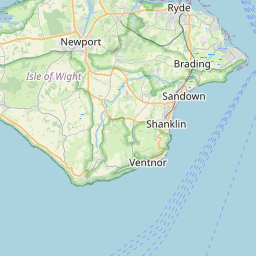
Langbridge Map, Satellite view of Langbridge, Isle of Wight, England
Langbridge is located in Isle of Wight County, Isle of Wight, South East, England, United Kingdom.
Location informations of Langbridge
Latitude of city of Langbridge is 50.67074 and longitude of city of Langbridge is -1.21047. Langbridge has 1 postcode / zip code, in county of Isle of Wight.The County of Langbridge is Isle of Wight.
Postcode / zip code of Langbridge
PO36 0Administrative division of Langbridge
County :Isle of WightGPS coordinates of Langbridge
Latitude : 50.67074Longitude : -1.21047
Online Map of Langbridge - road map, satellite view and street view


Leaflet | © OpenStreetMap contributors
Search distance between two cities
The weather for Langbridge in the United Kingdom
Get today and tomorrow's weather forecasts for Langbridge. Find out the weather forecast for the week ahead and the weekend for Langbridge in the UK.Langbridge weather forecast 15 days
What is the nearest train station to Langbridge?
List of Railway Stations near to LangbridgeThe nearest railway stations to Langbridge are listed below. Tickets are available at the train station ticket office or ticket machines.
| Name | Distances from Langbridge |
|---|---|
| Sandown Station | 3.72 Km |
| Lake Station | 4.12 Km |
| Shanklin Station | 4.63 Km |
| Brading Station | 5.13 Km |
| Smallbrook Junction Station | 5.99 Km |
| Ryde St.John's Road Station | 7.07 Km |
| Ryde Esplanade Station | 7.78 Km |
| Ryde Pier Head Station | 8.40 Km |
| Portsmouth Harbour Station | 15.78 Km |
| Portsmouth and Southsea Station | 16.51 Km |
Isle of Wight / Sandown Airport , UK (2.80 Km)
Bembridge Airport , UK (7.17 Km)
What is the nearest Public Transport Stops to Langbridge?
List of Stops near to LangbridgeGetting there by public transport (nearest train, tube, overground line station and bus stops). The nearest stops to Langbridge are listed below.
| Stop Name | Distances from Langbridge |
|---|---|
| Langbridge Bus Stop (N-bound) | 86 m |
| Langbridge Bus Stop (S-bound) | 90 m |
| Knighton Lane Bus Stop (near) | 403 m |
| Knighton Lane Bus Stop (adjacent) | 426 m |
| Pointer Inn Bus Stop (opposite) | 552 m |
| Pointer Inn Bus Stop (adjacent) | 572 m |
| Wackland Lane Bus Stop (S-bound) | 947 m |
| Wackland Lane Bus Stop (N-bound) | 956 m |
| Knighton Farm Bus Stop (N-bound) | 975 m |
| Knighton Farm Bus Stop (SW-bound) | 981 m |
Historic Places to Visit near Langbridge
List of Historic places near to Langbridge
| Name | Distances from Langbridge |
|---|---|
| The Shipwreck Centre & Maritime Museum | 2.47 Km |
| Arreton, St Georges Church | 2.59 Km |
| Newport Roman Villa | 2.65 Km |
| Arreton Manor | 2.65 Km |
| Nunwell House and Gardens | 3.80 Km |
| Brading Roman Villa | 4.43 Km |
| Morton Manor | 4.47 Km |
| Godshill, All Saints Church | 5.21 Km |
| Appuldurcombe House | 5.85 Km |
| Bembridge Fort | 6.52 Km |
| Carisbrooke Castle | 7.51 Km |
| Appley Tower | 7.90 Km |
| Bembridge Windmill | 8.12 Km |
| Ventnor Botanic Garden | 9.10 Km |
| Osborne House | 9.88 Km |
| St Catherines Oratory | 10.81 Km |
| Cowes Maritime Museum | 11.72 Km |
| Brighstone, St Marys Church | 13.35 Km |
| Newtown Old Town Hall | 14.40 Km |
Cities or Towns near Langbridge
List of places near to
| Name | Distance |
|---|---|
| Newchurch | 0.70 Km |
| Knighton | 0.78 Km |
| Skinner's Hill | 1.18 Km |
| Alverstone Garden Village | 1.47 Km |
| Horringford | 1.62 Km |
| Queen's Bower | 1.67 Km |
| Arreton | 1.86 Km |
| Winford Cross | 1.89 Km |
| Alverstone | 1.89 Km |
| Hale Common | 1.90 Km |
| Winford | 1.95 Km |
| Bathingbourne | 2.32 Km |
| Branstone | 2.37 Km |
| Apse Heath | 2.68 Km |
| Princelett | 3.04 Km |
| Downend | 3.17 Km |
| Merstone | 3.26 Km |
| Ninham | 3.58 Km |
| Merrie Gardens | 3.59 Km |
| Adgestone | 3.60 Km |
| Ashey | 3.81 Km |
| Landguard Manor | 3.83 Km |
| Lake | 3.83 Km |
| Havenstreet | 4.28 Km |
| Morton | 4.39 Km |
| Sandford | 4.40 Km |
| Whiteley Bank | 4.47 Km |
| Lower Hyde | 4.54 Km |
| Sandown | 4.55 Km |
| Upper Hyde | 4.59 Km |
| Yarbridge | 4.64 Km |
| Brading | 4.81 Km |
| Upton | 4.94 Km |
| Godshill | 5.20 Km |
| Littletown | 5.21 Km |
| Shanklin | 5.27 Km |
| Blackwater | 5.34 Km |
| Yaverland | 5.39 Km |
| Old Village | 5.40 Km |
| Hillgrove | 5.45 Km |
| Rookley | 5.49 Km |
| Rookley Green | 5.55 Km |
| Staplers | 5.66 Km |
| Wootton Common | 5.71 Km |
| Haylands | 5.79 Km |
| Shide | 6.02 Km |
| Pan | 6.02 Km |
| Fernhill | 6.13 Km |
| Wootton Bridge | 6.13 Km |
| Swanmore | 6.18 Km |