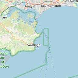
Knighton Map, Satellite view of Knighton, Dorset, England
Knighton is located in Dorset County, Poole, South West, England, United Kingdom.
Location informations of Knighton
Latitude of city of Knighton is 50.77745 and longitude of city of Knighton is -1.93119. Knighton has 1 postcode / zip code, in county of Dorset.The County of Knighton is Dorset.
Postcode / zip code of Knighton
BH21 3Administrative division of Knighton
County :DorsetGPS coordinates of Knighton
Latitude : 50.77745Longitude : -1.93119
Online Map of Knighton - road map, satellite view and street view


Leaflet | © OpenStreetMap contributors
Search distance between two cities
The weather for Knighton in the United Kingdom
Get today and tomorrow's weather forecasts for Knighton. Find out the weather forecast for the week ahead and the weekend for Knighton in the UK.Knighton weather forecast 15 days
What is the nearest train station to Knighton?
List of Railway Stations near to KnightonThe nearest railway stations to Knighton are listed below. Tickets are available at the train station ticket office or ticket machines.
| Name | Distances from Knighton |
|---|---|
| Branksome Station | 5.67 Km |
| Parkstone Station | 6.17 Km |
| Bournemouth Station | 7.29 Km |
| Poole Station | 7.42 Km |
| Hamworthy Station | 8.50 Km |
| Pokesdown Station | 9.07 Km |
| Christchurch Station | 11.20 Km |
| Holton Heath Station | 12.67 Km |
| Hinton Admiral Station | 15.51 Km |
| Wareham Station | 16.01 Km |
Bournemouth Airport , UK (6.24 Km)
What is the nearest Public Transport Stops to Knighton?
List of Stops near to KnightonGetting there by public transport (nearest train, tube, overground line station and bus stops). The nearest stops to Knighton are listed below.
Historic Places to Visit near Knighton
List of Historic places near to Knighton
| Name | Distances from Knighton |
|---|---|
| Knoll Gardens | 2.69 Km |
| Deans Court | 4.51 Km |
| Wimborne Minster Church | 4.61 Km |
| Priests House Museum | 4.65 Km |
| Russell-Cotes Art Gallery and Museum | 7.89 Km |
| Compton Acres | 8.05 Km |
| Kingston Lacy | 8.18 Km |
| White Mill | 9.58 Km |
| Chalbury, All Saints Church | 9.79 Km |
| Brownsea Island | 10.01 Km |
| Badbury Rings | 10.10 Km |
| Horton, St Wolfridas Church | 10.12 Km |
| Christchurch Castle | 12.04 Km |
| Knowlton Church and Earthworks | 13.00 Km |
| Gussage All Saints Church | 13.94 Km |
| Tarrant Keynston, All Saints Church | 14.03 Km |
| Tarrant Rushton, St Marys Church | 14.05 Km |
| Edmondsham, St Nicholas Church | 14.06 Km |
| Tarrant Crawford, St Marys Church | 14.06 Km |
| Edmondsham House and Gardens | 14.13 Km |
| Wimborne St Giles Church | 14.56 Km |
Cities or Towns near Knighton
List of places near to
| Name | Distance |
|---|---|
| Bearwood | 0.80 Km |
| Bear Cross | 1.35 Km |
| Hampreston | 1.71 Km |
| Canford Magna | 1.87 Km |
| Longham | 1.92 Km |
| West Howe | 2.10 Km |
| Little Canford | 2.14 Km |
| Kinson | 2.52 Km |
| Hayes | 2.89 Km |
| West Parley | 2.89 Km |
| Dudsbury | 2.89 Km |
| Merley | 2.99 Km |
| Stapehill | 3.01 Km |
| Oakley | 3.01 Km |
| East Howe | 3.02 Km |
| Canford Bottom | 3.04 Km |
| Turbary Common | 3.07 Km |
| Alderney | 3.08 Km |
| Wallisdown | 3.25 Km |
| Leigh | 3.41 Km |
| Northbourne | 3.48 Km |
| Ensbury | 3.48 Km |
| Columbia Farm | 3.65 Km |
| Manning's Heath | 3.87 Km |
| Ensbury Park | 3.90 Km |
| Ferndown | 3.91 Km |
| Colehill | 3.98 Km |
| Canford Heath | 3.98 Km |
| St Johns | 4.00 Km |
| Newtown | 4.24 Km |
| Talbot Village | 4.29 Km |
| Rowlands | 4.29 Km |
| East Brook | 4.44 Km |
| Rossmore | 4.45 Km |
| Pilford | 4.58 Km |
| Red Hill | 4.58 Km |
| Merry Field Hill | 4.65 Km |
| Wimborne Minster | 4.67 Km |
| Talbot Heath | 4.71 Km |
| Bourne Valley | 4.71 Km |
| Parley Green | 4.85 Km |
| Broadstone | 4.87 Km |
| Ashington | 4.89 Km |
| Moordown | 4.96 Km |
| Muscliff | 4.98 Km |
| Happy Bottom | 5.01 Km |
| East Parley | 5.04 Km |
| Nuffield | 5.09 Km |
| Ameysford | 5.12 Km |
| Muscliffe | 5.14 Km |