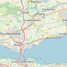
Kennoway Map, Satellite view of Kennoway, Fife, Scotland
Kennoway is located in Fife County, Fife, Scotland, Scotland, United Kingdom.
Location informations of Kennoway
Latitude of city of Kennoway is 56.21091 and longitude of city of Kennoway is -3.04898. Kennoway has 1 postcode / zip code, in county of Fife.The County of Kennoway is Fife.
Postcode / zip code of Kennoway
KY8 5Administrative division of Kennoway
County :FifeGPS coordinates of Kennoway
Latitude : 56.21091Longitude : -3.04898
Online Map of Kennoway - road map, satellite view and street view


Leaflet | © OpenStreetMap contributors
Search distance between two cities
The weather for Kennoway in the United Kingdom
Get today and tomorrow's weather forecasts for Kennoway. Find out the weather forecast for the week ahead and the weekend for Kennoway in the UK.Kennoway weather forecast 15 days
What is the nearest train station to Kennoway?
List of Railway Stations near to KennowayThe nearest railway stations to Kennoway are listed below. Tickets are available at the train station ticket office or ticket machines.
| Name | Distances from Kennoway |
|---|---|
| Markinch Station | 5.18 Km |
| Glenrothes with Thornton Station | 7.94 Km |
| Ladybank Station | 8.33 Km |
| Springfield Station | 9.35 Km |
| Cupar Station | 12.05 Km |
| Kirkcaldy Station | 13.20 Km |
| Cardenden Station | 15.27 Km |
| Kinghorn Station | 17.55 Km |
| Lochgelly Station | 18.37 Km |
| Burntisland Station | 20.56 Km |
What is the nearest Public Transport Stops to Kennoway?
List of Stops near to KennowayGetting there by public transport (nearest train, tube, overground line station and bus stops). The nearest stops to Kennoway are listed below.
| Stop Name | Distances from Kennoway |
|---|---|
| New Road Bus Stop (Northbound) | 58 m |
| New Road Bus Stop (Southbound) | 62 m |
| Manse Park Bus Stop (opp) | 90 m |
| Laburnum Bank Bus Stop (adj) | 100 m |
| Laburnum Bank Bus Stop (opp) | 129 m |
| Manse Park Bus Stop (adj) | 170 m |
| Kennoway Shops Bus Stop (adj) | 171 m |
| Kennoway Bowling Club Bus Stop (adj) | 233 m |
| Cockburn House Bus Stop (adj) | 249 m |
| Kenmount Drive Bus Stop (adj 40) | 346 m |
Historic Places to Visit near Kennoway
List of Historic places near to Kennoway
| Name | Distances from Kennoway |
|---|---|
| Lundin Links Standing Stones | 5.58 Km |
| Scotstarvit Tower | 8.95 Km |
| Hill of Tarvit Mansion | 9.77 Km |
| Falkland Palace | 10.86 Km |
| Ravenscraig Castle | 11.76 Km |
| Dogton Stone | 12.74 Km |
| Kirkcaldy Museum and Art Gallery | 13.10 Km |
Cities or Towns near Kennoway
List of places near to
| Name | Distance |
|---|---|
| Bonnybank | 1.12 Km |
| Baintown | 1.22 Km |
| Balcurvie | 1.58 Km |
| Windygates | 2.06 Km |
| Kirkland Dam | 2.08 Km |
| Pepper Hill | 2.31 Km |
| Kirkland | 2.46 Km |
| Broom | 2.70 Km |
| Methilhill | 2.86 Km |
| Cameron Bridge | 3.07 Km |
| Cameron | 3.07 Km |
| Sillerhole | 3.16 Km |
| Methil | 3.26 Km |
| Scoonie | 3.61 Km |
| Leven | 3.66 Km |
| Innerleven | 3.69 Km |
| Muiredge | 3.78 Km |
| Star | 3.80 Km |
| Milton of Balgonie | 3.84 Km |
| Denbeath | 3.87 Km |
| Leven Links | 3.89 Km |
| Buckhaven | 4.53 Km |
| Coaltown of Burnturk | 5.35 Km |
| Markinch | 5.42 Km |
| Kettlehill | 5.63 Km |
| East Wemyss | 5.69 Km |
| Coaltown of Balgonie | 5.79 Km |
| Lundin Links | 5.99 Km |
| Mount Frost | 6.34 Km |
| Drummochy | 6.45 Km |
| Alburne Park | 6.45 Km |
| Kirkforthar Feus | 6.46 Km |
| Woodside | 6.62 Km |
| Balmalcolm | 6.64 Km |
| Gateside | 6.66 Km |
| Eastfield | 6.74 Km |
| Kettlebridge | 6.79 Km |
| Muirhead | 6.82 Km |
| Kingskettle | 6.95 Km |
| Lower Largo | 6.97 Km |
| Kirkton of Cults | 6.98 Km |
| Balfarg | 7.03 Km |
| Queensway | 7.35 Km |
| Pitlessie | 7.37 Km |
| Cadham | 7.39 Km |
| Upper Largo / Kirkton of Largo | 7.45 Km |
| Auchmuty | 7.46 Km |
| Coaltown of Wemyss | 7.49 Km |
| Pitcoudie | 7.69 Km |
| Town Centre | 7.77 Km |