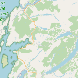
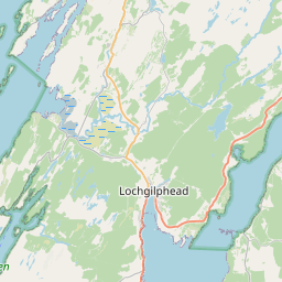
Kenmore Map, Satellite view of Kenmore, Argyll and Bute, Scotland
Kenmore is located in Argyll and Bute County, Argyll and Bute, Scotland, Scotland, United Kingdom.
Location informations of Kenmore
Latitude of city of Kenmore is 56.17172 and longitude of city of Kenmore is -5.12012. Kenmore has 1 postcode / zip code, in county of Argyll and Bute.The County of Kenmore is Argyll and Bute.
Postcode / zip code of Kenmore
PA27 8Administrative division of Kenmore
County :Argyll and ButeGPS coordinates of Kenmore
Latitude : 56.17172Longitude : -5.12012
Online Map of Kenmore - road map, satellite view and street view


Leaflet | © OpenStreetMap contributors
Search distance between two cities
The weather for Kenmore in the United Kingdom
Get today and tomorrow's weather forecasts for Kenmore. Find out the weather forecast for the week ahead and the weekend for Kenmore in the UK.Kenmore weather forecast 15 days
What is the nearest train station to Kenmore?
List of Railway Stations near to KenmoreThe nearest railway stations to Kenmore are listed below. Tickets are available at the train station ticket office or ticket machines.
| Name | Distances from Kenmore |
|---|---|
| Garelochhead Station | 20.91 Km |
| Falls Of Cruachan Station | 24.71 Km |
| Arrochar and Tarbet Station | 24.85 Km |
| Loch Awe Station | 26.06 Km |
| Dalmally Station | 26.87 Km |
| Ardlui Station | 28.57 Km |
| Taynuilt Station | 29.74 Km |
| Gourock Station | 29.95 Km |
What is the nearest Public Transport Stops to Kenmore?
List of Stops near to KenmoreGetting there by public transport (nearest train, tube, overground line station and bus stops). The nearest stops to Kenmore are listed below.
| Stop Name | Distances from Kenmore |
|---|---|
| Medical Practice Bus Stop (opp) | 2.30 Km |
| Medical Practice Bus Stop (at) | 2.31 Km |
| The Bay Bus Stop (at) | 2.59 Km |
| The Bay Bus Stop (opp) | 2.60 Km |
| The Clachan Bus Stop (at) | 3.31 Km |
| The Clachan Bus Stop (opp) | 3.34 Km |
| Forest View Bus Stop (opp) | 3.36 Km |
| Forest View Bus Stop (near) | 3.38 Km |
| Argyll Caravan Park Bus Stop (at) | 3.52 Km |
| Argyll Caravan Park Bus Stop (opp) | 3.54 Km |
Historic Places to Visit near Kenmore
List of Historic places near to Kenmore
| Name | Distances from Kenmore |
|---|---|
| Auchindrain Open Air Museum | 3.58 Km |
| Inveraray Jail | 7.15 Km |
| Inveraray Maritime Museum | 7.25 Km |
| Inveraray Castle | 7.74 Km |
| Ardkinglas Woodland Garden | 13.72 Km |
Cities or Towns near Kenmore
List of places near to
| Name | Distance |
|---|---|
| Creggans | 2.14 Km |
| Auchindrain | 3.23 Km |
| Achnagoul | 3.40 Km |
| Newton | 3.62 Km |
| Strachur | 3.71 Km |
| Glen Sluain | 4.29 Km |
| Furnace | 4.48 Km |
| Goatfield | 5.12 Km |
| Glenbranter | 6.34 Km |
| Garbhallt | 6.77 Km |
| Inveraray | 7.14 Km |
| Invernoaden | 7.59 Km |
| St Catherines | 7.89 Km |
| Crarae | 8.67 Km |
| Minard | 10.14 Km |
| Minard Castle | 11.64 Km |
| Tullochgorm | 11.84 Km |
| Kilbridemore | 11.90 Km |
| Garvie | 11.90 Km |
| Eredine | 12.01 Km |
| Braevallich | 12.14 Km |
| Lephinmore | 12.37 Km |
| Birdfield | 12.42 Km |
| Lochgoilhead | 12.92 Km |
| Portinnisherrich | 12.94 Km |
| Ardchonnell | 13.14 Km |
| Kilmichael Beg | 13.82 Km |
| Conchra | 14.08 Km |
| Dalavich | 14.32 Km |
| Carrick Castle | 14.53 Km |
| Cairndow / An Cárn Dubh | 14.55 Km |