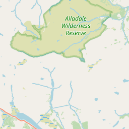
Inveran Map, Satellite view of Inveran, Sutherland, Scotland
Inveran is located in Sutherland County, Highland, Scotland, Scotland, United Kingdom.
Location informations of Inveran
Latitude of city of Inveran is 57.94462 and longitude of city of Inveran is -4.40950. Inveran has 1 postcode / zip code, in county of Sutherland.The County of Inveran is Sutherland.
Postcode / zip code of Inveran
IV27 4Administrative division of Inveran
County :SutherlandGPS coordinates of Inveran
Latitude : 57.94462Longitude : -4.40950
Online Map of Inveran - road map, satellite view and street view


Leaflet | © OpenStreetMap contributors
Search distance between two cities
The weather for Inveran in the United Kingdom
Get today and tomorrow's weather forecasts for Inveran. Find out the weather forecast for the week ahead and the weekend for Inveran in the UK.Inveran weather forecast 15 days
What is the nearest train station to Inveran?
List of Railway Stations near to InveranThe nearest railway stations to Inveran are listed below. Tickets are available at the train station ticket office or ticket machines.
| Name | Distances from Inveran |
|---|---|
| Invershin Station | 2.27 Km |
| Culrain Station | 2.81 Km |
| Lairg Station | 6.39 Km |
| Ardgay Station | 7.56 Km |
| Rogart Station | 15.61 Km |
| Golspie Station | 25.09 Km |
| Tain Station | 25.62 Km |
| Dunrobin Castle Station | 27.54 Km |
| Alness Station | 29.39 Km |
What is the nearest Public Transport Stops to Inveran?
List of Stops near to InveranGetting there by public transport (nearest train, tube, overground line station and bus stops). The nearest stops to Inveran are listed below.
| Stop Name | Distances from Inveran |
|---|---|
| Old Schoolhouse Bus Stop (opp) | 104 m |
| Old Schoolhouse Bus Stop (o/s) | 109 m |
| Invershin Farm Rd End Bus Stop (at) | 1.10 Km |
| Invershin Farm Rd End Bus Stop (opp) | 1.11 Km |
| Falls of Shin Visitor Centre Bus Stop (o/s) | 1.78 Km |
| Station Railway Station (Entrance) | 2.27 Km |
| Invershin Rail Station | 2.27 Km |
| Achinduich Bus Stop (S-bound) | 2.40 Km |
| Achinduich Bus Stop (N-bound) | 2.41 Km |
| Hotel Bus Stop (opp) | 2.41 Km |
Historic Places to Visit near Inveran
Cities or Towns near Inveran
List of places near to
| Name | Distance |
|---|---|
| Rhelonie | 1.86 Km |
| Achinduich | 2.42 Km |
| Invershin | 2.74 Km |
| Culrain | 2.90 Km |
| Torroy | 2.96 Km |
| Linsidemore | 3.62 Km |
| Achany | 3.99 Km |
| Balinoe | 4.07 Km |
| Gruids | 5.41 Km |
| Tullich | 5.57 Km |
| Achnahanat | 5.72 Km |
| Airdens | 6.33 Km |
| Cornhill | 6.41 Km |
| Soyal | 6.47 Km |
| Auchintoul | 6.54 Km |
| Kilmachalmack | 6.87 Km |
| Dounie | 6.91 Km |
| Bonar Bridge | 6.95 Km |
| Claonel | 7.06 Km |
| Upper Gledfield | 7.11 Km |
| Migdale | 7.13 Km |
| Lower Gledfield | 7.35 Km |
| Ardgay | 7.48 Km |
| Ardgayhill | 7.51 Km |
| Braelangwell | 7.57 Km |
| Wester Gruinards | 7.58 Km |
| Torroble | 7.60 Km |
| Rhinamain | 7.62 Km |
| Rhian Breck | 7.65 Km |
| Tomich | 7.93 Km |
| Balloan | 8.08 Km |
| Mid Altass | 8.35 Km |
| Altass | 8.46 Km |
| Lairg / Luirg | 8.82 Km |
| Balnadelson | 8.91 Km |
| Kincardine | 9.00 Km |
| Lochside | 9.36 Km |
| Upper Ardchronie | 9.56 Km |
| Ardchronie | 9.91 Km |
| Lairg Muir | 9.96 Km |
| Amatnatua | 10.65 Km |
| Saval | 10.96 Km |
| Creich | 11.03 Km |
| Rosehall | 11.31 Km |
| Ardachu | 11.63 Km |
| Muie | 11.82 Km |
| Colaboll | 12.58 Km |
| Oape | 12.58 Km |
| Spinningdale | 12.66 Km |
| Dalchork | 13.03 Km |