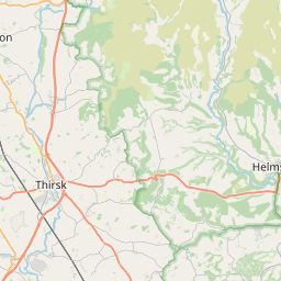
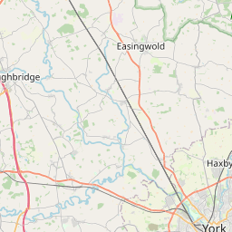
Hovingham Map, Satellite view of Hovingham, North Yorkshire, England
Hovingham is located in North Yorkshire County, Ryedale District, Yorkshire and the Humber, England, United Kingdom.
Location informations of Hovingham
Latitude of city of Hovingham is 54.17228 and longitude of city of Hovingham is -0.97915. Hovingham has 1 postcode / zip code, in county of North Yorkshire.The County of Hovingham is North Yorkshire.
Postcode / zip code of Hovingham
YO62 4Administrative division of Hovingham
County :North YorkshireGPS coordinates of Hovingham
Latitude : 54.17228Longitude : -0.97915
Online Map of Hovingham - road map, satellite view and street view


Leaflet | © OpenStreetMap contributors
Search distance between two cities
The weather for Hovingham in the United Kingdom
Get today and tomorrow's weather forecasts for Hovingham. Find out the weather forecast for the week ahead and the weekend for Hovingham in the UK.Hovingham weather forecast 15 days
What is the nearest train station to Hovingham?
List of Railway Stations near to HovinghamThe nearest railway stations to Hovingham are listed below. Tickets are available at the train station ticket office or ticket machines.
| Name | Distances from Hovingham |
|---|---|
| Malton Station | 12.66 Km |
| Poppleton Station | 24.48 Km |
| York Station | 24.97 Km |
| Thirsk Station | 26.34 Km |
| Hammerton Station | 27.90 Km |
| Cattal Station | 29.56 Km |
What is the nearest Public Transport Stops to Hovingham?
List of Stops near to HovinghamGetting there by public transport (nearest train, tube, overground line station and bus stops). The nearest stops to Hovingham are listed below.
| Stop Name | Distances from Hovingham |
|---|---|
| Worsley Arms Hotel Bus Stop (opp) | 104 m |
| Worsley Arms Hotel Bus Stop (S-bound) | 106 m |
| Hovingham Green Bus Stop (S-bound) | 130 m |
| Mowbray Crsecent Bus Stop (W-bound) | 299 m |
| Mowbray Crescent Bus Stop (E-bound) | 300 m |
| Lane End Bus Stop (SE-bound) | 2.14 Km |
| Lane End Bus Stop (NW-bound) | 2.17 Km |
| Manor Farm Bus Stop (NW-bound) | 2.25 Km |
| Manor Farm Bus Stop (SE-bound) | 2.26 Km |
| Cawton Village Bus Stop (W-bound) | 2.70 Km |
Historic Places to Visit near Hovingham
List of Historic places near to Hovingham
| Name | Distances from Hovingham |
|---|---|
| Hovingham Hall | 0.11 Km |
| Hovingham, All Saints Church | 0.20 Km |
| Slingsby, All Saints Church | 3.06 Km |
| Nunnington Hall | 3.70 Km |
| Barton-le-Street, St Michaels Church | 5.62 Km |
| Gilling Castle | 6.26 Km |
| Whenby, St Martins Church | 6.86 Km |
| Appleton-le-Street, All Saints Church | 7.28 Km |
| Castle Howard | 7.36 Km |
| Amotherby, St Helens Church | 8.56 Km |
| Bulmer, St Martins Church | 8.61 Km |
| Sheriff Hutton Church | 9.34 Km |
| Duncombe Park | 9.70 Km |
| Helmsley Castle | 9.79 Km |
| Kirkham Priory | 12.07 Km |
| Byland Abbey | 12.30 Km |
| Crambe, St Michaels Church | 12.54 Km |
| Rievaulx Terrace and Temples | 12.84 Km |
| Eden Camp | 13.08 Km |
| Rievaulx Abbey | 13.11 Km |
| Old Malton Priory | 13.31 Km |
| Sutton Park | 13.61 Km |
| Sutton-on-the-Forest Church | 13.88 Km |
Cities or Towns near Hovingham
List of places near to
| Name | Distance |
|---|---|
| Wath | 1.20 Km |
| Fryton | 2.14 Km |
| Stonegrave | 2.43 Km |
| Cawton | 2.61 Km |
| Slingsby | 3.25 Km |
| Wiganthorpe | 3.41 Km |
| Scackleton | 3.48 Km |
| South Holme | 3.56 Km |
| Coulton | 3.56 Km |
| Nunnington | 3.75 Km |
| East Newton | 4.21 Km |
| East Ness | 4.21 Km |
| West Ness | 4.22 Km |
| Terrington | 4.97 Km |
| Muscoates | 5.11 Km |
| Dalby | 5.18 Km |
| Gilling East | 5.28 Km |
| Oswaldkirk | 5.54 Km |
| Barton-le-Street | 5.60 Km |
| Ganthorpe | 5.72 Km |
| Skewsby | 6.02 Km |
| Coneysthorpe | 6.26 Km |
| Mowthorpe | 6.53 Km |
| Salton | 6.57 Km |
| Butterwick | 6.67 Km |
| Harome | 6.71 Km |
| Brawby | 6.84 Km |
| Whenby | 6.90 Km |
| Stearsby | 7.05 Km |
| Appleton-le-Street | 7.30 Km |
| Sproxton | 7.99 Km |
| Yearsley | 8.02 Km |
| High Stittenham | 8.13 Km |
| Little Habton | 8.28 Km |
| Wombleton | 8.32 Km |
| Amotherby | 8.49 Km |
| Great Barugh | 8.52 Km |
| Brandsby | 8.53 Km |
| Bulmer | 8.62 Km |
| Welburn | 8.95 Km |
| Normanby | 8.95 Km |
| Ampleforth | 8.96 Km |
| Great Habton | 9.12 Km |
| Beadlam | 9.14 Km |
| Nawton | 9.17 Km |
| Seaves | 9.17 Km |
| Great Edstone | 9.21 Km |
| Sheriff Hutton | 9.42 Km |
| Swinton | 9.42 Km |
| Farlington | 9.54 Km |