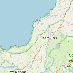
Helland Map, Satellite view of Helland, Cornwall, England
Helland is located in Cornwall County, Cornwall, South West, England, United Kingdom.
Location informations of Helland
Latitude of city of Helland is 50.50762 and longitude of city of Helland is -4.71566. Helland has 1 postcode / zip code, in county of Cornwall.The County of Helland is Cornwall.
Postcode / zip code of Helland
PL30 4Administrative division of Helland
County :CornwallGPS coordinates of Helland
Latitude : 50.50762Longitude : -4.71566
Online Map of Helland - road map, satellite view and street view


Leaflet | © OpenStreetMap contributors
Search distance between two cities
The weather for Helland in the United Kingdom
Get today and tomorrow's weather forecasts for Helland. Find out the weather forecast for the week ahead and the weekend for Helland in the UK.Helland weather forecast 15 days
What is the nearest train station to Helland?
List of Railway Stations near to HellandThe nearest railway stations to Helland are listed below. Tickets are available at the train station ticket office or ticket machines.
| Name | Distances from Helland |
|---|---|
| Bodmin Parkway Station | 7.81 Km |
| Lostwithiel Station | 11.71 Km |
| Roche Station | 12.80 Km |
| Bugle Station | 13.10 Km |
| Luxulyan Station | 13.27 Km |
| Par Station | 16.95 Km |
| Coombe Junction Halt Station | 17.91 Km |
| Liskeard Station | 18.68 Km |
| St.Austell Station | 19.41 Km |
| St.Columb Road Station | 20.02 Km |
What is the nearest Public Transport Stops to Helland?
List of Stops near to HellandGetting there by public transport (nearest train, tube, overground line station and bus stops). The nearest stops to Helland are listed below.
| Stop Name | Distances from Helland |
|---|---|
| Longstone Cross Bus Stop (opp) | 2.75 Km |
| Longstone Cross Bus Stop (S-bound) | 2.83 Km |
| Longstone Cross Bus Stop (NE-bound) | 2.85 Km |
| Lay By Bus Stop (SW-bound) | 3.07 Km |
| Shelter Bus Stop (NW-bound) | 3.21 Km |
| Bus Shelter Bus Stop (NW-bound) | 3.24 Km |
| Bus Shelter Bus Stop (opp) | 3.24 Km |
| Lay By Bus Stop (NE-bound) | 3.28 Km |
| Callywith Industrial Estate Bus Stop (NW-bound) | 3.41 Km |
| Callywith College Bus Stop (opp) | 3.47 Km |
Historic Places to Visit near Helland
List of Historic places near to Helland
| Name | Distances from Helland |
|---|---|
| Blisland, St Protus and St Hyacinth | 3.26 Km |
| Pencarrow House | 3.90 Km |
| Bodmin, St Petrocs Church | 4.04 Km |
| Lanhydrock | 7.34 Km |
| Egloshayle Church | 7.47 Km |
| Lanhydrock, St Hydrocs Church | 7.48 Km |
| Restormel Castle | 10.20 Km |
| St Endellion, St Endelientas Church | 10.89 Km |
| St Breock Downs Monolith | 11.06 Km |
| St Neot Church | 11.47 Km |
| Rough Tor Bronze Age Settlements | 11.57 Km |
| Lanlivery, St Brevitas Church | 11.96 Km |
| Jamaica Inn Smugglers Museum | 12.22 Km |
| Boconnoc | 12.58 Km |
| Nine Maidens Stone Row | 14.23 Km |
| St Winnow Church | 14.61 Km |
| The Arthurian Centre | 14.81 Km |
| Golitha Falls | 14.94 Km |
Cities or Towns near Helland
List of places near to
| Name | Distance |
|---|---|
| Hellandbridge | 1.12 Km |
| Tredethy | 1.12 Km |
| Merry Meeting | 2.62 Km |
| Tresarrett | 2.62 Km |
| Keybridge | 2.62 Km |
| Longstone | 2.76 Km |
| Clerkenwater | 2.76 Km |
| Blisland | 3.23 Km |
| Cooksland | 3.43 Km |
| Penpont | 3.63 Km |
| Waterloo | 3.65 Km |
| Lane-end | 3.92 Km |
| St Mabyn | 3.95 Km |
| Pendrift | 3.99 Km |
| Washaway | 3.99 Km |
| Bodmin | 4.04 Km |
| Croanford | 4.05 Km |
| Wenfordbridge | 4.21 Km |
| Lower Lank | 4.35 Km |
| Millpool | 4.44 Km |
| Lank | 4.54 Km |
| Dunmere | 4.58 Km |
| Lower Croan | 5.04 Km |
| Costislost | 5.05 Km |
| Milltown | 5.15 Km |
| Trevilder | 5.22 Km |
| Cardinham | 5.26 Km |
| St Tudy | 5.34 Km |
| Bunny's Hill | 5.50 Km |
| St Lawrence | 5.56 Km |
| Nanstallon | 5.59 Km |
| Carminow Cross | 5.64 Km |
| St Breward | 5.69 Km |
| Fletchersbridge | 5.82 Km |
| Turfdown | 5.89 Km |
| Old Cardinham Castle | 5.92 Km |
| Tredannick | 6.03 Km |
| Threewaters | 6.08 Km |
| Bradford | 6.14 Km |
| St Kew Highway | 6.16 Km |
| Burlorne Tregoose | 6.22 Km |
| Polbrock | 6.22 Km |
| Treningle | 6.33 Km |
| Little Downs | 6.40 Km |
| Trevenning | 6.44 Km |
| Sladesbridge | 6.47 Km |
| Three Holes Cross | 6.49 Km |
| Churchtown | 6.50 Km |
| Gam | 6.51 Km |
| Tregullon | 6.67 Km |