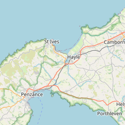
Greensplat Map, Satellite view of Greensplat, Cornwall, England
Greensplat is located in Cornwall County, Cornwall, South West, England, United Kingdom.
Location informations of Greensplat
Latitude of city of Greensplat is 50.22023 and longitude of city of Greensplat is -5.13163. Greensplat has 1 postcode / zip code, in county of Cornwall.The County of Greensplat is Cornwall.
Postcode / zip code of Greensplat
TR3 7Administrative division of Greensplat
County :CornwallGPS coordinates of Greensplat
Latitude : 50.22023Longitude : -5.13163
Online Map of Greensplat - road map, satellite view and street view


Leaflet | © OpenStreetMap contributors
Search distance between two cities
The weather for Greensplat in the United Kingdom
Get today and tomorrow's weather forecasts for Greensplat. Find out the weather forecast for the week ahead and the weekend for Greensplat in the UK.Greensplat weather forecast 15 days
What is the nearest train station to Greensplat?
List of Railway Stations near to GreensplatThe nearest railway stations to Greensplat are listed below. Tickets are available at the train station ticket office or ticket machines.
| Name | Distances from Greensplat |
|---|---|
| Perranwell Station | 1.45 Km |
| Penryn Station | 5.69 Km |
| Truro Station | 6.79 Km |
| Redruth Station | 6.86 Km |
| Penmere Station | 8.50 Km |
| Falmouth Town Station | 9.30 Km |
| Falmouth Docks Station | 9.42 Km |
| Camborne Station | 11.85 Km |
| Hayle Station | 20.87 Km |
| Quintrell Downs Station | 21.71 Km |
What is the nearest Public Transport Stops to Greensplat?
List of Stops near to GreensplatGetting there by public transport (nearest train, tube, overground line station and bus stops). The nearest stops to Greensplat are listed below.
| Stop Name | Distances from Greensplat |
|---|---|
| Farmcot Bus Stop (opp) | 310 m |
| Farmcot Bus Stop (E-bound) | 323 m |
| Pecantol Bus Stop (W-bound) | 617 m |
| Pencantol Bus Stop (opp) | 628 m |
| Cornish Arms Bus Stop (SW-bound) | 701 m |
| Cornish Arms Bus Stop (NE-bound) | 712 m |
| Post Box Bus Stop (opp) | 812 m |
| Post Box Bus Stop (NW-bound) | 813 m |
| Greenwith Crescent Bus Stop (E-bound) | 870 m |
| Greenwith Crescent Bus Stop (W-bound) | 879 m |
Historic Places to Visit near Greensplat
List of Historic places near to Greensplat
| Name | Distances from Greensplat |
|---|---|
| Burncoose Garden | 2.66 Km |
| Gwennap Pit | 5.17 Km |
| Bosvigo Gardens | 6.79 Km |
| Trelissick Garden | 6.98 Km |
| Wheal Peevor Mine | 7.11 Km |
| Royal Cornwall Museum | 7.31 Km |
| Carn Brea Neolithic Settlement | 7.98 Km |
| National Maritime Museum Cornwall | 9.12 Km |
| St Just in Roseland Church | 9.24 Km |
| East Pool Mine | 9.54 Km |
| Penjerrick Gardens | 9.57 Km |
| Pendennis Castle | 10.06 Km |
| St Mawes Castle | 10.56 Km |
| St Mawes Church | 10.68 Km |
| Perranzabuloe, St Pirans Church | 11.77 Km |
| Wheal Coates Tin Mine | 11.84 Km |
| Poldark Mine | 11.93 Km |
| St Anthony-in-Roseland Church | 12.01 Km |
| Glendurgan Gardens | 12.63 Km |
| Trebah Garden | 12.76 Km |
| Perran Round | 14.26 Km |
| Veryan, St Symphorians Church | 14.97 Km |
Cities or Towns near Greensplat
List of places near to
| Name | Distance |
|---|---|
| Hick's Mill | 0.30 Km |
| Frogpool | 0.74 Km |
| Greenwith Common | 0.83 Km |
| Coombe | 0.88 Km |
| Cusgarne | 0.92 Km |
| Perranwell | 1.22 Km |
| Fernsplatt | 1.24 Km |
| Bissoe | 1.38 Km |
| Tresamble | 1.43 Km |
| Perran Wharf | 1.94 Km |
| Perranwell Station | 1.95 Km |
| Perranarworthal | 1.99 Km |
| Helston Water | 2.17 Km |
| Twelveheads | 2.17 Km |
| Ringwell | 2.29 Km |
| Wheal Baddon | 2.36 Km |
| United Downs | 2.51 Km |
| Hale Mills | 2.53 Km |
| Ponsanooth | 2.69 Km |
| Devoran | 2.84 Km |
| Gwennap | 2.85 Km |
| Carclew | 2.95 Km |
| Baldhu | 3.11 Km |
| Goon Gumpas | 3.12 Km |
| Cusveorth Coombe | 3.23 Km |
| Comford | 3.28 Km |
| Sparry Bottom | 3.29 Km |
| Hugus | 3.32 Km |
| Carnon Downs | 3.32 Km |
| Burnthouse | 3.60 Km |
| Crofthandy | 3.73 Km |
| Carharrack | 3.74 Km |
| Todpool | 3.77 Km |
| Creegbrawse | 3.90 Km |
| Cox Hill | 3.90 Km |
| Angarrick | 3.93 Km |
| Trevarth | 3.96 Km |
| Little Beside | 4.15 Km |
| Chycoose | 4.18 Km |
| Kerley Downs | 4.23 Km |
| Seaureaugh Moor | 4.23 Km |
| Tresavean | 4.26 Km |
| Tomperrow | 4.30 Km |
| Tolcarne | 4.34 Km |
| St Day | 4.37 Km |
| Chacewater | 4.45 Km |
| Penpol | 4.55 Km |
| Lower Treluswell | 4.60 Km |
| Vogue | 4.68 Km |
| Tolgullow | 4.71 Km |