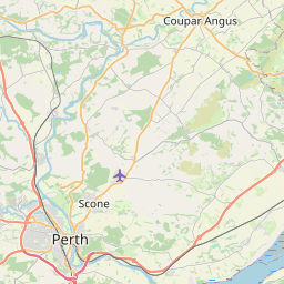
Grange Map, Satellite view of Grange, Perth and Kinross, Scotland
Grange is located in Perth and Kinross County, Perth and Kinross, Scotland, Scotland, United Kingdom.
Location informations of Grange
Latitude of city of Grange is 56.41525 and longitude of city of Grange is -3.18134. Grange has 1 postcode / zip code, in county of Perth and Kinross.The County of Grange is Perth and Kinross.
Postcode / zip code of Grange
PH2 7Administrative division of Grange
County :Perth and KinrossGPS coordinates of Grange
Latitude : 56.41525Longitude : -3.18134
Online Map of Grange - road map, satellite view and street view


Leaflet | © OpenStreetMap contributors
Search distance between two cities
The weather for Grange in the United Kingdom
Get today and tomorrow's weather forecasts for Grange. Find out the weather forecast for the week ahead and the weekend for Grange in the UK.Grange weather forecast 15 days
What is the nearest train station to Grange?
List of Railway Stations near to GrangeThe nearest railway stations to Grange are listed below. Tickets are available at the train station ticket office or ticket machines.
| Name | Distances from Grange |
|---|---|
| Invergowrie Station | 8.89 Km |
| Dundee Station | 13.71 Km |
| Cupar Station | 15.24 Km |
| Springfield Station | 15.55 Km |
| Perth Station | 16.10 Km |
| Ladybank Station | 16.15 Km |
| Leuchars Station | 18.26 Km |
| Broughty Ferry Station | 19.80 Km |
| Balmossie Station | 22.05 Km |
| Monifieth Station | 23.45 Km |
Dundee Airport , UK (10.42 Km)
Perth/Scone Airport , UK (12.04 Km)
What is the nearest Public Transport Stops to Grange?
List of Stops near to GrangeGetting there by public transport (nearest train, tube, overground line station and bus stops). The nearest stops to Grange are listed below.
| Stop Name | Distances from Grange |
|---|---|
| Bus Shelter Bus Stop (opp) | 21 m |
| Bus Shelter Bus Stop (at) | 49 m |
| Bogmiln Farm Bus Stop (opp) | 1.07 Km |
| Bogmiln Farm Bus Stop (at) | 1.11 Km |
| East Leys Farm Bus Stop (at) | 1.73 Km |
| East Leys Farm Bus Stop (opp) | 1.74 Km |
| Level Crossing Bus Stop (after) | 1.74 Km |
| Level Crossing Bus Stop (at) | 1.77 Km |
| Errol Station Bus Stop (at) | 2.14 Km |
| Errol Station Bus Stop (opp) | 2.14 Km |
Historic Places to Visit near Grange
List of Historic places near to Grange
| Name | Distances from Grange |
|---|---|
| Megginch Castle Gardens | 3.10 Km |
| Lindores Abbey | 7.46 Km |
| Balmerino Abbey | 8.95 Km |
| Elcho Castle | 11.36 Km |
| Abernethy Round Tower | 12.09 Km |
| Museum of Abernethy | 12.11 Km |
| Kinnoull Hill Tower | 12.79 Km |
| Verdant Works | 13.15 Km |
| McManus Galleries | 14.01 Km |
| Branklyn Garden | 14.91 Km |
Cities or Towns near Grange
List of places near to
| Name | Distance |
|---|---|
| Middlebank | 2.70 Km |
| Westown | 2.73 Km |
| Errol | 3.19 Km |
| Inchture | 3.49 Km |
| Kinnaird | 4.04 Km |
| Ballindean | 4.14 Km |
| Craigdallie | 4.44 Km |
| Rait | 4.70 Km |
| Baledgarno | 4.72 Km |
| Templehall | 5.16 Km |
| Kilspindie | 5.29 Km |
| Abernyte | 5.97 Km |
| Longforgan | 6.11 Km |
| Knapp | 6.16 Km |
| Brunton | 6.52 Km |
| Criech | 6.56 Km |
| Creich | 6.86 Km |
| Blinkbonny | 6.90 Km |
| Leetown | 6.91 Km |
| Glenduckie | 7.02 Km |
| Glendoick | 7.29 Km |
| Hazelton Walls | 7.36 Km |
| Dunbog | 7.42 Km |
| Balruddery | 7.55 Km |
| Kingoodie | 7.68 Km |
| Chapelhill | 7.80 Km |
| Cottown | 7.92 Km |
| Newburgh | 8.01 Km |
| Benvie | 8.05 Km |
| Luthrie | 8.17 Km |
| Glencarse | 8.46 Km |
| Den of Lindores | 8.47 Km |
| Lindores | 8.47 Km |
| Balmerino | 8.55 Km |
| Bandirran | 8.66 Km |
| St Madoes | 8.79 Km |
| Invergowrie | 8.84 Km |
| Kirkton | 8.96 Km |
| Grange of Lindores | 9.03 Km |
| Fowlis | 9.30 Km |
| Easter Kinsleith | 9.32 Km |
| Mains of Gray | 9.46 Km |
| Parbroath | 9.49 Km |
| Bottomcraig | 9.65 Km |
| Fincraigs | 9.70 Km |
| Collace | 9.75 Km |
| Rathillet | 9.75 Km |
| Liff | 9.82 Km |
| Denhead of Gray | 9.84 Km |
| Kirkton of Collace | 10.00 Km |