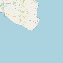
Garlieston Map, Satellite view of Garlieston, Wigtown, Scotland
Garlieston is located in Wigtown County, Dumfries and Galloway, Scotland, Scotland, United Kingdom.
Location informations of Garlieston
Latitude of city of Garlieston is 54.78991 and longitude of city of Garlieston is -4.37002. Garlieston has 1 postcode / zip code, in county of Wigtown.The County of Garlieston is Wigtown.
Postcode / zip code of Garlieston
DG8 8Administrative division of Garlieston
County :WigtownGPS coordinates of Garlieston
Latitude : 54.78991Longitude : -4.37002
Online Map of Garlieston - road map, satellite view and street view


Leaflet | © OpenStreetMap contributors
Search distance between two cities
The weather for Garlieston in the United Kingdom
Get today and tomorrow's weather forecasts for Garlieston. Find out the weather forecast for the week ahead and the weekend for Garlieston in the UK.Garlieston weather forecast 15 days
What is the nearest Public Transport Stops to Garlieston?
List of Stops near to GarliestonGetting there by public transport (nearest train, tube, overground line station and bus stops). The nearest stops to Garlieston are listed below.
| Stop Name | Distances from Garlieston |
|---|---|
| Forteviot Gardens Bus Stop (Shelter) | 106 m |
| South Crescent Bus Stop (opp no 12) | 112 m |
| Mill Road Bus Stop (opp junction) | 115 m |
| High Street Bus Stop (Tennis Courts) | 166 m |
| South Street Bus Stop (Mid) | 206 m |
| Whitehills Bus Stop (Road End) | 2.69 Km |
| Whitehills Bus Stop (opp Road End) | 2.69 Km |
| Orchardton Cottages Bus Stop (opp Road End) | 3.56 Km |
| Orchardton Cottages Bus Stop (Road End) | 3.56 Km |
| Village Bus Stop (Post Office) | 3.93 Km |
Historic Places to Visit near Garlieston
List of Historic places near to Garlieston
| Name | Distances from Garlieston |
|---|---|
| Galloway House Gardens | 0.95 Km |
| Sorbie Tower | 2.65 Km |
| Cruggleton Church | 3.60 Km |
| Whithorn Museum | 6.88 Km |
| Whithorn Priory | 7.06 Km |
| Carsluith Castle | 7.82 Km |
| Rispain Camp | 8.04 Km |
| Cairn Holy Chambered Cairns | 8.64 Km |
| St Ninians Chapel | 10.25 Km |
| Drumtroddan Standing Stones | 11.47 Km |
| Drumtroddan Cup and Ring Marked Rocks | 11.60 Km |
| St Ninians Cave | 11.93 Km |
| Cardoness Castle | 12.64 Km |
| Druchtag Motte | 12.76 Km |
| Torhouse Stone Circle | 13.80 Km |
| Barsalloch Fort | 13.98 Km |
Cities or Towns near Garlieston
List of places near to
| Name | Distance |
|---|---|
| Sorbie | 3.86 Km |
| North Balfern | 6.18 Km |
| Whithorn | 6.85 Km |
| Kirkinner | 7.31 Km |
| Portyerrock | 7.65 Km |
| Kirkdale | 7.74 Km |
| Braehead | 7.77 Km |
| Whauphill | 8.06 Km |
| Carsluith | 8.45 Km |
| Glasserton | 9.50 Km |
| Bladnoch | 9.80 Km |
| Wigtown | 9.84 Km |
| Isle of Whithorn | 9.91 Km |
| Duncan Park | 10.11 Km |
| Carrick Shore | 11.03 Km |
| Knockbrex | 11.32 Km |
| Sandgreen | 11.49 Km |
| Barrachan | 11.86 Km |
| Creetown | 12.40 Km |
| Kirkandrews | 12.41 Km |
| Monreith | 12.91 Km |
| Mochrum | 13.00 Km |
| Skyreburn | 13.29 Km |
| Borness | 13.78 Km |
| Port William | 14.07 Km |
| Anwoth | 14.33 Km |
| Girthon | 14.66 Km |
| Causeway End | 14.85 Km |