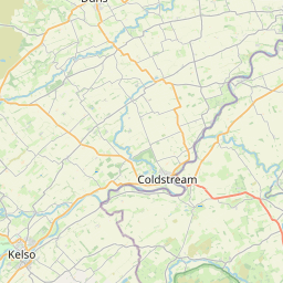
Ford Forge Map, Satellite view of Ford Forge, Northumberland, England
Ford Forge is located in Northumberland County, Northumberland, North East, England, United Kingdom.
Location informations of Ford Forge
Latitude of city of Ford Forge is 55.64001 and longitude of city of Ford Forge is -2.10482. Ford Forge has 1 postcode / zip code, in county of Northumberland.The County of Ford Forge is Northumberland.
Postcode / zip code of Ford Forge
TD12 4Administrative division of Ford Forge
County :NorthumberlandGPS coordinates of Ford Forge
Latitude : 55.64001Longitude : -2.10482
Online Map of Ford Forge - road map, satellite view and street view


Leaflet | © OpenStreetMap contributors
Search distance between two cities
The weather for Ford Forge in the United Kingdom
Get today and tomorrow's weather forecasts for Ford Forge. Find out the weather forecast for the week ahead and the weekend for Ford Forge in the UK.Ford Forge weather forecast 15 days
What is the nearest train station to Ford Forge?
List of Railway Stations near to Ford ForgeThe nearest railway stations to Ford Forge are listed below. Tickets are available at the train station ticket office or ticket machines.
| Name | Distances from Ford Forge |
|---|---|
| Berwick-Upon-Tweed Station | 16.05 Km |
| Chathill Station | 27.55 Km |
What is the nearest Public Transport Stops to Ford Forge?
List of Stops near to Ford ForgeGetting there by public transport (nearest train, tube, overground line station and bus stops). The nearest stops to Ford Forge are listed below.
| Stop Name | Distances from Ford Forge |
|---|---|
| Mill Bus Stop (southbound) | 110 m |
| Mill Bus Stop (northbound) | 123 m |
| Village entrance Bus Stop (adj) | 1.18 Km |
| Village entrance Bus Stop (opp) | 1.19 Km |
| Lady Waterford Hall Bus Stop (near) | 1.59 Km |
| Bank Top Bus Stop (eb) | 1.60 Km |
| Bank Top Bus Stop (wb) | 1.61 Km |
| Village Bus Stop (eb) | 1.88 Km |
| Village Bus Stop (wb) | 1.94 Km |
| Pallinsburn Bus Stop (nb) | 2.12 Km |
Historic Places to Visit near Ford Forge
List of Historic places near to Ford Forge
| Name | Distances from Ford Forge |
|---|---|
| Heatherslaw Mill | 0.25 Km |
| Heatherslaw Light Railway | 0.48 Km |
| Etal, St Marys Chapel | 1.11 Km |
| Etal Castle | 1.42 Km |
| Ford, St Michael & All Angels Church | 1.46 Km |
| Lady Waterford Hall | 1.55 Km |
| Flodden Battlefield Site | 3.79 Km |
| Maelmin Heritage Trail | 4.86 Km |
| Duddo Stone Circle | 5.24 Km |
| Ad Gefrin (Yeavering) | 8.04 Km |
| Yeavering Bell Hillfort | 9.21 Km |
| Coldstream Museum | 9.23 Km |
| Norham Castle | 9.46 Km |
| Norham, St Cuthberts Church | 9.59 Km |
| The Hirsel Estate & Homestead Museum | 10.40 Km |
| Wooler, St Marys Church | 11.92 Km |
| Union Chain Bridge | 12.57 Km |
| St Cuthberts Cave | 12.92 Km |
| Paxton House | 14.02 Km |
Cities or Towns near Ford Forge
List of places near to
| Name | Distance |
|---|---|
| Etal | 1.15 Km |
| Ford | 1.63 Km |
| Crookham | 1.89 Km |
| Ford Hill | 2.23 Km |
| Mardon | 3.23 Km |
| Flodden | 3.60 Km |
| Kimmerston | 3.60 Km |
| Duddo | 4.11 Km |
| Branxton | 4.15 Km |
| West Flodden | 4.47 Km |
| Milfield | 4.67 Km |
| New Heaton | 5.37 Km |
| Howtel | 5.65 Km |
| Bareless | 5.98 Km |
| Felkington | 6.08 Km |
| Bowsden | 6.39 Km |
| Grindon | 6.61 Km |
| Melkington | 6.69 Km |
| Nesbit | 6.88 Km |
| East Learmouth | 7.05 Km |
| Reedsford | 7.20 Km |
| Lanton | 7.32 Km |
| Cornhill on Tweed | 7.45 Km |
| Ancroft Northmoor | 7.61 Km |
| Kilham | 7.83 Km |
| Shoreswood | 7.98 Km |
| Lowick | 8.08 Km |
| Yeavering | 8.21 Km |
| Kirknewton | 8.41 Km |
| Shoresdean | 8.45 Km |
| West Learmouth | 8.47 Km |
| Berrington | 8.52 Km |
| West Allerdean | 8.58 Km |
| Lennel | 8.60 Km |
| Westnewton | 8.61 Km |
| Doddington | 8.65 Km |
| Akeld | 9.04 Km |
| Thornton | 9.24 Km |
| Coldstream | 9.26 Km |
| Upsettlington | 9.30 Km |
| Ancroft | 9.31 Km |
| Norham | 9.42 Km |
| Pawston | 9.70 Km |
| Low Humbleton | 10.16 Km |
| Norham West Mains | 10.19 Km |
| Ladykirk | 10.24 Km |
| Pressen | 10.41 Km |
| New Ladykirk | 10.76 Km |
| Holburn | 10.81 Km |
| Humbleton | 10.82 Km |