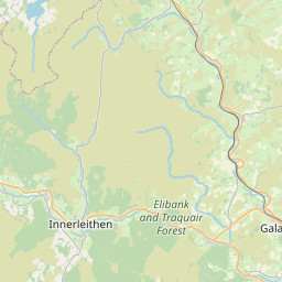
Faughill Map, Satellite view of Faughill, Roxburgh, Ettrick and Lauderdale, Scotland
Faughill is located in Roxburgh, Ettrick and Lauderdale County, Scottish Borders, Scotland, Scotland, United Kingdom.
Location informations of Faughill
Latitude of city of Faughill is 55.56604 and longitude of city of Faughill is -2.72302. Faughill has 1 postcode / zip code, in county of Roxburgh, Ettrick and Lauderdale.The County of Faughill is Roxburgh, Ettrick and Lauderdale.
Postcode / zip code of Faughill
TD6 0Administrative division of Faughill
County :Roxburgh, Ettrick and LauderdaleGPS coordinates of Faughill
Latitude : 55.56604Longitude : -2.72302
Online Map of Faughill - road map, satellite view and street view


Leaflet | © OpenStreetMap contributors
Search distance between two cities
The weather for Faughill in the United Kingdom
Get today and tomorrow's weather forecasts for Faughill. Find out the weather forecast for the week ahead and the weekend for Faughill in the UK.Faughill weather forecast 15 days
What is the nearest train station to Faughill?
List of Railway Stations near to FaughillThe nearest railway stations to Faughill are listed below. Tickets are available at the train station ticket office or ticket machines.
| Name | Distances from Faughill |
|---|---|
| Tweedbank Station | 4.98 Km |
| Galashiels Station | 7.85 Km |
| Stow Station | 16.67 Km |
What is the nearest Public Transport Stops to Faughill?
List of Stops near to FaughillGetting there by public transport (nearest train, tube, overground line station and bus stops). The nearest stops to Faughill are listed below.
| Stop Name | Distances from Faughill |
|---|---|
| Cotland Cottages Bus Stop (At) | 663 m |
| Cotland Cottages Bus Stop (Opp) | 677 m |
| Commonside Bus Stop (At) | 919 m |
| Commonside Bus Stop (Opp) | 925 m |
| Scottsdale Bus Stop (Op) | 2.24 Km |
| Scottsdale Bus Stop (at) | 2.25 Km |
| Dingleton Drive Bus Stop (Op) | 2.46 Km |
| Dingleton Hill Bus Stop (near) | 2.48 Km |
| Dingleton Apartments Bus Stop (Opp) | 2.78 Km |
| Dingleton Apartments Bus Stop (At) | 2.79 Km |
Historic Places to Visit near Faughill
List of Historic places near to Faughill
| Name | Distances from Faughill |
|---|---|
| Eildon Hills | 1.74 Km |
| Priorwood Garden | 3.58 Km |
| Melrose Abbey | 3.62 Km |
| Harmony Garden | 3.91 Km |
| Dryburgh Abbey | 4.72 Km |
| Abbotsford House | 5.26 Km |
| Mertoun House Gardens | 7.37 Km |
| Halliwells House Museum | 7.71 Km |
| Smailholm Tower | 10.15 Km |
| Waterloo Monument | 11.56 Km |
| Bowhill | 11.99 Km |
| Mellerstain House | 13.46 Km |
| Mary Queen of Scots Visitor Centre | 14.47 Km |
| Jedburgh Castle Jail and Museum | 14.49 Km |
| Jedburgh Abbey | 14.61 Km |
Cities or Towns near Faughill
List of places near to
| Name | Distance |
|---|---|
| Bowden | 0.93 Km |
| Kippilaw Mains | 1.00 Km |
| Kippilaw | 2.00 Km |
| Greenwells | 2.23 Km |
| Whiterigg | 2.23 Km |
| Dingleton | 2.74 Km |
| Elliston | 2.82 Km |
| Prieston | 2.82 Km |
| Clarilaw | 3.16 Km |
| Eildon | 3.41 Km |
| Newtown St Boswells | 3.46 Km |
| Melrose | 3.47 Km |
| Midlem | 3.51 Km |
| Highcross | 3.72 Km |
| Charlesfield | 3.76 Km |
| Darnick | 3.86 Km |
| Newstead | 4.03 Km |
| Cavers Carre | 4.12 Km |
| Faldonside | 4.46 Km |
| Chesterknowes | 4.47 Km |
| Gattonside | 4.69 Km |
| Longnewton | 4.82 Km |
| St Boswells | 4.90 Km |
| Dryburgh | 4.90 Km |
| Tweedbank | 5.01 Km |
| Bewlie Mains | 5.09 Km |
| Bewlie | 5.38 Km |
| Lilliesleaf | 5.55 Km |
| Boleside | 5.63 Km |
| Galafoot | 5.70 Km |
| Glenmayne | 5.82 Km |
| Easter Langlee | 5.82 Km |
| Lowood | 5.82 Km |
| Lindean | 5.91 Km |
| Bridgelands | 5.98 Km |
| Bemersyde | 6.03 Km |
| Netherdale | 6.04 Km |
| Wester Housebyres | 6.08 Km |
| Belses | 6.08 Km |
| Langlee | 6.22 Km |
| The Rink | 6.31 Km |
| Old Belses | 6.32 Km |
| Redpath | 6.60 Km |
| Langlee Mains | 6.70 Km |
| Riddell | 6.70 Km |
| Maxton | 6.75 Km |
| Glenfield | 6.84 Km |
| Clintmains | 7.04 Km |
| High Sunderland | 7.05 Km |
| Netherraw | 7.06 Km |