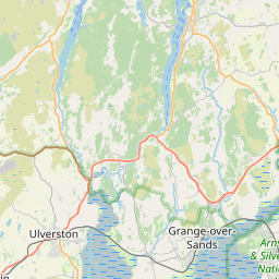
Eskrigge Map, Satellite view of Eskrigge, Lancashire, England
Eskrigge is located in Lancashire County, Lancaster District, North West, England, United Kingdom.
Location informations of Eskrigge
Latitude of city of Eskrigge is 54.11745 and longitude of city of Eskrigge is -2.65900. Eskrigge has 1 postcode / zip code, in county of Lancashire.The County of Eskrigge is Lancashire.
Postcode / zip code of Eskrigge
LA2 8Administrative division of Eskrigge
County :LancashireGPS coordinates of Eskrigge
Latitude : 54.11745Longitude : -2.65900
Online Map of Eskrigge - road map, satellite view and street view


Leaflet | © OpenStreetMap contributors
Search distance between two cities
The weather for Eskrigge in the United Kingdom
Get today and tomorrow's weather forecasts for Eskrigge. Find out the weather forecast for the week ahead and the weekend for Eskrigge in the UK.Eskrigge weather forecast 15 days
What is the nearest train station to Eskrigge?
List of Railway Stations near to EskriggeThe nearest railway stations to Eskrigge are listed below. Tickets are available at the train station ticket office or ticket machines.
| Name | Distances from Eskrigge |
|---|---|
| Wennington Station | 4.71 Km |
| Carnforth Station | 7.44 Km |
| Bentham Station | 9.67 Km |
| Silverdale Station | 11.09 Km |
| Lancaster Station | 12.34 Km |
| Bare Lane Station | 12.45 Km |
| Arnside Station | 14.54 Km |
| Morecambe Station | 14.68 Km |
| Clapham (North Yorkshire) Station | 16.26 Km |
| Grange-Over-Sands Station | 18.10 Km |
What is the nearest Public Transport Stops to Eskrigge?
List of Stops near to EskriggeGetting there by public transport (nearest train, tube, overground line station and bus stops). The nearest stops to Eskrigge are listed below.
| Stop Name | Distances from Eskrigge |
|---|---|
| Eskridge Hall Bus Stop (by) | 129 m |
| Lea Barn Bus Stop (by) | 223 m |
| St Johns Church Bus Stop (by) | 701 m |
| Fall Kirk Bus Stop (by) | 724 m |
| Village Centre Bus Stop (o/s) | 747 m |
| Village Centre Bus Stop (by) | 765 m |
| Robin Croft Bus Stop (by) | 772 m |
| Aughton Road End Bus Stop (by) | 1.05 Km |
| High School Bus Stop (o/s) | 1.39 Km |
| Hornby Bank Bus Stop (by) | 1.40 Km |
Historic Places to Visit near Eskrigge
List of Historic places near to Eskrigge
| Name | Distances from Eskrigge |
|---|---|
| Gresgarth Hall Gardens | 6.82 Km |
| Warton, St Oswalds Church | 7.71 Km |
| Warton Old Rectory | 7.75 Km |
| Halton, St Wilfrids Church | 8.39 Km |
| Leighton Hall | 9.17 Km |
| Lancaster, St Johns Church | 11.81 Km |
| Lancaster Priory | 12.02 Km |
| Lancaster Castle | 12.02 Km |
| Wery Wall and Roman Bath House | 12.05 Km |
| Ingleton, St Marys Church | 13.12 Km |
| Arnside and Silverdale | 14.47 Km |
Cities or Towns near Eskrigge
List of places near to
| Name | Distance |
|---|---|
| Gressingham | 0.73 Km |
| Hornby | 1.81 Km |
| Butt Yeats | 2.30 Km |
| Farleton | 2.41 Km |
| Claughton | 2.73 Km |
| Aughton | 2.74 Km |
| Arkholme | 3.21 Km |
| Swarthdale | 3.39 Km |
| Melling | 3.47 Km |
| Wray | 3.73 Km |
| Tatham | 3.81 Km |
| Caton Green | 4.49 Km |
| Capernwray | 4.72 Km |
| Wennington | 4.76 Km |
| Over Kellet | 4.82 Km |
| Wrayton | 5.02 Km |
| Brookhouse | 5.51 Km |
| Tunstall | 5.83 Km |
| Borwick | 5.85 Km |
| Newton | 5.88 Km |
| Priest Hutton | 5.99 Km |
| Caton | 6.00 Km |
| Cantsfield | 6.20 Km |
| Nether Kellet | 6.60 Km |
| Old Wennington | 6.65 Km |
| Tewitfield | 6.68 Km |
| Halton Green | 6.71 Km |
| Crossgill | 6.91 Km |
| Carnforth | 7.18 Km |
| Green | 7.23 Km |
| Nether Burrow | 7.39 Km |
| Whittington | 7.60 Km |
| Millhead | 7.66 Km |
| Crag Bank | 7.72 Km |
| Warton | 7.80 Km |
| Dalton | 7.82 Km |
| Low Bentham | 7.87 Km |
| Over Burrow | 8.14 Km |
| Halton | 8.23 Km |
| Burton-in-Kendal | 8.27 Km |
| Yealand Conyers | 8.28 Km |
| Bolton-le-Sands | 8.73 Km |
| Hutton Roof | 9.05 Km |
| Burton in Lonsdale | 9.09 Km |
| Clawthorpe | 9.11 Km |
| Bolton Town End | 9.12 Km |
| Overtown | 9.13 Km |
| Low Biggins | 9.48 Km |
| Yealand Redmayne | 9.51 Km |
| High Biggins | 9.51 Km |