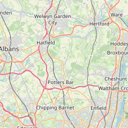
Enfield Map, Satellite view of Enfield, Greater London, England
Enfield is located in Greater London County, Enfield, London, England, United Kingdom.
Location informations of Enfield
Latitude of city of Enfield is 51.65222 and longitude of city of Enfield is -0.08438. Enfield has 1 postcode / zip code, in county of Greater London.The County of Enfield is Greater London.
Postcode / zip code of Enfield
EN2 6Administrative division of Enfield
County :Greater LondonGPS coordinates of Enfield
Latitude : 51.65222Longitude : -0.08438
Online Map of Enfield - road map, satellite view and street view

Leaflet | © OpenStreetMap contributors
Search distance between two cities
The weather for Enfield in the United Kingdom
Get today and tomorrow's weather forecasts for Enfield. Find out the weather forecast for the week ahead and the weekend for Enfield in the UK.Enfield weather forecast 15 days
What is the nearest train station to Enfield?
List of Railway Stations near to EnfieldThe nearest railway stations to Enfield are listed below. Tickets are available at the train station ticket office or ticket machines.
| Name | Distances from Enfield |
|---|---|
| Enfield Town Station | 349 m |
| Enfield Chase Station | 450 m |
| Grange Park Station | 1.39 Km |
| Gordon Hill Station | 1.42 Km |
| Bush Hill Park Station | 1.58 Km |
| Southbury Station | 2.24 Km |
| Winchmore Hill Station | 2.33 Km |
| Turkey Street Station | 3.42 Km |
| Edmonton Green Station | 3.43 Km |
| Ponders End Station | 3.58 Km |
What is the nearest Public Transport Stops to Enfield?
List of Stops near to EnfieldGetting there by public transport (nearest train, tube, overground line station and bus stops). The nearest stops to Enfield are listed below.
Historic Places to Visit near Enfield
List of Historic places near to Enfield
Cities or Towns near Enfield
List of places near to
| Name | Distance |
|---|---|
| Enfield Town | 0.65 Km |
| Bush Hill Park | 1.49 Km |
| Grange Park | 1.54 Km |
| Forty Hill | 1.68 Km |
| World's End | 1.80 Km |
| Southbury | 1.92 Km |
| Highlands Village | 2.00 Km |
| Winchmore Hill | 2.37 Km |
| Enfield Highway | 2.71 Km |
| Oakwood | 2.80 Km |
| Lower Edmonton | 3.04 Km |
| Bulls Cross | 3.16 Km |
| Ponders End | 3.22 Km |
| Crews Hill | 3.42 Km |
| Edmonton | 3.49 Km |
| Enfield Wash | 3.51 Km |
| Bullsmoor | 3.85 Km |
| Southgate | 3.92 Km |
| Botany Bay | 3.96 Km |
| Palmers Green | 3.97 Km |
| Brimsdown | 4.06 Km |
| Freezy Water | 4.29 Km |
| Upper Edmonton | 4.40 Km |
| Cockfosters | 4.42 Km |
| Osidge | 4.68 Km |
| Enfield Lock | 4.76 Km |
| Arnos Grove | 5.03 Km |
| Enfield Island Village | 5.12 Km |
| Waltham Cross | 5.14 Km |
| Bowes Park | 5.26 Km |
| Brunswick Park | 5.26 Km |
| Sewardstone | 5.49 Km |
| New Southgate | 5.49 Km |
| Holdbrook | 5.75 Km |
| Northaw Valley | 5.76 Km |
| Bury Green | 5.80 Km |
| Gilwell Park | 5.86 Km |
| East Barnet | 5.95 Km |
| Bounds Green | 5.97 Km |
| Barnet | 6.00 Km |
| Tower Gardens | 6.06 Km |
| Oakleigh Park | 6.08 Km |
| Hadley Wood | 6.10 Km |
| Chingford Green | 6.16 Km |
| Noel Park | 6.29 Km |
| Cheshunt | 6.30 Km |
| Churchgate | 6.30 Km |
| Wood Green | 6.37 Km |
| Chingford | 6.37 Km |
| Goff's Oak | 6.47 Km |