Elsthorpe Map, Satellite view of Elsthorpe, Lincolnshire, England
Elsthorpe is located in Lincolnshire County, South Kesteven District, East Midlands, England, United Kingdom.
Location informations of Elsthorpe
Latitude of city of Elsthorpe is 52.80088 and longitude of city of Elsthorpe is -0.43067. Elsthorpe has 1 postcode / zip code, in county of Lincolnshire.The County of Elsthorpe is Lincolnshire.
Postcode / zip code of Elsthorpe
PE10 0Administrative division of Elsthorpe
County :LincolnshireGPS coordinates of Elsthorpe
Latitude : 52.80088Longitude : -0.43067
Online Map of Elsthorpe - road map, satellite view and street view
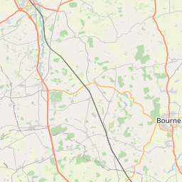


Leaflet | © OpenStreetMap contributors
Search distance between two cities
The weather for Elsthorpe in the United Kingdom
Get today and tomorrow's weather forecasts for Elsthorpe. Find out the weather forecast for the week ahead and the weekend for Elsthorpe in the UK.Elsthorpe weather forecast 15 days
What is the nearest train station to Elsthorpe?
List of Railway Stations near to ElsthorpeThe nearest railway stations to Elsthorpe are listed below. Tickets are available at the train station ticket office or ticket machines.
| Name | Distances from Elsthorpe |
|---|---|
| Stamford Station | 17.34 Km |
| Grantham Station | 18.44 Km |
| Spalding Station | 18.46 Km |
| Rauceby Station | 20.57 Km |
| Heckington Station | 21.66 Km |
| Sleaford Station | 21.68 Km |
| Ancaster Station | 21.93 Km |
| Swineshead Station | 24.89 Km |
| Oakham Station | 24.94 Km |
| Ruskington Station | 26.96 Km |
What is the nearest Public Transport Stops to Elsthorpe?
List of Stops near to ElsthorpeGetting there by public transport (nearest train, tube, overground line station and bus stops). The nearest stops to Elsthorpe are listed below.
| Stop Name | Distances from Elsthorpe |
|---|---|
| Letter Box Bus Stop (opp) | 30 m |
| Demand Responsive Area Bus Stop | 31 m |
| Letter Box Bus Stop (adj) | 32 m |
| The Black Horse Inn Bus Stop (o/s) | 1.42 Km |
| Demand Responsive Area Bus Stop | 1.43 Km |
| The Black Horse Inn Bus Stop (opp) | 1.44 Km |
| St Michael & All Angels Bus Stop (opp) | 1.90 Km |
| St Michael & All Angels Bus Stop (adj) | 1.90 Km |
| Demand Responsive Area Bus Stop | 2.07 Km |
| Pumping Station Bus Stop (adj) | 2.45 Km |
Historic Places to Visit near Elsthorpe
List of Historic places near to Elsthorpe
| Name | Distances from Elsthorpe |
|---|---|
| Grimsthorpe Castle | 1.34 Km |
| Sempringham Church and Holy Well | 10.31 Km |
| Haceby, St Barbaras Church | 12.54 Km |
| Easton Walled Gardens | 13.23 Km |
| Woolsthorpe Manor | 13.47 Km |
| Ellys Manor House | 14.72 Km |
Cities or Towns near Elsthorpe
List of places near to
| Name | Distance |
|---|---|
| Grimsthorpe | 1.08 Km |
| Edenham | 1.75 Km |
| Bulby | 2.49 Km |
| Stainfield | 2.51 Km |
| Hanthorpe | 2.61 Km |
| Scottlethorpe | 2.92 Km |
| Cawthorpe | 3.52 Km |
| Morton | 3.84 Km |
| Kirkby Underwood | 3.93 Km |
| Hawthorpe | 3.97 Km |
| Swinstead | 4.27 Km |
| Irnham | 4.55 Km |
| Dyke | 4.73 Km |
| Haconby | 4.91 Km |
| Bourne | 5.11 Km |
| Osgodby | 5.45 Km |
| Dunsby | 5.63 Km |
| Lound | 5.64 Km |
| Rippingale | 5.66 Km |
| Keisby | 5.69 Km |
| Corby Glen | 6.04 Km |
| Creeton | 6.08 Km |
| Counthorpe | 6.32 Km |
| Toft | 6.61 Km |
| Manor Farm | 6.91 Km |
| Swayfield | 6.95 Km |
| Witham on the Hill | 7.10 Km |
| Aslackby | 7.10 Km |
| Graby | 7.12 Km |
| Little Bytham | 7.18 Km |
| Northorpe | 7.38 Km |
| Lenton | 7.41 Km |
| Thurlby | 7.75 Km |
| Manthorpe | 7.81 Km |
| Dowsby | 7.93 Km |
| Careby | 8.15 Km |
| Burton-le-Coggles | 8.19 Km |
| Ingoldsby | 8.19 Km |
| Laughton | 8.39 Km |
| Birkholme | 8.79 Km |
| Castle Bytham | 8.80 Km |
| Bitchfield | 8.85 Km |
| Millthorpe | 9.05 Km |
| Hanby | 9.06 Km |
| Obthorpe | 9.20 Km |
| Obthorpe Lodge | 9.43 Km |
| Holywell | 9.48 Km |
| Westby | 9.74 Km |
| Carlby | 9.77 Km |
| Aunby | 9.80 Km |