Ebblake Map, Satellite view of Ebblake, Dorset, England
Ebblake is located in Dorset County, East Dorset District, South West, England, United Kingdom.
Location informations of Ebblake
Latitude of city of Ebblake is 50.87152 and longitude of city of Ebblake is -1.85178. Ebblake has 1 postcode / zip code, in county of Dorset.The County of Ebblake is Dorset.
Postcode / zip code of Ebblake
BH31 7Administrative division of Ebblake
County :DorsetGPS coordinates of Ebblake
Latitude : 50.87152Longitude : -1.85178
Online Map of Ebblake - road map, satellite view and street view

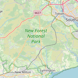
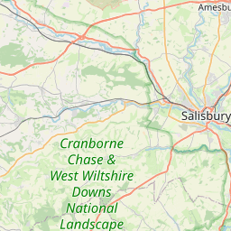
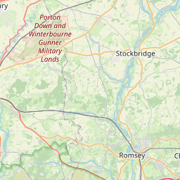
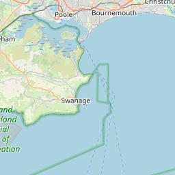
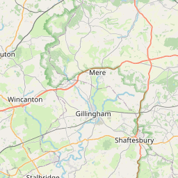


Leaflet | © OpenStreetMap contributors
Search distance between two cities
The weather for Ebblake in the United Kingdom
Get today and tomorrow's weather forecasts for Ebblake. Find out the weather forecast for the week ahead and the weekend for Ebblake in the UK.Ebblake weather forecast 15 days
What is the nearest train station to Ebblake?
List of Railway Stations near to EbblakeThe nearest railway stations to Ebblake are listed below. Tickets are available at the train station ticket office or ticket machines.
| Name | Distances from Ebblake |
|---|---|
| Christchurch Station | 15.56 Km |
| Pokesdown Station | 15.73 Km |
| Bournemouth Station | 16.06 Km |
| Hinton Admiral Station | 16.38 Km |
| Branksome Station | 16.77 Km |
| Parkstone Station | 17.85 Km |
| New Milton Station | 18.75 Km |
| Poole Station | 19.27 Km |
| Sway Station | 19.53 Km |
| Hamworthy Station | 20.09 Km |
Bournemouth Airport , UK (10.20 Km)
What is the nearest Public Transport Stops to Ebblake?
List of Stops near to EbblakeGetting there by public transport (nearest train, tube, overground line station and bus stops). The nearest stops to Ebblake are listed below.
Historic Places to Visit near Ebblake
List of Historic places near to Ebblake
| Name | Distances from Ebblake |
|---|---|
| Edmondsham, St Nicholas Church | 5.64 Km |
| Edmondsham House and Gardens | 5.65 Km |
| Fordingbridge, St Marys Church | 7.16 Km |
| Cranborne, St Mary & St Bartholomew | 7.25 Km |
| Cranborne Manor Gardens | 7.33 Km |
| Horton, St Wolfridas Church | 7.50 Km |
| Wimborne St Giles Church | 8.34 Km |
| Knowlton Church and Earthworks | 8.42 Km |
| Chalbury, All Saints Church | 8.68 Km |
| Rockbourne Roman Villa | 9.17 Km |
| Knoll Gardens | 9.19 Km |
| Rockbourne, St Andrews Church | 10.44 Km |
| Gussage All Saints Church | 10.68 Km |
| Breamore Saxon Church | 12.02 Km |
| Breamore House | 12.03 Km |
| Priests House Museum | 12.44 Km |
| Wimborne Minster Church | 12.49 Km |
| Deans Court | 12.50 Km |
| Kingston Lacy | 13.90 Km |
| Badbury Rings | 14.92 Km |
Cities or Towns near Ebblake
List of places near to
| Name | Distance |
|---|---|
| Verwood | 2.24 Km |
| Crab Orchard | 2.56 Km |
| Dewlands Common | 2.62 Km |
| Lower Turmer | 3.05 Km |
| Woolsbridge | 3.09 Km |
| Three Legged Cross | 3.32 Km |
| Horton Common | 3.38 Km |
| Romford | 3.48 Km |
| Turmer | 3.74 Km |
| Gotham | 3.83 Km |
| Ashley Heath | 3.87 Km |
| Ellingham | 3.91 Km |
| Woodlands Common | 4.04 Km |
| Kent | 4.14 Km |
| Harbridge | 4.49 Km |
| St Ives | 4.50 Km |
| Whitmore | 4.52 Km |
| Alderholt | 4.56 Km |
| Ibsley | 4.56 Km |
| Daggons | 4.56 Km |
| Bleak Hill | 4.58 Km |
| Lower Mannington | 4.58 Km |
| Cripplestyle | 4.64 Km |
| Harbridge Green | 4.68 Km |
| Sutton Holms | 4.70 Km |
| St Leonards | 4.75 Km |
| Knob's Crook | 4.76 Km |
| Mannington | 4.83 Km |
| Ashley | 4.89 Km |
| Horton Heath | 4.90 Km |
| Camel Green | 4.90 Km |
| Blashford | 4.91 Km |
| Ringwood | 5.11 Km |
| Crendell | 5.33 Km |
| Lower Holwell | 5.41 Km |
| Holt Heath | 5.45 Km |
| Avon Castle | 5.46 Km |
| Edmondsham | 5.51 Km |
| Lower Daggons | 5.51 Km |
| Crooked Withies | 5.61 Km |
| Rockford | 5.70 Km |
| West Moors | 5.78 Km |
| Mockbeggar | 5.84 Km |
| Woodlands | 5.86 Km |
| Grange Estate | 5.87 Km |
| Wigbeth | 5.91 Km |
| North Poulner | 6.00 Km |
| Poulner | 6.09 Km |
| New Town | 6.13 Km |
| South Gorley | 6.21 Km |