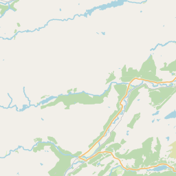
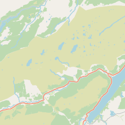
Easter Clunes Map, Satellite view of Easter Clunes, Inverness, Scotland
Easter Clunes is located in Inverness County, Highland, Scotland, Scotland, United Kingdom.
Location informations of Easter Clunes
Latitude of city of Easter Clunes is 57.44242 and longitude of city of Easter Clunes is -4.41927. Easter Clunes has 1 postcode / zip code, in county of Inverness.The County of Easter Clunes is Inverness.
Postcode / zip code of Easter Clunes
IV5 7Administrative division of Easter Clunes
County :InvernessGPS coordinates of Easter Clunes
Latitude : 57.44242Longitude : -4.41927
Online Map of Easter Clunes - road map, satellite view and street view


Leaflet | © OpenStreetMap contributors
Search distance between two cities
The weather for Easter Clunes in the United Kingdom
Get today and tomorrow's weather forecasts for Easter Clunes. Find out the weather forecast for the week ahead and the weekend for Easter Clunes in the UK.Easter Clunes weather forecast 15 days
What is the nearest train station to Easter Clunes?
List of Railway Stations near to Easter ClunesThe nearest railway stations to Easter Clunes are listed below. Tickets are available at the train station ticket office or ticket machines.
| Name | Distances from Easter Clunes |
|---|---|
| Beauly Station | 5.01 Km |
| Muir Of Ord Station | 8.74 Km |
| Inverness Station | 12.44 Km |
| Conon Bridge Station | 13.33 Km |
| Dingwall Station | 16.88 Km |
| Garve Station | 24.86 Km |
| Alness Station | 29.79 Km |
What is the nearest Public Transport Stops to Easter Clunes?
List of Stops near to Easter ClunesGetting there by public transport (nearest train, tube, overground line station and bus stops). The nearest stops to Easter Clunes are listed below.
| Stop Name | Distances from Easter Clunes |
|---|---|
| Moniack Castle Bus Stop (opp) | 1.87 Km |
| Moniack Castle Bus Stop (o/s) | 1.88 Km |
| Bus Shelter Bus Stop (at) | 2.25 Km |
| Balchraggan Houses Bus Stop (at) | 2.26 Km |
| Bus Shelter Bus Stop (opp) | 2.26 Km |
| Belladrum Festival Site Bus Stop (at) | 2.68 Km |
| Cononbank Farm Bus Stop (opp) | 2.94 Km |
| Cononbank Farm Bus Stop (o/s) | 2.96 Km |
| Belladrum Lodge Bus Stop (at) | 3.03 Km |
| Belladrum Lodge Bus Stop (opp) | 3.05 Km |
Historic Places to Visit near Easter Clunes
List of Historic places near to Easter Clunes
| Name | Distances from Easter Clunes |
|---|---|
| Beauly Priory | 5.25 Km |
| Dochfour House & Gardens | 6.08 Km |
| Craig Phadrig Hill Fort | 9.50 Km |
| Inverness Botanic Gardens | 10.94 Km |
| Ness Islands | 11.61 Km |
| Knocknagael Boar Stone | 11.65 Km |
| Inverness Old High Church | 12.17 Km |
| Inverness Castle | 12.17 Km |
| Abertarff House | 12.19 Km |
| Loch Ness Centre & Exhibition | 12.19 Km |
| Inverness Museum and Art Gallery | 12.21 Km |
| Loch Ness | 12.22 Km |
| Urquhart Castle | 13.20 Km |
Cities or Towns near Easter Clunes
List of places near to
| Name | Distance |
|---|---|
| South Clunes | 1.02 Km |
| Cabrich | 1.48 Km |
| Knockbain | 1.59 Km |
| Balchraggan | 2.17 Km |
| Belladrum | 2.55 Km |
| Tomnacross | 3.36 Km |
| Newtonhill | 3.46 Km |
| Drumchardine | 3.54 Km |
| Kirkhill | 3.77 Km |
| Blackfold | 3.79 Km |
| Inchmore | 3.88 Km |
| Glaichbea | 3.98 Km |
| Teavarran | 4.26 Km |
| Kiltarlity | 4.45 Km |
| Camault Muir | 4.54 Km |
| Loaneckheim | 4.55 Km |
| Lentran | 4.81 Km |
| Cragganvallie | 4.98 Km |
| Beauly | 5.17 Km |
| Wester Balblair | 5.19 Km |
| Ardendrain | 5.21 Km |
| Lonbuie | 5.98 Km |
| Kilmorack | 6.06 Km |
| Lochend | 6.08 Km |
| Kirkton | 6.15 Km |
| Fanellan | 6.17 Km |
| Ruisaurie | 6.19 Km |
| Englishton Muir | 6.26 Km |
| Abriachan | 6.31 Km |
| Culburnie | 6.36 Km |
| Purlie Lodge | 6.40 Km |
| Broallan | 6.57 Km |
| Balmore | 6.62 Km |
| Windhill | 6.62 Km |
| Rheindown | 6.63 Km |
| Dunmore | 6.64 Km |
| Ruilick | 6.66 Km |
| Dochgarroch | 7.08 Km |
| Torgormack | 7.11 Km |
| Killianan | 7.18 Km |
| Hughton | 7.22 Km |
| Drumindorsair | 7.23 Km |
| Balchraggan | 7.28 Km |
| Clashandorran | 7.42 Km |
| Teandalloch | 7.46 Km |
| Aultvaich | 7.71 Km |
| Bunchrew | 7.75 Km |
| Farley | 7.99 Km |
| Corry of Ardnagrask | 8.10 Km |
| Crask of Aigas | 8.12 Km |