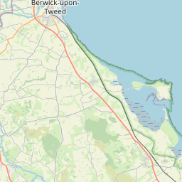
Dunstan Map, Satellite view of Dunstan, Northumberland, England
Dunstan is located in Northumberland County, Northumberland, North East, England, United Kingdom.
Location informations of Dunstan
Latitude of city of Dunstan is 55.47307 and longitude of city of Dunstan is -1.60709. Dunstan has 1 postcode / zip code, in county of Northumberland.The County of Dunstan is Northumberland.
Postcode / zip code of Dunstan
NE66 3Administrative division of Dunstan
County :NorthumberlandGPS coordinates of Dunstan
Latitude : 55.47307Longitude : -1.60709
Online Map of Dunstan - road map, satellite view and street view


Leaflet | © OpenStreetMap contributors
Search distance between two cities
The weather for Dunstan in the United Kingdom
Get today and tomorrow's weather forecasts for Dunstan. Find out the weather forecast for the week ahead and the weekend for Dunstan in the UK.Dunstan weather forecast 15 days
What is the nearest train station to Dunstan?
List of Railway Stations near to DunstanThe nearest railway stations to Dunstan are listed below. Tickets are available at the train station ticket office or ticket machines.
| Name | Distances from Dunstan |
|---|---|
| Alnmouth Station | 9.12 Km |
| Chathill Station | 9.44 Km |
| Acklington Station | 18.67 Km |
| Widdrington Station | 25.78 Km |
What is the nearest Public Transport Stops to Dunstan?
List of Stops near to DunstanGetting there by public transport (nearest train, tube, overground line station and bus stops). The nearest stops to Dunstan are listed below.
| Stop Name | Distances from Dunstan |
|---|---|
| White Lodge Bus Stop (nr) | 14 m |
| White Lodge Bus Stop (opp) | 25 m |
| Car park Bus Stop (adj) | 689 m |
| Harbour Bus Stop (opp) | 783 m |
| Harbour Bus Stop (nr) | 790 m |
| The Heugh Bus Stop (near) | 952 m |
| Howick Scar Bus Stop (adj) | 1.05 Km |
| Howick Scar Bus Stop (opp) | 1.06 Km |
| Phone box Bus Stop (adj) | 2.31 Km |
| Phone box Bus Stop (opp) | 2.33 Km |
Historic Places to Visit near Dunstan
List of Historic places near to Dunstan
| Name | Distances from Dunstan |
|---|---|
| Dunstanburgh Castle | 1.33 Km |
| Howick Hall Gardens | 2.42 Km |
| Howick, St Michaels Church | 2.58 Km |
| Alnwick Garden | 3.46 Km |
| Preston Tower | 8.46 Km |
| Alnwick Castle | 8.93 Km |
| Bailiffgate Museum, Alnwick | 9.03 Km |
| Alnwick, St Michaels Church | 9.07 Km |
| Alnwick Abbey Gatehouse | 9.23 Km |
| Hulne Priory | 9.45 Km |
| Warkworth, St Lawrence Church | 13.79 Km |
| Warkworth Castle Hermitage | 14.11 Km |
| Warkworth Castle | 14.22 Km |
| Eglingham, St Maurices Church | 14.28 Km |
Cities or Towns near Dunstan
List of places near to
| Name | Distance |
|---|---|
| Craster | 0.77 Km |
| Howick | 2.42 Km |
| Stamford | 2.68 Km |
| Embleton | 3.25 Km |
| Rennington | 4.07 Km |
| Littlehoughton | 4.08 Km |
| Longhoughton | 4.56 Km |
| Rock | 4.56 Km |
| Low Newton-by-the-Sea | 4.64 Km |
| Christon Bank | 4.76 Km |
| Peppermoor | 5.10 Km |
| High Newton-by-the-Sea | 5.37 Km |
| Broxfield | 5.63 Km |
| Boulmer | 5.89 Km |
| Brunton | 6.25 Km |
| Denwick | 7.05 Km |
| Tughall | 7.35 Km |
| Doxford | 7.78 Km |
| Hawkhill | 7.86 Km |
| Preston | 8.45 Km |
| South Charlton | 8.45 Km |
| Lesbury | 8.52 Km |
| North Charlton | 8.54 Km |
| Hipsburn | 9.08 Km |
| Brownieside | 9.15 Km |
| Freelands | 9.24 Km |
| Alnwick | 9.24 Km |
| Swinhoe | 9.26 Km |
| Alnmouth | 9.29 Km |
| Chathill | 9.32 Km |
| Bilton | 9.43 Km |
| Beadnell | 9.50 Km |
| Ellingham | 9.70 Km |
| West Fleetham | 10.22 Km |
| Newham | 11.26 Km |
| High Buston | 11.40 Km |
| North Sunderland | 12.10 Km |
| Shilbottle Grange | 12.30 Km |
| Seahouses | 12.44 Km |
| Shilbottle | 12.51 Km |
| Rugley | 12.67 Km |
| Low Buston | 12.68 Km |
| Birling | 13.43 Km |
| Church Side | 13.65 Km |
| Eastfield Hall | 13.69 Km |
| Abberwick | 13.71 Km |
| Warkworth | 13.94 Km |
| Lucker | 14.01 Km |
| The Butts | 14.01 Km |
| Warenford | 14.16 Km |