Dry Gill Map, Satellite view of Dry Gill, North Yorkshire, England
Dry Gill is located in North Yorkshire County, Craven District, Yorkshire and the Humber, England, United Kingdom.
Location informations of Dry Gill
Latitude of city of Dry Gill is 54.06617 and longitude of city of Dry Gill is -1.87819. Dry Gill has 1 postcode / zip code, in county of North Yorkshire.The County of Dry Gill is North Yorkshire.
Postcode / zip code of Dry Gill
BD23 6Administrative division of Dry Gill
County :North YorkshireGPS coordinates of Dry Gill
Latitude : 54.06617Longitude : -1.87819
Online Map of Dry Gill - road map, satellite view and street view
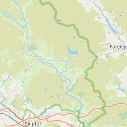

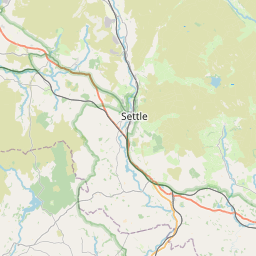


Leaflet | © OpenStreetMap contributors
Search distance between two cities
The weather for Dry Gill in the United Kingdom
Get today and tomorrow's weather forecasts for Dry Gill. Find out the weather forecast for the week ahead and the weekend for Dry Gill in the UK.Dry Gill weather forecast 15 days
What is the nearest train station to Dry Gill?
List of Railway Stations near to Dry GillThe nearest railway stations to Dry Gill are listed below. Tickets are available at the train station ticket office or ticket machines.
| Name | Distances from Dry Gill |
|---|---|
| Skipton Station | 15.36 Km |
| Ilkley Station | 16.15 Km |
| Ben Rhydding Station | 16.49 Km |
| Gargrave Station | 17.75 Km |
| Cononley Station | 18.70 Km |
| Steeton and Silsden Station | 18.98 Km |
| Burley-In-Wharfedale Station | 19.37 Km |
| Menston Station | 21.46 Km |
| Keighley Station | 22.09 Km |
| Crossflatts Station | 23.20 Km |
What is the nearest Public Transport Stops to Dry Gill?
List of Stops near to Dry GillGetting there by public transport (nearest train, tube, overground line station and bus stops). The nearest stops to Dry Gill are listed below.
| Stop Name | Distances from Dry Gill |
|---|---|
| Stump Cross Caverns Bus Stop (W-bound) | 798 m |
| Stump Cross Caverns Bus Stop (E-bound) | 824 m |
| Lily Green Bus Stop (SE-bound) | 2.34 Km |
| Grimwith Reservoir Bus Stop (E-bound) | 2.67 Km |
| Grimwith Reservoir Bus Stop (W-bound) | 2.67 Km |
| Miner's Arms Bus Stop (E-bound) | 3.30 Km |
| Miner's Arms Bus Stop (W-bound) | 3.31 Km |
| Duck Street Bus Stop (32004818) | 3.34 Km |
| Hazler Lane Bus Stop (S-bound) | 3.98 Km |
| Stangs Lane End Bus Stop (N-bound) | 3.98 Km |
Historic Places to Visit near Dry Gill
List of Historic places near to Dry Gill
| Name | Distances from Dry Gill |
|---|---|
| Parcevall Hall Gardens | 2.89 Km |
| Barden Bridge | 6.74 Km |
| Barden Tower | 6.79 Km |
| The Strid | 7.10 Km |
| Bolton Abbey | 9.31 Km |
| Brimham Rocks | 13.45 Km |
| Skipton Castle | 14.28 Km |
Cities or Towns near Dry Gill
List of places near to
| Name | Distance |
|---|---|
| Keld Houses | 2.33 Km |
| High Skyreholme | 2.59 Km |
| Middle Skyreholme | 2.91 Km |
| Greenhow | 3.27 Km |
| Skyreholme | 3.34 Km |
| Near Hardcastle | 4.03 Km |
| Appletreewick | 4.31 Km |
| Hartlington | 4.74 Km |
| Drebley | 5.00 Km |
| Burnsall | 5.30 Km |
| Hebden | 5.37 Km |
| Ashfold Side | 5.41 Km |
| Hole Bottom | 5.71 Km |
| Bramley Head | 6.65 Km |
| Ladies Riggs | 6.76 Km |
| Thorpe | 6.90 Km |
| Heathfield | 6.93 Km |
| Thorpe Fell View | 7.64 Km |
| Bridgehouse Gate | 7.66 Km |
| Bewerley | 7.72 Km |
| Grassington | 7.76 Km |
| Wath | 8.02 Km |
| Silver Hill | 8.03 Km |
| Pateley Bridge | 8.12 Km |
| Linton | 8.19 Km |
| West End | 8.48 Km |
| Ramsgill | 8.63 Km |
| Bouthwaite | 8.89 Km |
| Storiths | 9.02 Km |
| Threshfield | 9.06 Km |
| Thruscross | 9.13 Km |
| Summerscales | 9.19 Km |
| Padside | 9.20 Km |
| Padside Green | 9.25 Km |
| Heyshaw | 9.26 Km |
| Glasshouses | 9.36 Km |
| Bolton Abbey | 9.46 Km |
| Hazlewood | 9.64 Km |
| Blazefield | 9.78 Km |
| Deerstones | 9.87 Km |
| Threapland | 9.97 Km |
| Stean | 10.06 Km |
| Hambleton | 10.08 Km |
| Halton East | 10.09 Km |
| Wilsill | 10.14 Km |
| Long Ashes | 10.19 Km |
| Lofthouse | 10.20 Km |
| Thornthwaite | 10.21 Km |
| Skirethorns | 10.23 Km |
| Bolton Bridge | 10.25 Km |