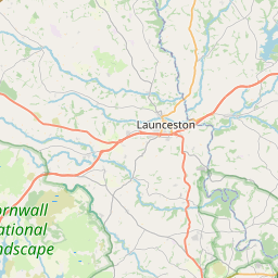
Derriton Map, Satellite view of Derriton, Devon, England
Derriton is located in Devon County, Torridge District, South West, England, United Kingdom.
Location informations of Derriton
Latitude of city of Derriton is 50.80401 and longitude of city of Derriton is -4.36434. Derriton has 1 postcode / zip code, in county of Devon.The County of Derriton is Devon.
Postcode / zip code of Derriton
EX22 6Administrative division of Derriton
County :DevonGPS coordinates of Derriton
Latitude : 50.80401Longitude : -4.36434
Online Map of Derriton - road map, satellite view and street view


Leaflet | © OpenStreetMap contributors
Search distance between two cities
The weather for Derriton in the United Kingdom
Get today and tomorrow's weather forecasts for Derriton. Find out the weather forecast for the week ahead and the weekend for Derriton in the UK.Derriton weather forecast 15 days
What is the nearest train station to Derriton?
List of Railway Stations near to DerritonThe nearest railway stations to Derriton are listed below. Tickets are available at the train station ticket office or ticket machines.
| Name | Distances from Derriton |
|---|---|
| Okehampton Station | 27.09 Km |
| Sampford Courtenay Station | 29.45 Km |
What is the nearest Public Transport Stops to Derriton?
List of Stops near to DerritonGetting there by public transport (nearest train, tube, overground line station and bus stops). The nearest stops to Derriton are listed below.
| Stop Name | Distances from Derriton |
|---|---|
| Woodland View Bus Stop (S-bound) | 533 m |
| Waitrose Bus Stop (opp) | 589 m |
| Waitrose Bus Stop (E-bound) | 599 m |
| Deer Valley Road Bus Stop (SE-bound) | 708 m |
| West Croft Road Bus Stop (NW-bound) | 785 m |
| Waitrose Bus Stop (NW-bound) | 798 m |
| HATS Theatre opp Bus Stop (opp) | 806 m |
| HATS Theatre Bus Stop (SW-bound) | 812 m |
| Old Cattle Market Entrance Bus Stop (opp) | 819 m |
| Old Cattle Market Entrance Bus Stop (W-bound) | 827 m |
Historic Places to Visit near Derriton
List of Historic places near to Derriton
| Name | Distances from Derriton |
|---|---|
| Luffincott, St James Church | 8.20 Km |
| Launcells, St Swithins Church | 9.04 Km |
| Stratton, St Andrews Church | 10.83 Km |
| Kilkhampton, St James Church | 11.54 Km |
| Winsford Walled Garden | 11.64 Km |
| Poughill, St Olafs Church | 12.13 Km |
| Penhallam Manor | 12.46 Km |
| Bude Castle Heritage Centre | 13.24 Km |
| Poundstock, St Winwaloes Church | 13.75 Km |
| Poundstock Gildhouse | 13.76 Km |
| North Petherwin Holy Well | 14.28 Km |
| North Petherwin, St Paternus Church | 14.53 Km |
| Tamar Otter & Wildlife Centre | 14.57 Km |
Cities or Towns near Derriton
List of places near to
| Name | Distance |
|---|---|
| Chasty | 0.75 Km |
| Holsworthy | 1.04 Km |
| Trewyn | 1.34 Km |
| Whimble | 1.43 Km |
| Pyworthy | 2.20 Km |
| Burnard's Ho | 2.40 Km |
| Derril | 2.82 Km |
| Hopworthy | 3.06 Km |
| Parnacott | 3.07 Km |
| Chilsworthy | 3.16 Km |
| Hollacombe | 4.18 Km |
| Clawton | 4.29 Km |
| Pancrasweek | 4.66 Km |
| Upcott | 4.85 Km |
| Brendon | 4.99 Km |
| Churchtown | 5.21 Km |
| Lana | 5.41 Km |
| Buckhorn | 5.41 Km |
| Holsworthy Beacon | 5.48 Km |
| Kingford | 5.77 Km |
| Cookbury Wick | 5.79 Km |
| North Tamerton | 6.36 Km |
| Bridgerule | 6.38 Km |
| Tetcott | 6.45 Km |
| Woodacott | 6.68 Km |
| Lana | 6.90 Km |
| Woodacott Cross | 6.95 Km |
| Jewell's Cross | 6.98 Km |
| Buttsbear Cross | 7.10 Km |
| Muckworthy | 7.12 Km |
| Merrifield | 7.17 Km |
| Dexbeer | 7.21 Km |
| South Wonford | 7.31 Km |
| Red Post | 7.35 Km |
| Soldon Cross | 7.47 Km |
| Borough | 7.50 Km |
| Brandis Corner | 7.63 Km |
| Launcells Cross | 7.73 Km |
| Cookbury | 7.74 Km |
| Mount Lane | 7.91 Km |
| Grimscott | 8.09 Km |
| Whitstone | 8.27 Km |
| Middlecott | 8.31 Km |
| Sutcombe | 8.38 Km |
| Thornbury | 8.39 Km |
| Sutcombemill | 8.40 Km |
| Luffincott | 8.54 Km |
| Langaford | 8.81 Km |
| Hersham | 8.93 Km |
| Milton Damerel | 8.96 Km |