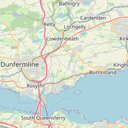
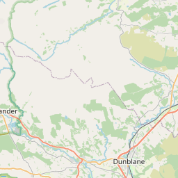
Crook of Devon Map, Satellite view of Crook of Devon, Perth and Kinross, Scotland
Crook of Devon is located in Perth and Kinross County, Perth and Kinross, Scotland, Scotland, United Kingdom.
Location informations of Crook of Devon
Latitude of city of Crook of Devon is 56.18584 and longitude of city of Crook of Devon is -3.56032. Crook of Devon has 1 postcode / zip code, in county of Perth and Kinross.The County of Crook of Devon is Perth and Kinross.
Postcode / zip code of Crook of Devon
KY13 0Administrative division of Crook of Devon
County :Perth and KinrossGPS coordinates of Crook of Devon
Latitude : 56.18584Longitude : -3.56032
Online Map of Crook of Devon - road map, satellite view and street view


Leaflet | © OpenStreetMap contributors
Search distance between two cities
The weather for Crook of Devon in the United Kingdom
Get today and tomorrow's weather forecasts for Crook of Devon. Find out the weather forecast for the week ahead and the weekend for Crook of Devon in the UK.Crook of Devon weather forecast 15 days
What is the nearest train station to Crook of Devon?
List of Railway Stations near to Crook of DevonThe nearest railway stations to Crook of Devon are listed below. Tickets are available at the train station ticket office or ticket machines.
| Name | Distances from Crook of Devon |
|---|---|
| Gleneagles Station | 14.47 Km |
| Dunfermline Station | 14.53 Km |
| Dunfermline Queen Margaret Station | 14.69 Km |
| Cowdenbeath Station | 15.75 Km |
| Alloa Station | 16.12 Km |
| Lochgelly Station | 16.32 Km |
| Rosyth Station | 17.65 Km |
| Cardenden Station | 19.15 Km |
| Inverkeithing Station | 19.65 Km |
| Dalgety Bay Station | 19.95 Km |
What is the nearest Public Transport Stops to Crook of Devon?
List of Stops near to Crook of DevonGetting there by public transport (nearest train, tube, overground line station and bus stops). The nearest stops to Crook of Devon are listed below.
| Stop Name | Distances from Crook of Devon |
|---|---|
| Naemoor Road Bus Stop (at) | 157 m |
| Naemoor Road Bus Stop (opp) | 209 m |
| Post Office Bus Stop (at) | 315 m |
| West Crook Way Bus Stop (at) | 397 m |
| West Crook Way Bus Stop (opp) | 410 m |
| Post Office Bus Stop (opp) | 411 m |
| Fossoway Garage Bus Stop (at) | 624 m |
| Fossoway Garage Bus Stop (opp) | 641 m |
| Drumhead Bus Stop (opp) | 1.10 Km |
| Drumhead Bus Stop (at) | 1.20 Km |
Historic Places to Visit near Crook of Devon
List of Historic places near to Crook of Devon
| Name | Distances from Crook of Devon |
|---|---|
| Castle Campbell | 7.16 Km |
| Dollar Glen | 7.21 Km |
| Kinross House | 9.39 Km |
| Burleigh Castle | 10.39 Km |
| Lochleven Castle | 10.51 Km |
| Pittencrieff House Museum | 14.09 Km |
| Abbot House Heritage Centre | 14.15 Km |
| Dupplin Cross | 14.16 Km |
| Dunfermline Abbey and Palace | 14.22 Km |
| Dunfermline Museum | 14.33 Km |
| Andrew Carnegie Birthplace | 14.57 Km |
| Culross Abbey | 14.77 Km |
Cities or Towns near Crook of Devon
List of places near to
| Name | Distance |
|---|---|
| Drum | 1.19 Km |
| Rumbling Bridge | 1.80 Km |
| Fossoway | 2.16 Km |
| Powmill | 2.66 Km |
| Yetts o' Muckhart | 2.83 Km |
| Pool of Muckhart | 3.23 Km |
| Carnbo | 3.48 Km |
| Coldrain | 4.26 Km |
| Hill End | 4.90 Km |
| Blairingone | 5.91 Km |
| Balado | 6.57 Km |
| Glendevon | 6.62 Km |
| Cleish | 6.63 Km |
| Dalqueich | 6.68 Km |
| Balgonar | 6.88 Km |
| Dollar | 7.34 Km |
| Watergate | 7.41 Km |
| Saline | 7.92 Km |
| Steelend | 8.16 Km |
| Lower Mains | 8.23 Km |
| Kinross | 8.86 Km |
| Stronachie | 9.05 Km |
| Cowstrandburn | 9.25 Km |
| Gairney Bank | 9.44 Km |
| Milnathort | 9.80 Km |
| Gairneybridge | 9.99 Km |
| Forestmill | 10.35 Km |
| Oakley | 11.17 Km |
| Middleton | 11.17 Km |
| Blairhall | 11.19 Km |
| Comrie | 11.20 Km |
| Maryburgh | 11.25 Km |
| Bowershall | 11.40 Km |
| Blairforge | 11.41 Km |
| Carnock | 11.42 Km |
| Gowkhall | 11.44 Km |
| West Netherton | 11.49 Km |
| Keltybridge | 11.63 Km |
| Tillicoultry | 11.67 Km |
| Devonside | 11.84 Km |
| Milesmark | 11.87 Km |
| Path of Condie | 11.98 Km |
| Coalsnaughton | 12.12 Km |
| Black Muir | 12.26 Km |
| Parkneuk | 12.35 Km |
| Backmuir of Pitfirrane | 12.46 Km |
| Pathstruie | 12.54 Km |
| Kelty | 12.66 Km |
| Wellwood | 12.84 Km |
| Rumblingwell | 12.93 Km |