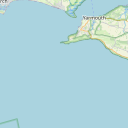
Cridmore Map, Satellite view of Cridmore, Isle of Wight, England
Cridmore is located in Isle of Wight County, Isle of Wight, South East, England, United Kingdom.
Location informations of Cridmore
Latitude of city of Cridmore is 50.63957 and longitude of city of Cridmore is -1.29834. Cridmore has 1 postcode / zip code, in county of Isle of Wight.The County of Cridmore is Isle of Wight.
Postcode / zip code of Cridmore
PO30 3Administrative division of Cridmore
County :Isle of WightGPS coordinates of Cridmore
Latitude : 50.63957Longitude : -1.29834
Online Map of Cridmore - road map, satellite view and street view


Leaflet | © OpenStreetMap contributors
Search distance between two cities
The weather for Cridmore in the United Kingdom
Get today and tomorrow's weather forecasts for Cridmore. Find out the weather forecast for the week ahead and the weekend for Cridmore in the UK.Cridmore weather forecast 15 days
What is the nearest train station to Cridmore?
List of Railway Stations near to CridmoreThe nearest railway stations to Cridmore are listed below. Tickets are available at the train station ticket office or ticket machines.
| Name | Distances from Cridmore |
|---|---|
| Shanklin Station | 8.38 Km |
| Lake Station | 9.34 Km |
| Sandown Station | 9.78 Km |
| Brading Station | 12.05 Km |
| Smallbrook Junction Station | 12.90 Km |
| Ryde St.John's Road Station | 13.74 Km |
| Ryde Esplanade Station | 14.25 Km |
| Ryde Pier Head Station | 14.75 Km |
| Lymington Pier Station | 20.96 Km |
| Lymington Town Station | 21.56 Km |
Isle of Wight / Sandown Airport , UK (8.32 Km)
Bembridge Airport , UK (13.99 Km)
What is the nearest Public Transport Stops to Cridmore?
List of Stops near to CridmoreGetting there by public transport (nearest train, tube, overground line station and bus stops). The nearest stops to Cridmore are listed below.
| Stop Name | Distances from Cridmore |
|---|---|
| Billingham North Bus Stop (SE-bound) | 1.32 Km |
| Billingham Manor Bus Stop (opposite) | 1.33 Km |
| Billingham North Bus Stop (NW-bound) | 1.34 Km |
| Billingham Manor Bus Stop (adjacent) | 1.35 Km |
| East Appleford Bus Stop (N-bound) | 1.38 Km |
| East Appleford Bus Stop (S-bound) | 1.40 Km |
| Chequers Bus Stop (opposite) | 1.47 Km |
| Bleak Down Landfill Site Bus Stop (opposite) | 1.47 Km |
| Chequers Bus Stop (adjacent) | 1.47 Km |
| Bleak Down Landfill Site Bus Stop (adjacent) | 1.49 Km |
Historic Places to Visit near Cridmore
List of Historic places near to Cridmore
| Name | Distances from Cridmore |
|---|---|
| Godshill, All Saints Church | 3.06 Km |
| Appuldurcombe House | 4.90 Km |
| St Catherines Oratory | 5.14 Km |
| Carisbrooke Castle | 5.45 Km |
| Arreton Manor | 5.63 Km |
| Newport Roman Villa | 5.63 Km |
| Arreton, St Georges Church | 5.67 Km |
| The Shipwreck Centre & Maritime Museum | 5.75 Km |
| Brighstone, St Marys Church | 6.79 Km |
| Ventnor Botanic Garden | 7.35 Km |
| Mottistone Manor Garden | 9.18 Km |
| Mottistone, St Peter & St Paul Church | 9.25 Km |
| Nunwell House and Gardens | 10.89 Km |
| Newtown Old Town Hall | 11.13 Km |
| Brading Roman Villa | 11.24 Km |
| Morton Manor | 11.32 Km |
| Osborne House | 12.57 Km |
| Bembridge Fort | 13.20 Km |
| Cowes Maritime Museum | 13.42 Km |
| Appley Tower | 14.50 Km |
| Bembridge Windmill | 15.00 Km |
Cities or Towns near Cridmore
List of places near to
| Name | Distance |
|---|---|
| Roslin | 0.50 Km |
| Lower Rill | 0.72 Km |
| Rookley Green | 1.59 Km |
| Rookley | 1.85 Km |
| Chillerton | 1.96 Km |
| Kingston | 2.08 Km |
| Roud | 2.82 Km |
| Chale Green | 2.82 Km |
| Gatcombe | 2.93 Km |
| Godshill | 3.16 Km |
| Merstone | 4.01 Km |
| Pyle | 4.04 Km |
| Blackwater | 4.07 Km |
| Southford | 4.11 Km |
| Shorwell | 4.13 Km |
| Little Atherfield | 4.25 Km |
| Atherfield Green | 4.39 Km |
| Bierley | 4.47 Km |
| Sandford | 4.51 Km |
| Chale | 4.76 Km |
| Yafford | 4.95 Km |
| Nettlecombe | 5.08 Km |
| Bowcombe | 5.23 Km |
| Whitwell | 5.25 Km |
| Kingates | 5.25 Km |
| Plaish | 5.32 Km |
| Limerstone | 5.37 Km |
| Bathingbourne | 5.41 Km |
| Whiteley Bank | 5.47 Km |
| Horringford | 5.50 Km |
| Hale Common | 5.56 Km |
| Clatterford | 5.59 Km |
| Arreton | 5.73 Km |
| Blackgang | 5.77 Km |
| Shide | 5.77 Km |
| Niton | 5.85 Km |
| Carisbrooke | 5.89 Km |
| Thorncross | 5.94 Km |
| Wroxall | 5.99 Km |
| Branstone | 6.08 Km |
| Princelett | 6.28 Km |
| Winford Cross | 6.38 Km |
| Downend | 6.45 Km |
| Pan | 6.54 Km |
| The Orchard | 6.55 Km |
| Gunville | 6.69 Km |
| Newport | 6.75 Km |
| Apse Heath | 6.79 Km |
| Winford | 6.82 Km |
| St Lawrence | 6.89 Km |