Cotton of Gardyne Map, Satellite view of Cotton of Gardyne, Angus, Scotland
Cotton of Gardyne is located in Angus County, Angus, Scotland, Scotland, United Kingdom.
Location informations of Cotton of Gardyne
Latitude of city of Cotton of Gardyne is 56.61743 and longitude of city of Cotton of Gardyne is -2.69412. Cotton of Gardyne has 1 postcode / zip code, in county of Angus.The County of Cotton of Gardyne is Angus.
Postcode / zip code of Cotton of Gardyne
DD11 3Administrative division of Cotton of Gardyne
County :AngusGPS coordinates of Cotton of Gardyne
Latitude : 56.61743Longitude : -2.69412
Online Map of Cotton of Gardyne - road map, satellite view and street view
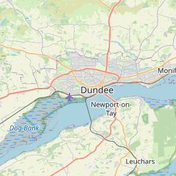
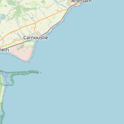
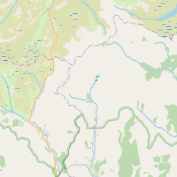

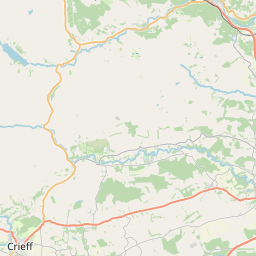

Leaflet | © OpenStreetMap contributors
Search distance between two cities
The weather for Cotton of Gardyne in the United Kingdom
Get today and tomorrow's weather forecasts for Cotton of Gardyne. Find out the weather forecast for the week ahead and the weekend for Cotton of Gardyne in the UK.Cotton of Gardyne weather forecast 15 days
What is the nearest train station to Cotton of Gardyne?
List of Railway Stations near to Cotton of GardyneThe nearest railway stations to Cotton of Gardyne are listed below. Tickets are available at the train station ticket office or ticket machines.
| Name | Distances from Cotton of Gardyne |
|---|---|
| Arbroath Station | 9.10 Km |
| Carnoustie Station | 13.02 Km |
| Golf Street Station | 13.39 Km |
| Barry Links Station | 14.17 Km |
| Monifieth Station | 17.06 Km |
| Montrose Station | 17.22 Km |
| Balmossie Station | 18.20 Km |
| Broughty Ferry Station | 19.99 Km |
| Dundee Station | 24.68 Km |
| Laurencekirk Station | 28.04 Km |
What is the nearest Public Transport Stops to Cotton of Gardyne?
List of Stops near to Cotton of GardyneGetting there by public transport (nearest train, tube, overground line station and bus stops). The nearest stops to Cotton of Gardyne are listed below.
| Stop Name | Distances from Cotton of Gardyne |
|---|---|
| Knockhill Farm Road End Bus Stop (at) | 541 m |
| Knockhill Bus Stop (at) | 711 m |
| Knockhill Bus Stop (opp) | 733 m |
| Dunvegan House Bus Stop (at) | 1.33 Km |
| Dunvegan House Bus Stop (opp) | 1.35 Km |
| Middleton Road End Bus Stop (opp) | 1.38 Km |
| Middleton Road End Bus Stop (at) | 1.42 Km |
| Farm Cottages Bus Stop (at) | 1.58 Km |
| Cononsyth Crossroads Bus Stop (near) | 1.83 Km |
| Leysmill Road End Bus Stop (opp) | 1.86 Km |
Historic Places to Visit near Cotton of Gardyne
List of Historic places near to Cotton of Gardyne
| Name | Distances from Cotton of Gardyne |
|---|---|
| Pitmuies Gardens | 2.40 Km |
| St Vigeans Museum | 7.77 Km |
| Arbroath Abbey | 9.18 Km |
| Arbroath Signal Tower Museum | 9.60 Km |
| Aberlemno Sculptured Stones | 9.61 Km |
| Restenneth Priory | 10.13 Km |
| Brechin Castle | 12.30 Km |
| Brechin Cathedral Round Tower | 12.67 Km |
| Finavon Doocot | 12.69 Km |
| Brechin Cathedral | 12.75 Km |
| Maison Dieu Chapel | 13.03 Km |
| Carlungie Earth-House | 13.14 Km |
| Barry Mill | 13.25 Km |
| Dunninald | 14.62 Km |
| Ardestie Earth-House | 14.96 Km |
Cities or Towns near Cotton of Gardyne
List of places near to
| Name | Distance |
|---|---|
| Cononsyth | 1.41 Km |
| Pitmuies | 2.23 Km |
| Newton of Boysack | 2.99 Km |
| Leysmill | 3.01 Km |
| Friockheim | 3.14 Km |
| Guthrie | 3.43 Km |
| Redford | 3.51 Km |
| Firth Muir of Boysack | 3.60 Km |
| Colliston | 3.75 Km |
| Milldens | 3.99 Km |
| Greens of Gardyne | 4.00 Km |
| Mosston | 4.23 Km |
| Drummygar | 4.47 Km |
| Kinnell | 4.53 Km |
| Letham | 4.79 Km |
| West Hills | 4.99 Km |
| Woodville Feus | 4.99 Km |
| Carmyllie | 5.08 Km |
| Pickerton | 5.09 Km |
| Boysack | 5.20 Km |
| Mains of Balgavies | 5.64 Km |
| Greystone | 5.77 Km |
| Bowriefauld | 5.89 Km |
| Tulloes | 6.62 Km |
| Turin | 6.64 Km |
| Dunnichen | 6.67 Km |
| Waulkmills | 6.69 Km |
| Hayhillock | 7.06 Km |
| Craichie | 7.17 Km |
| Carnegie | 7.20 Km |
| Hodgeton | 7.26 Km |
| Arbirlot | 7.46 Km |
| East Mains of Burnside | 7.59 Km |
| Kirkton | 7.66 Km |
| St Vigeans | 7.93 Km |
| Bonnington Smiddy | 7.99 Km |
| Easter Knox | 8.05 Km |
| Cauldcots | 8.08 Km |
| Kirkbuddo | 8.14 Km |
| Marywell | 8.25 Km |
| Rescobie | 8.39 Km |
| Cairnie | 8.39 Km |
| Warddykes | 8.44 Km |
| Balcathie | 8.53 Km |
| Hillend | 8.68 Km |
| Demondale | 8.77 Km |
| West Balmirmer | 8.99 Km |
| East Balmirmer | 9.05 Km |
| Hayshead | 9.09 Km |
| Arbroath | 9.11 Km |