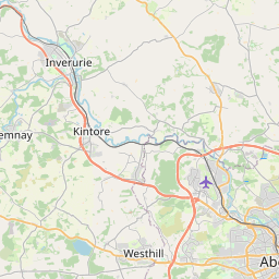
Cothal Map, Satellite view of Cothal, Aberdeenshire, Scotland
Cothal is located in Aberdeenshire County, Aberdeenshire, Scotland, Scotland, United Kingdom.
Location informations of Cothal
Latitude of city of Cothal is 57.23275 and longitude of city of Cothal is -2.21232. Cothal has 1 postcode / zip code, in county of Aberdeenshire.The County of Cothal is Aberdeenshire.
Postcode / zip code of Cothal
AB21 0Administrative division of Cothal
County :AberdeenshireGPS coordinates of Cothal
Latitude : 57.23275Longitude : -2.21232
Online Map of Cothal - road map, satellite view and street view


Leaflet | © OpenStreetMap contributors
Search distance between two cities
The weather for Cothal in the United Kingdom
Get today and tomorrow's weather forecasts for Cothal. Find out the weather forecast for the week ahead and the weekend for Cothal in the UK.Cothal weather forecast 15 days
What is the nearest train station to Cothal?
List of Railway Stations near to CothalThe nearest railway stations to Cothal are listed below. Tickets are available at the train station ticket office or ticket machines.
| Name | Distances from Cothal |
|---|---|
| Dyce Station | 3.24 Km |
| Inverurie Station | 11.38 Km |
| Aberdeen Station | 12.04 Km |
| Portlethen Station | 19.74 Km |
| Insch Station | 26.97 Km |
| Stonehaven Station | 29.58 Km |
Aberdeen Dyce Airport , UK (3.54 Km)
What is the nearest Public Transport Stops to Cothal?
List of Stops near to CothalGetting there by public transport (nearest train, tube, overground line station and bus stops). The nearest stops to Cothal are listed below.
| Stop Name | Distances from Cothal |
|---|---|
| Cothal Rd End Bus Stop (at) | 16 m |
| Nia Roo Bus Stop (adj) | 2.15 Km |
| Nia Roo Bus Stop (opp) | 2.17 Km |
| Ord Of Elrick Bus Stop (o/s) | 2.21 Km |
| Old Toll House Bus Stop (opp) | 2.23 Km |
| Old Toll House Bus Stop (at) | 2.24 Km |
| Aker Solutions Bus Stop (opp) | 2.40 Km |
| Howe Moss Terrace Bus Stop (adj) | 2.41 Km |
| Aker Solutions Bus Stop (adj) | 2.41 Km |
| Kirkhill Industrial Estate Bus Stop (Howe Moss Avenue opposite Howe Moss Terrace) | 2.41 Km |
Historic Places to Visit near Cothal
List of Historic places near to Cothal
| Name | Distances from Cothal |
|---|---|
| Dyce Symbol Stones | 0.45 Km |
| Kintore Symbol Stone | 7.91 Km |
| Kinkell Church | 9.32 Km |
| Rhynie Man | 9.68 Km |
| Cruickshank Botanic Garden | 9.70 Km |
| Kings College Chapel, Aberdeen | 10.19 Km |
| Inverurie Bass | 10.36 Km |
| Inverurie Symbol Stones | 10.40 Km |
| Aberdeen Art Gallery | 11.48 Km |
| Provost Skenes House | 11.78 Km |
| Tolbooth Museum | 11.79 Km |
| Aberdeen Maritime Museum | 11.86 Km |
| Pitmedden Garden | 12.55 Km |
| Tolquhon Castle | 12.80 Km |
| Duthie Park and Winter Gardens | 12.98 Km |
| Brandsbutt Symbol Stone | 13.12 Km |
| Cullerlie Stone Circle | 14.51 Km |
| East Aquhorthies Stone Circle | 14.87 Km |
| Lang Stane oCraigearn | 14.90 Km |
Cities or Towns near Cothal
List of places near to
| Name | Distance |
|---|---|
| Drumligair | 3.01 Km |
| Kinmundy | 3.12 Km |
| Hatton of Fintray | 3.20 Km |
| Dyce | 3.29 Km |
| Corsehill | 3.44 Km |
| Newmachar | 3.89 Km |
| Mill of Fintray | 3.94 Km |
| Mains of Grandhome | 3.97 Km |
| Kingseat | 4.58 Km |
| Whitecairns | 4.58 Km |
| Bridgefield | 4.60 Km |
| Stoneywood | 4.90 Km |
| Sittyton | 5.02 Km |
| Chapel of Stoneywood | 5.35 Km |
| Blackburn | 5.62 Km |
| Craigie | 5.66 Km |
| Upper Persley | 5.74 Km |
| Bankhead | 5.90 Km |
| Newhills | 6.06 Km |
| Bucksburn | 6.64 Km |
| Potterton | 6.66 Km |
| Kinmuck | 6.73 Km |
| Muir of Kinellar | 6.77 Km |
| Middleton Park | 6.87 Km |
| Kinellar | 7.07 Km |
| Danestone | 7.20 Km |
| Shiels | 7.50 Km |
| Heathryfold | 7.56 Km |
| Belhelvie | 7.59 Km |
| Affleck | 7.73 Km |
| Middlemuir | 7.77 Km |
| Whiterashes | 7.86 Km |
| Middlefield | 7.95 Km |
| Kintore | 8.00 Km |
| Northfield | 8.03 Km |
| Nether Crimond | 8.10 Km |
| Hill of Keir | 8.10 Km |
| Woodside | 8.19 Km |
| Denmore | 8.21 Km |
| Cummings Park | 8.40 Km |
| Blackdog | 8.45 Km |
| Kingswells | 8.57 Km |
| Bridge of Don | 8.76 Km |
| Hilton | 8.79 Km |
| Pettymuick | 8.87 Km |
| Sheddocksley | 8.89 Km |
| Hayton | 8.91 Km |
| Hattoncrook | 9.05 Km |
| Mastrick | 9.06 Km |
| Rosehill | 9.21 Km |