Copcut Map, Satellite view of Copcut, Worcestershire, England
Copcut is located in Worcestershire County, Wychavon District, West Midlands, England, United Kingdom.
Location informations of Copcut
Latitude of city of Copcut is 52.25601 and longitude of city of Copcut is -2.16586. Copcut has 1 postcode / zip code, in county of Worcestershire.The County of Copcut is Worcestershire.
Postcode / zip code of Copcut
WR9 8Administrative division of Copcut
County :WorcestershireGPS coordinates of Copcut
Latitude : 52.25601Longitude : -2.16586
Online Map of Copcut - road map, satellite view and street view
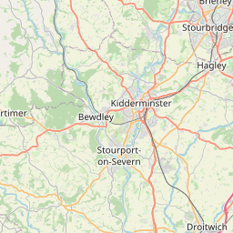
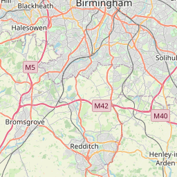
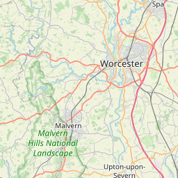
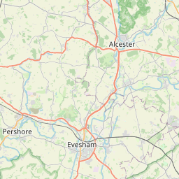

Leaflet | © OpenStreetMap contributors
Search distance between two cities
The weather for Copcut in the United Kingdom
Get today and tomorrow's weather forecasts for Copcut. Find out the weather forecast for the week ahead and the weekend for Copcut in the UK.Copcut weather forecast 15 days
What is the nearest train station to Copcut?
List of Railway Stations near to CopcutThe nearest railway stations to Copcut are listed below. Tickets are available at the train station ticket office or ticket machines.
| Name | Distances from Copcut |
|---|---|
| Droitwich Spa Station | 1.45 Km |
| Worcester Shrub Hill Station | 7.43 Km |
| Worcester Foregate Street Station | 7.76 Km |
| Hartlebury Station | 9.50 Km |
| Bromsgrove Station | 10.92 Km |
| Kidderminster Station | 15.11 Km |
| Pershore Station | 15.36 Km |
| Redditch Station | 16.02 Km |
| Barnt Green Station | 16.60 Km |
| Blakedown Station | 16.74 Km |
What is the nearest Public Transport Stops to Copcut?
List of Stops near to CopcutGetting there by public transport (nearest train, tube, overground line station and bus stops). The nearest stops to Copcut are listed below.
| Stop Name | Distances from Copcut |
|---|---|
| Pillar of Salt Bus Stop (Opp) | 7 m |
| Pillar of Salt Bus Stop (Adj) | 44 m |
| Teme Crescent Bus Stop (Adj) | 77 m |
| Copcut Court Bus Stop (Opp) | 179 m |
| Copcut Court Bus Stop (Adj) | 194 m |
| Lahn Drive Bus Stop (Adj) | 288 m |
| Long Sling Bus Stop (Opp) | 324 m |
| Neville Close Bus Stop (Adj) | 336 m |
| Neville Close Bus Stop (adj) | 338 m |
| Long Sling Bus Stop (Adj) | 343 m |
Historic Places to Visit near Copcut
List of Historic places near to Copcut
| Name | Distances from Copcut |
|---|---|
| Hawford Dovecote | 4.31 Km |
| Hanbury Hall | 5.90 Km |
| Hanbury, St Marys Church | 6.96 Km |
| George Marshall Medical Museum | 7.27 Km |
| Worcester City Museum and Art Gallery | 7.64 Km |
| Worcester, St Swithuns Church | 7.98 Km |
| Spetchley Gardens | 8.04 Km |
| Spetchley, All Saints Church | 8.05 Km |
| Worcester Guildhall | 8.10 Km |
| The Greyfriars | 8.12 Km |
| Tudor House | 8.22 Km |
| Commandery | 8.33 Km |
| Museum of Royal Worcester | 8.55 Km |
| Churchill, St Michaels Church | 9.10 Km |
| Avoncroft Museum of Historic Buildings | 9.11 Km |
| Edward Elgar Birthplace Museum | 10.22 Km |
| Wichenford Dovecote | 10.40 Km |
| Chaddesley Corbett, St Cassians Church | 11.69 Km |
| Rosedene | 11.80 Km |
| Harvington Hall | 12.43 Km |
| Witley Court | 12.55 Km |
| Leigh Court Barn | 13.45 Km |
Cities or Towns near Copcut
List of places near to
| Name | Distance |
|---|---|
| Chawson | 0.55 Km |
| Witton | 0.58 Km |
| Chawson Valley | 0.65 Km |
| Salwarpe | 1.11 Km |
| Newtown | 1.35 Km |
| Westacre | 1.37 Km |
| Briar Hill | 1.48 Km |
| Brownheath Common | 1.66 Km |
| Netherwich | 1.77 Km |
| Primsland | 1.79 Km |
| Ladywood | 1.89 Km |
| The Vines | 1.91 Km |
| Droitwich Spa | 1.92 Km |
| Newland Common | 1.92 Km |
| Westlands | 2.20 Km |
| Martin Hussingtree | 2.24 Km |
| Hill End | 2.40 Km |
| Berry Hill | 2.40 Km |
| Hadzor | 2.60 Km |
| Dunhampstead | 2.86 Km |
| Shernal Green | 2.89 Km |
| Hadley | 3.31 Km |
| Lower Town | 3.34 Km |
| Oddingley | 3.34 Km |
| Hampton Lovett | 3.49 Km |
| Smite Hill | 3.57 Km |
| Fernhill Heath | 3.59 Km |
| Chatley | 3.71 Km |
| Hindlip | 4.02 Km |
| Rashwood | 4.13 Km |
| Hawford | 4.45 Km |
| Sinton | 4.52 Km |
| Tibberton | 4.52 Km |
| Goosehill Green | 4.60 Km |
| Ombersley | 4.61 Km |
| Claines | 4.78 Km |
| Saleway | 4.81 Km |
| Doverdale | 4.97 Km |
| Gallows Green | 4.99 Km |
| Wychbold | 5.01 Km |
| Blackpole | 5.02 Km |
| Oldfield | 5.26 Km |
| Bevere | 5.44 Km |
| Broad Alley | 5.48 Km |
| Grimley | 5.48 Km |
| Astwood | 5.58 Km |
| Broad Common | 5.63 Km |
| Astwood | 5.69 Km |
| Uphampton | 5.71 Km |
| Sytchampton | 5.75 Km |