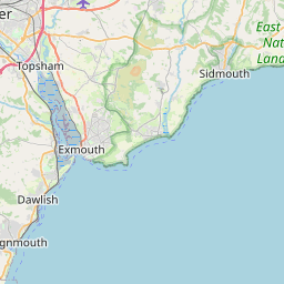
Clyst William Map, Satellite view of Clyst William, Devon, England
Clyst William is located in Devon County, East Devon District, South West, England, United Kingdom.
Location informations of Clyst William
Latitude of city of Clyst William is 50.81833 and longitude of city of Clyst William is -3.31997. Clyst William has 1 postcode / zip code, in county of Devon.The County of Clyst William is Devon.
Postcode / zip code of Clyst William
EX15 2Administrative division of Clyst William
County :DevonGPS coordinates of Clyst William
Latitude : 50.81833Longitude : -3.31997
Online Map of Clyst William - road map, satellite view and street view


Leaflet | © OpenStreetMap contributors
Search distance between two cities
The weather for Clyst William in the United Kingdom
Get today and tomorrow's weather forecasts for Clyst William. Find out the weather forecast for the week ahead and the weekend for Clyst William in the UK.Clyst William weather forecast 15 days
What is the nearest train station to Clyst William?
List of Railway Stations near to Clyst WilliamThe nearest railway stations to Clyst William are listed below. Tickets are available at the train station ticket office or ticket machines.
| Name | Distances from Clyst William |
|---|---|
| Feniton Station | 4.28 Km |
| Whimple Station | 6.09 Km |
| Honiton Station | 9.67 Km |
| Cranbrook Station | 10.37 Km |
| Tiverton Parkway Station | 11.34 Km |
| Pinhoe Station | 13.80 Km |
| Digby and Sowton Station | 15.85 Km |
| Polsloe Bridge Station | 16.04 Km |
| Newcourt Station | 16.56 Km |
| St.James' Park Station | 17.20 Km |
Exeter International Airport , UK (11.43 Km)
What is the nearest Public Transport Stops to Clyst William?
List of Stops near to Clyst WilliamGetting there by public transport (nearest train, tube, overground line station and bus stops). The nearest stops to Clyst William are listed below.
| Stop Name | Distances from Clyst William |
|---|---|
| Clyst William Cross Bus Stop (SW-bound) | 2 m |
| Clyst William Cross Bus Stop (NE-bound) | 7 m |
| Post Box Bus Stop (opp) | 1.15 Km |
| Post Box Bus Stop (S-bound) | 1.16 Km |
| Post Box Bus Stop (opp) | 1.50 Km |
| Post Box Bus Stop (N-bound) | 1.50 Km |
| Shelter Bus Stop (opp) | 1.65 Km |
| Shelter Bus Stop (SE-bound) | 1.65 Km |
| Yucca Cottages Bus Stop (N-bound) | 1.86 Km |
| Yucca Cottages Bus Stop (S-bound) | 1.89 Km |
Historic Places to Visit near Clyst William
List of Historic places near to Clyst William
| Name | Distances from Clyst William |
|---|---|
| Plymtree, St John the Baptist Church | 1.92 Km |
| Broadhembury, St Andrews Church | 3.56 Km |
| Escot Park & Gardens | 4.80 Km |
| Kentisbeare, St Marys Church | 5.22 Km |
| Cadhay | 6.79 Km |
| Wolford Chapel | 7.00 Km |
| Gittisham, St Michaels Church | 7.72 Km |
| Ottery St Mary Church | 7.90 Km |
| Coldharbour Mill Museum | 9.45 Km |
| Allhallows Museum of Lace and Local Antiquities | 9.48 Km |
| Honiton, St Pauls Church | 9.50 Km |
| Killerton Chapel | 9.64 Km |
| Budlake Old Post Office Room | 9.67 Km |
| Killerton | 9.82 Km |
| Markers Cottage | 10.25 Km |
| Broadclyst, St Johns Church | 10.56 Km |
| Clyston Mill | 10.67 Km |
| Farway, St Michael & All Angels Church | 11.98 Km |
| Sand | 12.42 Km |
| Holbrook Garden | 12.66 Km |
| Offwell, St Marys Church | 12.78 Km |
| Northleigh, St Giles Church | 14.28 Km |
| Fursdon | 14.95 Km |
Cities or Towns near Clyst William
List of places near to
| Name | Distance |
|---|---|
| Lower Tale | 1.10 Km |
| Luton | 1.16 Km |
| Fordmoor | 1.39 Km |
| Higher Tale | 1.42 Km |
| Norman's Green | 1.66 Km |
| Plymtree | 1.96 Km |
| Payhembury | 2.02 Km |
| Colliton | 2.10 Km |
| St Andrew's Wood | 2.65 Km |
| Higher Weaver | 2.75 Km |
| Upton | 2.75 Km |
| Dulford | 2.85 Km |
| Colestocks | 3.10 Km |
| Kerswell | 3.27 Km |
| Talaton | 3.38 Km |
| Aunk | 3.43 Km |
| Broadhembury | 3.52 Km |
| Lower Cheriton | 3.54 Km |
| Talewater | 3.69 Km |
| Higher Cheriton | 3.69 Km |
| Clyst Hydon | 3.78 Km |
| Aller | 4.07 Km |
| Feniton | 4.34 Km |
| Langford | 4.52 Km |
| Mutterton | 4.71 Km |
| Clyst St Lawrence | 4.86 Km |
| Kentisbeare | 5.28 Km |
| Westcott | 5.30 Km |
| Larkbeare | 5.35 Km |
| Wolverstone | 5.42 Km |
| Buckerell | 5.59 Km |
| Stoford Water | 5.61 Km |
| Hollis Green | 5.61 Km |
| Saint Hill | 5.63 Km |
| Fairmile | 6.00 Km |
| Fenny Bridges | 6.11 Km |
| Taleford | 6.24 Km |
| Gosford | 6.28 Km |
| Whimple | 6.34 Km |
| Blackborough | 6.43 Km |
| Stoneyford | 6.48 Km |
| Awliscombe | 6.55 Km |
| Cullompton | 6.55 Km |
| Coombelake | 6.56 Km |
| Alfington | 6.61 Km |
| Aller Grove | 6.62 Km |
| Westwood | 6.70 Km |
| Colebrook | 7.12 Km |
| St George's Well | 7.23 Km |
| Bradninch | 7.24 Km |