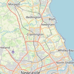
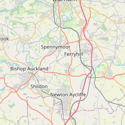
Chester Moor Map, Satellite view of Chester Moor, Durham, England
Chester Moor is located in Durham County, County Durham, North East, England, United Kingdom.
Location informations of Chester Moor
Latitude of city of Chester Moor is 54.83711 and longitude of city of Chester Moor is -1.58824. Chester Moor has 1 postcode / zip code, in county of Durham.The County of Chester Moor is Durham.
Postcode / zip code of Chester Moor
DH2 3Administrative division of Chester Moor
County :DurhamGPS coordinates of Chester Moor
Latitude : 54.83711Longitude : -1.58824
Online Map of Chester Moor - road map, satellite view and street view


Leaflet | © OpenStreetMap contributors
Search distance between two cities
The weather for Chester Moor in the United Kingdom
Get today and tomorrow's weather forecasts for Chester Moor. Find out the weather forecast for the week ahead and the weekend for Chester Moor in the UK.Chester Moor weather forecast 15 days
What is the nearest train station to Chester Moor?
List of Railway Stations near to Chester MoorThe nearest railway stations to Chester Moor are listed below. Tickets are available at the train station ticket office or ticket machines.
| Name | Distances from Chester Moor |
|---|---|
| Chester-Le-Street Station | 2.05 Km |
| Durham Station | 6.43 Km |
| Heworth Station | 12.90 Km |
| Dunston Station | 13.02 Km |
| MetroCentre Station | 14.40 Km |
| Newcastle Station | 14.72 Km |
| Manors Station | 15.12 Km |
| Sunderland Station | 15.20 Km |
| Seaham Station | 15.49 Km |
| Blaydon Station | 16.37 Km |
What is the nearest Public Transport Stops to Chester Moor?
List of Stops near to Chester MoorGetting there by public transport (nearest train, tube, overground line station and bus stops). The nearest stops to Chester Moor are listed below.
| Stop Name | Distances from Chester Moor |
|---|---|
| Inn Bus Stop (SW-bound) | 72 m |
| Inn Bus Stop (NE-bound) | 86 m |
| Farm Bus Stop (SW-bound) | 269 m |
| Estate Bus Stop (SE-bound) | 357 m |
| Estate Bus Stop (NW-bound) | 426 m |
| Warkworth Drive Bottom Bus Stop (SW-bound) | 641 m |
| Warkworth Drive Bottom Bus Stop (NE-bound) | 648 m |
| Warkworth Drive Bus Stop (N-bound) | 906 m |
| Warkworth Drive Bus Stop (S-bound) | 936 m |
| Thropton Close Bus Stop (NW-bound) | 1.00 Km |
Historic Places to Visit near Chester Moor
List of Historic places near to Chester Moor
| Name | Distances from Chester Moor |
|---|---|
| Finchale Priory | 3.74 Km |
| Crook Hall | 6.10 Km |
| Durham Castle | 6.87 Km |
| Houghton-le-Spring, St Michael and All Angels | 7.69 Km |
| Washington Old Hall | 8.56 Km |
| Gibside | 13.12 Km |
| Hylton Castle | 13.24 Km |
| Low Elswick Church Tower | 14.41 Km |
| Bessie Surtees House | 14.71 Km |
Cities or Towns near Chester Moor
List of places near to
| Name | Distance |
|---|---|
| Plawsworth | 1.32 Km |
| Plawsworth Gate | 1.69 Km |
| Nettlesworth | 1.70 Km |
| Tan Hills | 1.75 Km |
| Waldridge | 1.76 Km |
| Kimblesworth | 2.09 Km |
| Canada | 2.58 Km |
| Bridge End | 2.59 Km |
| Chester-le-Street | 2.59 Km |
| Whitehill | 2.69 Km |
| Edmondsley | 2.83 Km |
| Great Lumley | 3.01 Km |
| South Pelaw | 3.13 Km |
| Sacriston | 3.28 Km |
| Castle Dene | 3.30 Km |
| Pelton Fell | 3.31 Km |
| Pity Me | 3.71 Km |
| Newfield | 3.71 Km |
| Brasside | 3.94 Km |
| Pelton | 4.13 Km |
| Lumley Thicks | 4.15 Km |
| Grange Villa | 4.19 Km |
| Perkinsville | 4.45 Km |
| Newton Hall | 4.70 Km |
| Woodstone Village | 4.71 Km |
| Holmside | 4.72 Km |
| Framwellgate Moor | 4.83 Km |
| Witton Gilbert | 4.83 Km |
| Barley Mow | 4.85 Km |
| Bournmoor | 4.89 Km |
| High Handenhold | 4.90 Km |
| West Pelton | 5.00 Km |
| Leamside | 5.24 Km |
| Ouston | 5.35 Km |
| Rickleton | 5.46 Km |
| Craghead | 5.51 Km |
| High Urpeth | 5.55 Km |
| Whitesmocks | 5.69 Km |
| Aykley Heads | 5.72 Km |
| Urpeth | 5.79 Km |
| Fence Houses | 5.81 Km |
| North End | 5.85 Km |
| Beamish | 5.88 Km |
| Colliery Row | 5.94 Km |
| Chilton Moor | 5.98 Km |
| Harraton | 6.00 Km |
| West Rainton | 6.07 Km |
| Sedgeletch | 6.18 Km |
| Rainton Gate | 6.20 Km |
| The Middles | 6.22 Km |