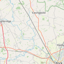
Chapel Fields Map, Satellite view of Chapel Fields, North Yorkshire, England
Chapel Fields is located in North Yorkshire County, York, Yorkshire and the Humber, England, United Kingdom.
Location informations of Chapel Fields
Latitude of city of Chapel Fields is 53.95248 and longitude of city of Chapel Fields is -1.14226. Chapel Fields has 1 postcode / zip code, in county of North Yorkshire.The County of Chapel Fields is North Yorkshire.
Postcode / zip code of Chapel Fields
YO26 5Administrative division of Chapel Fields
County :North YorkshireGPS coordinates of Chapel Fields
Latitude : 53.95248Longitude : -1.14226
Online Map of Chapel Fields - road map, satellite view and street view


Leaflet | © OpenStreetMap contributors
Search distance between two cities
The weather for Chapel Fields in the United Kingdom
Get today and tomorrow's weather forecasts for Chapel Fields. Find out the weather forecast for the week ahead and the weekend for Chapel Fields in the UK.Chapel Fields weather forecast 15 days
What is the nearest train station to Chapel Fields?
List of Railway Stations near to Chapel FieldsThe nearest railway stations to Chapel Fields are listed below. Tickets are available at the train station ticket office or ticket machines.
| Name | Distances from Chapel Fields |
|---|---|
| Poppleton Station | 2.64 Km |
| York Station | 3.27 Km |
| Hammerton Station | 10.48 Km |
| Ulleskelf Station | 11.96 Km |
| Cattal Station | 12.69 Km |
| Church Fenton Station | 15.07 Km |
| Sherburn-In-Elmet Station | 18.26 Km |
| Selby Station | 19.56 Km |
| South Milford Station | 20.21 Km |
| Micklefield Station | 21.85 Km |
RAF Linton-On-Ouse , UK (12.93 Km)
Leeds East Airport , UK (13.60 Km)
What is the nearest Public Transport Stops to Chapel Fields?
List of Stops near to Chapel FieldsGetting there by public transport (nearest train, tube, overground line station and bus stops). The nearest stops to Chapel Fields are listed below.
| Stop Name | Distances from Chapel Fields |
|---|---|
| Chapelfields Shops Bus Stop | 185 m |
| Bramham Avenue Bus Stop | 391 m |
| Ridgeway Bus Stop (o/s 88) | 406 m |
| Grange Lane Bus Stop (adj) | 415 m |
| Ridgeway Bus Stop (opp 90) | 430 m |
| Grange Lane Bus Stop (opp) | 430 m |
| St Aidan's Church Bus Stop (opp 83) | 437 m |
| St Aidan's Church Bus Stop (o/s 83) | 447 m |
| Collingham Place Bus Stop (opp) | 487 m |
| Collingham Place Bus Stop (adj) | 496 m |
Historic Places to Visit near Chapel Fields
List of Historic places near to Chapel Fields
Cities or Towns near Chapel Fields
List of places near to
| Name | Distance |
|---|---|
| Low Field | 0.93 Km |
| Knapton | 0.98 Km |
| Acomb | 1.09 Km |
| Ouse Acres | 2.04 Km |
| Holgate | 2.12 Km |
| Woodthorpe | 2.34 Km |
| Dringhouses | 2.50 Km |
| Knavesmire | 2.61 Km |
| Upper Poppleton | 3.13 Km |
| South Bank | 3.19 Km |
| Askham Bryan | 3.37 Km |
| Clementhorpe | 3.74 Km |
| Rufforth | 3.78 Km |
| Rawcliffe | 3.79 Km |
| Nether Poppleton | 3.92 Km |
| York | 3.98 Km |
| Clifton | 4.01 Km |
| Askham Richard | 4.09 Km |
| Copmanthorpe | 4.15 Km |
| Middlethorpe | 4.16 Km |
| Bishopthorpe | 4.45 Km |
| The Groves | 4.54 Km |
| Hessay | 4.68 Km |
| Overton | 4.87 Km |
| Layerthorpe | 4.87 Km |
| Foss Islands | 4.90 Km |
| Clifton Moor | 4.92 Km |
| Angram | 5.01 Km |
| Walmgate Stray | 5.13 Km |
| Bilbrough | 5.35 Km |
| Fulford | 5.39 Km |
| Skelton | 5.42 Km |
| Tang Hall | 5.63 Km |
| Hutton Wandesley | 5.74 Km |
| Heworth | 5.75 Km |
| Colton Lane End | 5.81 Km |
| Acaster Malbis | 6.09 Km |
| University | 6.19 Km |
| New Earswick | 6.25 Km |
| Long Marston | 6.29 Km |
| Heslington | 6.35 Km |
| Colton | 6.55 Km |
| Naburn | 6.56 Km |
| Moor Monkton Moor | 6.60 Km |
| Street Houses | 6.77 Km |
| Westfield Park | 6.98 Km |
| Steeton | 7.01 Km |
| Osbaldwick | 7.12 Km |
| Huntington | 7.18 Km |
| Healaugh | 7.23 Km |