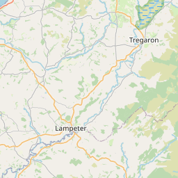
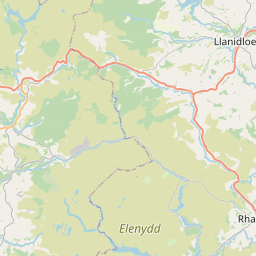
Chancery / Rhydgaled Map, Satellite view of Chancery / Rhydgaled, Dyfed, Wales
Chancery / Rhydgaled is located in Dyfed County, Ceredigion / Sir Ceredigion, Wales, Wales, United Kingdom.
Location informations of Chancery / Rhydgaled
Latitude of city of Chancery / Rhydgaled is 52.36985 and longitude of city of Chancery / Rhydgaled is -4.08590. Chancery / Rhydgaled has 1 postcode / zip code, in county of Dyfed.The County of Chancery / Rhydgaled is Dyfed.
Postcode / zip code of Chancery / Rhydgaled
SY23 4Administrative division of Chancery / Rhydgaled
County :DyfedGPS coordinates of Chancery / Rhydgaled
Latitude : 52.36985Longitude : -4.08590
Online Map of Chancery / Rhydgaled - road map, satellite view and street view


Leaflet | © OpenStreetMap contributors
Search distance between two cities
The weather for Chancery / Rhydgaled in the United Kingdom
Get today and tomorrow's weather forecasts for Chancery / Rhydgaled. Find out the weather forecast for the week ahead and the weekend for Chancery / Rhydgaled in the UK.Chancery / Rhydgaled weather forecast 15 days
What is the nearest train station to Chancery / Rhydgaled?
List of Railway Stations near to Chancery / RhydgaledThe nearest railway stations to Chancery / Rhydgaled are listed below. Tickets are available at the train station ticket office or ticket machines.
| Name | Distances from Chancery / Rhydgaled |
|---|---|
| Aberystwyth Station | 4.92 Km |
| Borth Station | 13.69 Km |
| Aberdovey Station | 19.46 Km |
| Penhelig Station | 19.85 Km |
| Tywyn Station | 23.99 Km |
| Dovey Junction Station | 24.25 Km |
| Tonfanau Station | 27.22 Km |
| Machynlleth Station | 29.55 Km |
What is the nearest Public Transport Stops to Chancery / Rhydgaled?
List of Stops near to Chancery / RhydgaledGetting there by public transport (nearest train, tube, overground line station and bus stops). The nearest stops to Chancery / Rhydgaled are listed below.
| Stop Name | Distances from Chancery / Rhydgaled |
|---|---|
| Brynglas House Bus Stop | 141 m |
| Brynglas House Bus Stop | 347 m |
| Rhydgwyn Lane Bus Stop | 579 m |
| Rhydgwyn Lane Bus Stop | 654 m |
| Blaenplwyf Bus Stop | 1.17 Km |
| Royal Oak Bus Stop | 1.26 Km |
| Royal Oak Bus Stop | 1.26 Km |
| Blaenplwyf Bus Stop | 1.35 Km |
| Marian House Bus Stop | 1.56 Km |
| Bryn Eglur Bus Stop | 1.63 Km |
Historic Places to Visit near Chancery / Rhydgaled
List of Historic places near to Chancery / Rhydgaled
| Name | Distances from Chancery / Rhydgaled |
|---|---|
| Vale of Rheidol Railway | 4.63 Km |
| Llanbadarn Fawr, St Padarns Church | 4.70 Km |
| Aberystwyth Castle | 4.88 Km |
| Ceredigion Museum | 5.21 Km |
| Plas Llidiardau Gardens | 6.14 Km |
| Caer Penrhos | 7.73 Km |
| Castell Gwallter | 10.92 Km |
| Landre, St Michaels Church | 11.08 Km |
Cities or Towns near Chancery / Rhydgaled
List of places near to
| Name | Distance |
|---|---|
| Pont Lanio / Blaenplwyf | 1.38 Km |
| Llanfarian | 1.57 Km |
| Rhydyfelin | 2.48 Km |
| Southgate | 3.38 Km |
| Caeffynnon | 3.79 Km |
| Penparcau | 3.84 Km |
| Pentre-llyn | 3.90 Km |
| Trefechan | 4.20 Km |
| Llanbadarn Fawr | 4.56 Km |
| Pendre | 4.60 Km |
| Llanilar | 4.62 Km |
| Pwllhobi | 4.62 Km |
| Llanddeiniol | 4.75 Km |
| Buarth Mawr | 4.94 Km |
| New Cross / Y Gors | 4.95 Km |
| Aberystwyth | 5.02 Km |
| Glanrafon | 5.11 Km |
| Moriah | 5.22 Km |
| Waun Fawr | 5.56 Km |
| Capel Seion | 5.77 Km |
| Penglais | 5.97 Km |
| Llangwyryfon | 6.33 Km |
| Comins Coch | 6.40 Km |
| Rhos-y-garth | 6.55 Km |
| Clarach | 7.22 Km |
| Pant-y-crûg | 7.35 Km |
| Blaengeuffordd | 7.40 Km |
| Capel Dewi | 7.51 Km |
| Llangorwen | 7.57 Km |
| Penllwyn | 8.05 Km |
| Llanrhystud | 8.15 Km |
| Capel Bangor | 8.29 Km |
| Dolypandy | 8.38 Km |
| Llanfihangel-y-Creuddyn | 8.41 Km |
| Plas Gogerddan | 8.69 Km |
| Trefenter | 8.77 Km |
| Y Ffald | 8.88 Km |
| Cefn Llwyd | 8.89 Km |
| Bow Street | 8.93 Km |
| Abermagwr | 8.93 Km |
| Maes-bangor | 9.06 Km |
| Rhydroser | 9.09 Km |
| Lledrod | 9.12 Km |
| Crosswood / Trawsgoed | 9.32 Km |
| Nantyronen Station | 9.56 Km |
| Penrhyn-coch | 9.57 Km |
| Cnwch Coch | 9.61 Km |
| Pisgah | 9.79 Km |
| Pen-y-garn | 9.81 Km |
| Joppa | 10.08 Km |