Castleloan Map, Satellite view of Castleloan, Stirling and Falkirk, Scotland
Castleloan is located in Stirling and Falkirk County, Falkirk, Scotland, Scotland, United Kingdom.
Location informations of Castleloan
Latitude of city of Castleloan is 56.01049 and longitude of city of Castleloan is -3.62138. Castleloan has 1 postcode / zip code, in county of Stirling and Falkirk.The County of Castleloan is Stirling and Falkirk.
Postcode / zip code of Castleloan
EH51 0Administrative division of Castleloan
County :Stirling and FalkirkGPS coordinates of Castleloan
Latitude : 56.01049Longitude : -3.62138
Online Map of Castleloan - road map, satellite view and street view

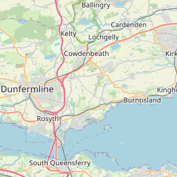


Leaflet | © OpenStreetMap contributors
Search distance between two cities
The weather for Castleloan in the United Kingdom
Get today and tomorrow's weather forecasts for Castleloan. Find out the weather forecast for the week ahead and the weekend for Castleloan in the UK.Castleloan weather forecast 15 days
What is the nearest train station to Castleloan?
List of Railway Stations near to CastleloanThe nearest railway stations to Castleloan are listed below. Tickets are available at the train station ticket office or ticket machines.
| Name | Distances from Castleloan |
|---|---|
| Linlithgow Station | 4.10 Km |
| Polmont Station | 6.49 Km |
| Falkirk Grahamston Station | 10.21 Km |
| Falkirk High Station | 10.82 Km |
| Camelon Station | 12.21 Km |
| Dunfermline Queen Margaret Station | 12.30 Km |
| Uphall Station | 12.59 Km |
| Bathgate Station | 12.64 Km |
| Rosyth Station | 12.67 Km |
| Livingston North Station | 13.04 Km |
What is the nearest Public Transport Stops to Castleloan?
List of Stops near to CastleloanGetting there by public transport (nearest train, tube, overground line station and bus stops). The nearest stops to Castleloan are listed below.
| Stop Name | Distances from Castleloan |
|---|---|
| The Loan Bus Stop (before) | 59 m |
| The Loan Bus Stop (after) | 72 m |
| Castlehill Bus Stop (before) | 117 m |
| Strachan Court Bus Stop (at) | 124 m |
| Strachan Court Bus Stop (opp) | 130 m |
| Maidenpark Place Bus Stop (after) | 184 m |
| Maidenpark Place Bus Stop (before) | 190 m |
| Kinneil Drive Bus Stop (at) | 204 m |
| Deanfield Drive Bus Stop (after) | 216 m |
| Kinneil Drive Bus Stop (opp) | 217 m |
Historic Places to Visit near Castleloan
List of Historic places near to Castleloan
| Name | Distances from Castleloan |
|---|---|
| Kinneil Museum | 0.83 Km |
| Kinneil House | 0.83 Km |
| Linlithgow Palace | 3.86 Km |
| Church of St Michael, Linlithgow | 3.86 Km |
| Annet House Museum and Garden | 3.97 Km |
| Culross Palace and Royal Burgh | 5.05 Km |
| Culross Abbey | 5.29 Km |
| Blackness Castle | 6.39 Km |
| House of the Binns | 6.64 Km |
| Westquarter Dovecot | 7.98 Km |
| Torphichen Preceptory | 8.64 Km |
| Cairnpapple Hill | 9.20 Km |
| Callendar House | 9.22 Km |
| Hopetoun House | 10.14 Km |
| Pittencrieff House Museum | 11.43 Km |
| Andrew Carnegie Birthplace | 11.82 Km |
| Dunfermline Abbey and Palace | 11.84 Km |
| Abbot House Heritage Centre | 11.91 Km |
| Dunfermline Museum | 12.35 Km |
| The Dunmore Pineapple | 12.66 Km |
| Watling Lodge (Antonine Wall) | 12.71 Km |
| Clackmannan Tower | 13.95 Km |
| Newliston | 14.06 Km |
Cities or Towns near Castleloan
List of places near to
| Name | Distance |
|---|---|
| Deanfield | 0.19 Km |
| Maidenpark | 0.28 Km |
| Corbiehall | 0.55 Km |
| Kinneil | 0.58 Km |
| Newtown | 0.96 Km |
| Borrowstoun Mains | 0.99 Km |
| Borrowstoun | 1.18 Km |
| Bo'ness | 1.26 Km |
| Mingle | 1.32 Km |
| Grahamsdyke | 1.37 Km |
| Bonhard Terrace | 1.58 Km |
| Grangepans | 2.01 Km |
| Bridgeness | 2.43 Km |
| Muirhouses | 2.81 Km |
| Carriden | 2.85 Km |
| Linlithgow Bridge | 3.84 Km |
| Linlithgow | 3.94 Km |
| Whitecross | 4.55 Km |
| Blairburn | 4.61 Km |
| Cauldcoats Holdings | 4.70 Km |
| Wholeflats | 5.09 Km |
| Culross | 5.14 Km |
| Low Valleyfield | 5.46 Km |
| Old Polmont | 5.49 Km |
| Bowhouse | 5.49 Km |
| Belsyde | 5.63 Km |
| Polmont | 5.78 Km |
| High Valleyfield | 5.82 Km |
| Low Torry | 5.85 Km |
| Newmills | 5.94 Km |
| Kingscavil | 5.94 Km |
| Mannerston | 5.98 Km |
| Torryburn | 6.21 Km |
| Blackness | 6.24 Km |
| Loan | 6.31 Km |
| Grangemouth | 6.33 Km |
| Maddiston | 6.49 Km |
| Shires Mill | 6.74 Km |
| Parkhill | 6.75 Km |
| Brightons | 6.79 Km |
| Rumford | 6.81 Km |
| Philpstoun | 6.99 Km |
| Crombie | 7.14 Km |
| Redding | 7.34 Km |
| Bridgend | 7.47 Km |
| Beancross | 7.61 Km |
| Glensburgh | 7.68 Km |
| Cairneyhill | 7.81 Km |
| Westquarter | 7.84 Km |
| Old Philpstoun | 7.89 Km |