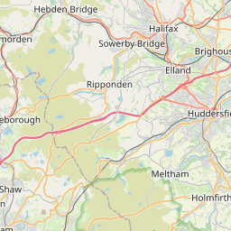
Cartworth Map, Satellite view of Cartworth, West Yorkshire, England
Cartworth is located in West Yorkshire County, Kirklees District, Yorkshire and the Humber, England, United Kingdom.
Location informations of Cartworth
Latitude of city of Cartworth is 53.56392 and longitude of city of Cartworth is -1.78255. Cartworth has 1 postcode / zip code, in county of West Yorkshire.The County of Cartworth is West Yorkshire.
Postcode / zip code of Cartworth
HD9 2Administrative division of Cartworth
County :West YorkshireGPS coordinates of Cartworth
Latitude : 53.56392Longitude : -1.78255
Online Map of Cartworth - road map, satellite view and street view

Leaflet | © OpenStreetMap contributors
Search distance between two cities
The weather for Cartworth in the United Kingdom
Get today and tomorrow's weather forecasts for Cartworth. Find out the weather forecast for the week ahead and the weekend for Cartworth in the UK.Cartworth weather forecast 15 days
What is the nearest train station to Cartworth?
List of Railway Stations near to CartworthThe nearest railway stations to Cartworth are listed below. Tickets are available at the train station ticket office or ticket machines.
| Name | Distances from Cartworth |
|---|---|
| Brockholes Station | 3.77 Km |
| Honley Station | 4.93 Km |
| Stocksmoor Station | 5.16 Km |
| Shepley Station | 5.82 Km |
| Berry Brow Station | 6.39 Km |
| Denby Dale Station | 7.94 Km |
| Lockwood Station | 7.97 Km |
| Slaithwaite Station | 9.33 Km |
| Huddersfield Station | 9.41 Km |
| Marsden Station | 10.71 Km |
What is the nearest Public Transport Stops to Cartworth?
List of Stops near to CartworthGetting there by public transport (nearest train, tube, overground line station and bus stops). The nearest stops to Cartworth are listed below.
Historic Places to Visit near Cartworth
List of Historic places near to Cartworth
| Name | Distances from Cartworth |
|---|---|
| National Coal Mining Museum for England | 13.97 Km |
Cities or Towns near Cartworth
List of places near to
| Name | Distance |
|---|---|
| Under Bank | 0.14 Km |
| Gully | 0.40 Km |
| New Gate | 0.54 Km |
| Washpit | 0.69 Km |
| Holmfirth | 0.78 Km |
| Cliff | 0.89 Km |
| Under Hill | 1.00 Km |
| Hill | 1.11 Km |
| Victoria | 1.19 Km |
| Arrunden | 1.21 Km |
| Scholes | 1.25 Km |
| Totties | 1.40 Km |
| Burnlee | 1.42 Km |
| Wooldale | 1.57 Km |
| Liphill Bank | 1.67 Km |
| Upperthong | 1.68 Km |
| Town End | 1.73 Km |
| Jackson Bridge | 1.93 Km |
| Hade Edge | 1.97 Km |
| Hinchliffe Mill | 1.99 Km |
| Hogley Green | 1.99 Km |
| Hepworth | 2.00 Km |
| Lydgate | 2.20 Km |
| Thongsbridge | 2.21 Km |
| Hole Bottom | 2.21 Km |
| Netherthong | 2.24 Km |
| New Mill | 2.47 Km |
| Holmbridge | 2.48 Km |
| Oldfield | 2.96 Km |
| Meal Hill | 2.99 Km |
| Flush House | 3.03 Km |
| Snowgate Head | 3.26 Km |
| Brockholes | 3.53 Km |
| Thurstonland | 3.55 Km |
| Barnside | 3.60 Km |
| Fulstone | 3.62 Km |
| Wilshaw | 3.63 Km |
| Holme | 3.88 Km |
| Victoria | 3.88 Km |
| Gate Foot | 3.98 Km |
| Honley Moor | 4.12 Km |
| Maythorn | 4.46 Km |
| Scotgate | 4.47 Km |
| Honley | 4.52 Km |
| Haddingley | 4.66 Km |
| Thick Hollins | 4.74 Km |
| Lane Head | 4.96 Km |
| Stocksmoor | 4.97 Km |
| Meltham Mills | 4.99 Km |
| Townhead | 5.08 Km |