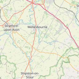
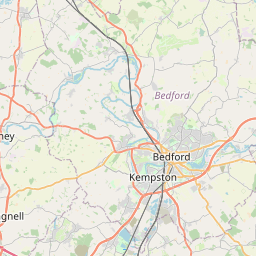
Canley Gardens Map, Satellite view of Canley Gardens, West Midlands, England
Canley Gardens is located in West Midlands County, Coventry District, West Midlands, England, United Kingdom.
Location informations of Canley Gardens
Latitude of city of Canley Gardens is 52.39644 and longitude of city of Canley Gardens is -1.53862. Canley Gardens has 1 postcode / zip code, in county of West Midlands.The County of Canley Gardens is West Midlands.
Postcode / zip code of Canley Gardens
CV5 6Administrative division of Canley Gardens
County :West MidlandsGPS coordinates of Canley Gardens
Latitude : 52.39644Longitude : -1.53862
Online Map of Canley Gardens - road map, satellite view and street view
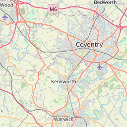


Leaflet | © OpenStreetMap contributors
Search distance between two cities
The weather for Canley Gardens in the United Kingdom
Get today and tomorrow's weather forecasts for Canley Gardens. Find out the weather forecast for the week ahead and the weekend for Canley Gardens in the UK.Canley Gardens weather forecast 15 days
What is the nearest train station to Canley Gardens?
List of Railway Stations near to Canley GardensThe nearest railway stations to Canley Gardens are listed below. Tickets are available at the train station ticket office or ticket machines.
| Name | Distances from Canley Gardens |
|---|---|
| Canley Station | 682 m |
| Coventry Station | 1.77 Km |
| Tile Hill Station | 3.95 Km |
| Coventry Arena Station | 6.45 Km |
| Berkswell Station | 7.07 Km |
| Bedworth Station | 10.40 Km |
| Hampton-In-Arden Station | 11.53 Km |
| Leamington Spa Station | 12.45 Km |
| Bermuda Park Station | 12.51 Km |
| Warwick Station | 12.57 Km |
Coventry Airport , UK (4.98 Km)
What is the nearest Public Transport Stops to Canley Gardens?
List of Stops near to Canley GardensGetting there by public transport (nearest train, tube, overground line station and bus stops). The nearest stops to Canley Gardens are listed below.
| Stop Name | Distances from Canley Gardens |
|---|---|
| St Andrews Rd Bus Stop (adj) | 71 m |
| St Andrews Rd Bus Stop (opp) | 86 m |
| Shaftesbury Rd Bus Stop (adj) | 220 m |
| Shaftesbury Rd Bus Stop (after) | 288 m |
| Shaftesbury Rd Bus Stop (opp) | 293 m |
| Shaftesbury Rd Bus Stop (opp) | 294 m |
| Providence St Bus Stop (adj) | 410 m |
| Providence St Bus Stop (opp) | 492 m |
| Burnsall Rd Bus Stop (before) | 592 m |
| Earlsdon Avenue Bus Stop (after) | 615 m |
Historic Places to Visit near Canley Gardens
List of Historic places near to Canley Gardens
| Name | Distances from Canley Gardens |
|---|---|
| Medieval Spon Street | 1.99 Km |
| Coventry, St John the Baptist Church | 2.08 Km |
| Coventry, Cheylesmore Manor (The Register) | 2.09 Km |
| Coventry, Old Bablake School & Bonds Hospital | 2.11 Km |
| Coventry, Christchurch Spire | 2.12 Km |
| Coventry, Ford?s Hospital Almshouse | 2.22 Km |
| Coventry Council House | 2.40 Km |
| Coventry Cross | 2.43 Km |
| Coventry, Lychgate Cottages | 2.44 Km |
| Coventry, St Marys Guildhall | 2.45 Km |
| Coventry, Holy Trinity Church | 2.45 Km |
| Coventry, St Marys Priory | 2.45 Km |
| Coventry, Medieval Stone Building | 2.49 Km |
| Herbert Museum & Art Gallery | 2.52 Km |
| Coventry City Walls & Gates | 2.64 Km |
| Coventry, Whitefriars Friary | 2.70 Km |
| Coventry, Charterhouse | 3.03 Km |
| Lunt Roman Fort | 3.82 Km |
| Stoneleigh, St Marys Church | 5.33 Km |
| Stoneleigh Abbey | 6.45 Km |
| Kenilworth Castle | 6.52 Km |
| Arbury Hall | 11.80 Km |
| Baddesley Clinton, St Michaels Church | 12.59 Km |
| Baddesley Clinton | 13.10 Km |
| Collegiate Church of St Mary, Warwick | 13.21 Km |
| Warwick Castle | 13.25 Km |
| Lord Leycesters Hospital | 13.38 Km |
Cities or Towns near Canley Gardens
List of places near to
| Name | Distance |
|---|---|
| Beechwood Gardens | 0.45 Km |
| Westwood Gardens | 0.49 Km |
| Earlsdon | 0.70 Km |
| Canley | 1.11 Km |
| Chapel Fields | 1.35 Km |
| Whoberley | 1.50 Km |
| Spon End | 1.55 Km |
| Stivichall | 1.81 Km |
| Green Lane | 1.88 Km |
| Lime Tree Park | 2.23 Km |
| Kirby Corner | 2.32 Km |
| Coventry | 2.49 Km |
| Cheylesmore | 2.50 Km |
| Draper's Fields | 2.72 Km |
| Lower Eastern Green | 2.84 Km |
| Westwood Heath | 2.98 Km |
| Gibbet Hill | 3.00 Km |
| Finham | 3.19 Km |
| Coundon | 3.19 Km |
| Tile Hill | 3.27 Km |
| Bishopgate Green | 3.28 Km |
| Hillfields | 3.33 Km |
| Radford | 3.40 Km |
| Allesley Green | 3.63 Km |
| Gosford Green | 3.64 Km |
| Whitley | 3.93 Km |
| Lower Stoke | 4.02 Km |
| Pinley Gardens | 4.02 Km |
| Pinley | 4.07 Km |
| Stoke Park | 4.24 Km |
| Baginton | 4.24 Km |
| Middle Stoke | 4.26 Km |
| Coundon Green | 4.27 Km |
| Allesley | 4.31 Km |
| Great Heath | 4.40 Km |
| Upper Eastern Green | 4.43 Km |
| Whitmore Park | 4.55 Km |
| Stoke Aldermoor | 4.62 Km |
| Church End | 4.66 Km |
| Upper Stoke | 4.66 Km |
| Hockley | 4.72 Km |
| Stoke Heath | 4.72 Km |
| Crackley | 4.83 Km |
| Edgwick | 4.90 Km |
| Paradise | 4.95 Km |
| Parting of the Heaths | 5.01 Km |
| Burton Green | 5.09 Km |
| Reeves Green | 5.12 Km |
| Brownshill Green | 5.12 Km |
| Keresley | 5.14 Km |