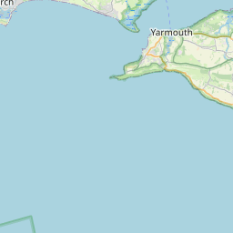
Bursledon Map, Satellite view of Bursledon, Hampshire, England
Bursledon is located in Hampshire County, Eastleigh District, South East, England, United Kingdom.
Location informations of Bursledon
Latitude of city of Bursledon is 50.88137 and longitude of city of Bursledon is -1.31068. Bursledon has 1 postcode / zip code, in county of Hampshire.The County of Bursledon is Hampshire.
Postcode / zip code of Bursledon
SO31 8Administrative division of Bursledon
County :HampshireGPS coordinates of Bursledon
Latitude : 50.88137Longitude : -1.31068
Online Map of Bursledon - road map, satellite view and street view


Leaflet | © OpenStreetMap contributors
Search distance between two cities
The weather for Bursledon in the United Kingdom
Get today and tomorrow's weather forecasts for Bursledon. Find out the weather forecast for the week ahead and the weekend for Bursledon in the UK.Bursledon weather forecast 15 days
What is the nearest train station to Bursledon?
List of Railway Stations near to BursledonThe nearest railway stations to Bursledon are listed below. Tickets are available at the train station ticket office or ticket machines.
| Name | Distances from Bursledon |
|---|---|
| Bursledon Station | 472 m |
| Hamble Station | 1.71 Km |
| Netley Station | 2.31 Km |
| Swanwick Station | 3.21 Km |
| Sholing Station | 4.17 Km |
| Woolston Station | 5.05 Km |
| Botley Station | 5.31 Km |
| Hedge End Station | 5.78 Km |
| Bitterne Station | 6.20 Km |
| St.Denys Station | 7.06 Km |
Southampton Airport , UK (8.32 Km)
What is the nearest Public Transport Stops to Bursledon?
List of Stops near to BursledonGetting there by public transport (nearest train, tube, overground line station and bus stops). The nearest stops to Bursledon are listed below.
| Stop Name | Distances from Bursledon |
|---|---|
| Bursledon Rail Station (Entrance) | 465 m |
| Bursledon Rail Station | 472 m |
| Station Road Bus Stop (NW-bound) | 734 m |
| Station Road Bus Stop (SE-bound) | 745 m |
| Swanwick Lane Bus Stop (opp) | 802 m |
| Dodwell Lane Bus Stop (NW-bound) | 938 m |
| Swanwick Lane Bus Stop (near) | 941 m |
| Dodwell Lane Bus Stop (SE-bound) | 953 m |
| Post Office Bus Stop (E-bound) | 994 m |
| Post Office Bus Stop (W-bound) | 1.00 Km |
Historic Places to Visit near Bursledon
List of Historic places near to Bursledon
| Name | Distances from Bursledon |
|---|---|
| Netley Abbey | 3.30 Km |
| Titchfield Abbey | 6.09 Km |
| Medieval Merchants House | 6.93 Km |
| Calshot Castle | 8.03 Km |
| Bishops Waltham Palace | 10.36 Km |
| Exbury Gardens and Steam Railway | 10.91 Km |
| Beaulieu | 11.93 Km |
| Eling Tide Mill Experience | 12.48 Km |
| Fort Brockhurst | 13.20 Km |
| Cowes Maritime Museum | 13.49 Km |
| Southwick, St James Without-the-Priory Gate Church | 13.94 Km |
| Southwick Priory | 14.28 Km |
| Portchester Castle | 14.66 Km |
| Osborne House | 14.75 Km |
Cities or Towns near Bursledon
List of places near to
| Name | Distance |
|---|---|
| Oak Hill | 1.00 Km |
| Lowford | 1.08 Km |
| Swanwick | 1.30 Km |
| Old Netley | 1.32 Km |
| Lower Swanwick | 1.33 Km |
| Sarisbury | 1.75 Km |
| Hound | 1.84 Km |
| Butlocks Heath | 2.01 Km |
| Netley Hill | 2.43 Km |
| Hamble-le-Rice | 2.54 Km |
| Hightown | 2.77 Km |
| Netley | 3.04 Km |
| Park Gate | 3.14 Km |
| Sholing | 3.29 Km |
| Warsash | 3.29 Km |
| Burridge | 3.36 Km |
| Locks Heath | 3.43 Km |
| Thornhill | 3.59 Km |
| Hedge End | 3.62 Km |
| Whiteley | 3.74 Km |
| Newtown | 3.86 Km |
| Fleetend | 3.96 Km |
| Weston | 4.11 Km |
| Wildern | 4.24 Km |
| Thornhill Park | 4.31 Km |
| Segensworth | 4.33 Km |
| Sholing Common | 4.43 Km |
| Titchfield Common | 4.54 Km |
| Botley | 4.59 Km |
| Curbridge | 4.59 Km |
| Harefield | 4.63 Km |
| Hook | 4.64 Km |
| Merry Oak | 4.76 Km |
| Shamblehurst | 4.85 Km |
| Abshot | 4.90 Km |
| Hook Park | 4.91 Km |
| Itchen | 4.93 Km |
| Titchfield Park | 4.97 Km |
| Woolston | 5.13 Km |
| Peartree Green | 5.19 Km |
| Bitterne | 5.28 Km |
| Hatch Bottom | 5.29 Km |
| Dowd's Farm | 5.29 Km |
| West End | 5.42 Km |
| Boorley Green | 5.69 Km |
| Lee Ground | 5.95 Km |
| Crosshouse | 5.96 Km |
| Midanbury | 6.05 Km |
| Chapel | 6.07 Km |
| Northam | 6.14 Km |