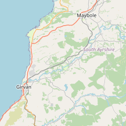
Burnton Map, Satellite view of Burnton, Ayrshire and Arran, Scotland
Burnton is located in Ayrshire and Arran County, East Ayrshire, Scotland, Scotland, United Kingdom.
Location informations of Burnton
Latitude of city of Burnton is 55.33250 and longitude of city of Burnton is -4.40730. Burnton has 1 postcode / zip code, in county of Ayrshire and Arran.The County of Burnton is Ayrshire and Arran.
Postcode / zip code of Burnton
KA6 7Administrative division of Burnton
County :Ayrshire and ArranGPS coordinates of Burnton
Latitude : 55.33250Longitude : -4.40730
Online Map of Burnton - road map, satellite view and street view


Leaflet | © OpenStreetMap contributors
Search distance between two cities
The weather for Burnton in the United Kingdom
Get today and tomorrow's weather forecasts for Burnton. Find out the weather forecast for the week ahead and the weekend for Burnton in the UK.Burnton weather forecast 15 days
What is the nearest train station to Burnton?
List of Railway Stations near to BurntonThe nearest railway stations to Burnton are listed below. Tickets are available at the train station ticket office or ticket machines.
| Name | Distances from Burnton |
|---|---|
| New Cumnock Station | 16.11 Km |
| Auchinleck Station | 16.87 Km |
| Maybole Station | 17.75 Km |
| Ayr Station | 19.64 Km |
| Newton-On-Ayr Station | 20.93 Km |
| Prestwick Station | 22.94 Km |
| Prestwick Internat'nl Airport Station | 23.58 Km |
| Kirkconnel Station | 26.57 Km |
| Troon Station | 28.14 Km |
| Girvan Station | 29.53 Km |
What is the nearest Public Transport Stops to Burnton?
List of Stops near to BurntonGetting there by public transport (nearest train, tube, overground line station and bus stops). The nearest stops to Burnton are listed below.
| Stop Name | Distances from Burnton |
|---|---|
| Burnton Turning Circle Bus Stop (opp) | 7 m |
| Broomknowe Bus Stop (opp 31) | 575 m |
| Broomknowe Bus Stop (at 28/29) | 592 m |
| High Main Street Bus Stop (before) | 771 m |
| Broomknowe Bus Stop (before) | 831 m |
| Bellsbank Crescent Bus Stop (after) | 986 m |
| Park Crescent Bus Stop (after) | 1.00 Km |
| Park Crescent Bus Stop (opp) | 1.04 Km |
| Fire Station Bus Stop (after) | 1.13 Km |
| Fire Station Bus Stop (opp) | 1.15 Km |
Historic Places to Visit near Burnton
List of Historic places near to Burnton
| Name | Distances from Burnton |
|---|---|
| Dalmellington Mote | 1.35 Km |
| Loch Doon Castle | 11.93 Km |
Cities or Towns near Burnton
List of places near to
| Name | Distance |
|---|---|
| Gillies' Knowe | 0.92 Km |
| Dalmellington | 1.14 Km |
| Pennyvenie | 2.07 Km |
| Bellsbank | 2.37 Km |
| Waterside | 3.72 Km |
| Patna | 7.05 Km |
| Polnessan | 7.25 Km |
| Rankinston | 7.80 Km |
| Littlemill | 8.56 Km |
| Straiton | 9.42 Km |
| Hayhill | 9.50 Km |
| Sinclairston | 9.84 Km |
| Dalleagles | 10.47 Km |
| Hollybush | 11.29 Km |
| Barbieston | 11.47 Km |
| Drongan | 11.89 Km |
| Skares | 11.96 Km |
| Craigmalloch | 12.23 Km |
| Burnside | 12.27 Km |
| Kirkmichael | 13.06 Km |
| Coalhall | 13.30 Km |
| Low Coylton | 13.49 Km |
| Dalrymple | 13.60 Km |
| Bankglen | 13.67 Km |
| Hillhead | 13.87 Km |
| Coylton | 13.95 Km |
| Connel Park | 14.21 Km |
| Joppa | 14.33 Km |
| Ochiltree | 14.47 Km |
| Crosshill | 14.63 Km |