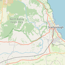
Burniston Map, Satellite view of Burniston, North Yorkshire, England
Burniston is located in North Yorkshire County, Scarborough District, Yorkshire and the Humber, England, United Kingdom.
Location informations of Burniston
Latitude of city of Burniston is 54.32183 and longitude of city of Burniston is -0.44427. Burniston has 1 postcode / zip code, in county of North Yorkshire.The County of Burniston is North Yorkshire.
Postcode / zip code of Burniston
YO13 0Administrative division of Burniston
County :North YorkshireGPS coordinates of Burniston
Latitude : 54.32183Longitude : -0.44427
Online Map of Burniston - road map, satellite view and street view


Leaflet | © OpenStreetMap contributors
Search distance between two cities
The weather for Burniston in the United Kingdom
Get today and tomorrow's weather forecasts for Burniston. Find out the weather forecast for the week ahead and the weekend for Burniston in the UK.Burniston weather forecast 15 days
What is the nearest train station to Burniston?
List of Railway Stations near to BurnistonThe nearest railway stations to Burniston are listed below. Tickets are available at the train station ticket office or ticket machines.
| Name | Distances from Burniston |
|---|---|
| Scarborough Station | 5.30 Km |
| Seamer Station | 9.19 Km |
| Filey Station | 15.83 Km |
| Hunmanby Station | 18.48 Km |
| Ruswarp Station | 20.33 Km |
| Sleights Station | 20.96 Km |
| Whitby Station | 21.22 Km |
| Grosmont Station | 22.18 Km |
| Egton Station | 24.24 Km |
| Glaisdale Station | 26.14 Km |
What is the nearest Public Transport Stops to Burniston?
List of Stops near to BurnistonGetting there by public transport (nearest train, tube, overground line station and bus stops). The nearest stops to Burniston are listed below.
Historic Places to Visit near Burniston
List of Historic places near to Burniston
| Name | Distances from Burniston |
|---|---|
| Scarborough Castle | 5.07 Km |
| Fylingdales, St Stephens Old Church | 14.62 Km |
Cities or Towns near Burniston
List of places near to
| Name | Distance |
|---|---|
| Cloughton | 1.82 Km |
| Lind Head | 2.33 Km |
| Scalby | 2.45 Km |
| Cloughton Newlands | 2.59 Km |
| Scalby Mills | 2.92 Km |
| Newby | 2.96 Km |
| Newlands | 3.13 Km |
| Suffield | 3.70 Km |
| Barrowcliff | 3.71 Km |
| Lady Edith's | 3.82 Km |
| Throxenby | 3.92 Km |
| Northstead | 3.94 Km |
| Prospect Mount | 4.29 Km |
| Woodlands | 4.61 Km |
| Silpho | 4.83 Km |
| Crowdon | 4.91 Km |
| Hackness | 5.08 Km |
| Scarborough | 5.24 Km |
| Sandybed | 5.33 Km |
| St Nicholas Cliff | 5.40 Km |
| Everley | 5.62 Km |
| Falsgrave | 5.69 Km |
| South Cliff | 5.72 Km |
| Harwood Dale | 5.81 Km |
| Staintondale | 5.91 Km |
| Edgehill | 6.62 Km |
| Weaponness | 6.74 Km |
| Broxa | 6.82 Km |
| Wheatcroft | 7.80 Km |
| Langdale End | 7.84 Km |
| East Ayton | 8.25 Km |
| Irton | 8.48 Km |
| West Ayton | 8.57 Km |
| Ravenscar | 8.96 Km |
| Crossgates | 9.06 Km |
| North Moor | 9.22 Km |
| Seamer | 9.33 Km |
| Osgodby | 9.34 Km |
| Hutton Buscel | 9.38 Km |
| Eastfield | 9.62 Km |
| Cayton | 10.40 Km |
| Sawdon | 10.62 Km |
| Wykeham | 10.94 Km |
| Ruston | 11.20 Km |
| Killerby | 11.47 Km |
| Lebberston | 12.41 Km |
| Brompton-by-Sawdon | 12.95 Km |
| Gristhorpe | 13.28 Km |
| Flixton Ings | 13.61 Km |
| Flixton | 13.64 Km |