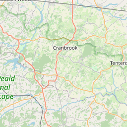
Broad Street Map, Satellite view of Broad Street, Kent, England
Broad Street is located in Kent County, Maidstone District, South East, England, United Kingdom.
Location informations of Broad Street
Latitude of city of Broad Street is 51.28043 and longitude of city of Broad Street is 0.62258. Broad Street has 1 postcode / zip code, in county of Kent.The County of Broad Street is Kent.
Postcode / zip code of Broad Street
ME17 1Administrative division of Broad Street
County :KentGPS coordinates of Broad Street
Latitude : 51.28043Longitude : 0.62258
Online Map of Broad Street - road map, satellite view and street view


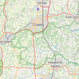


Leaflet | © OpenStreetMap contributors
Search distance between two cities
The weather for Broad Street in the United Kingdom
Get today and tomorrow's weather forecasts for Broad Street. Find out the weather forecast for the week ahead and the weekend for Broad Street in the UK.Broad Street weather forecast 15 days
What is the nearest train station to Broad Street?
List of Railway Stations near to Broad StreetThe nearest railway stations to Broad Street are listed below. Tickets are available at the train station ticket office or ticket machines.
| Name | Distances from Broad Street |
|---|---|
| Hollingbourne Station | 1.74 Km |
| Bearsted Station | 3.17 Km |
| Harrietsham Station | 5.26 Km |
| Maidstone East Station | 7.05 Km |
| Maidstone West Station | 7.51 Km |
| Maidstone Barracks Station | 7.56 Km |
| Lenham Station | 7.83 Km |
| Newington Station | 8.71 Km |
| Rainham (Kent) Station | 9.58 Km |
| East Farleigh Station | 9.99 Km |
Rochester Airport , UK (11.48 Km)
Lashenden (Headcorn) Airfield , UK (13.80 Km)
What is the nearest Public Transport Stops to Broad Street?
List of Stops near to Broad StreetGetting there by public transport (nearest train, tube, overground line station and bus stops). The nearest stops to Broad Street are listed below.
| Stop Name | Distances from Broad Street |
|---|---|
| Hollingbourne Rail Station (entrance) | 1.73 Km |
| Hollingbourne Rail Station | 1.73 Km |
| Maidstone Services Bus Stop (at) | 1.74 Km |
| Railway Station Bus Stop (o/s) | 2.06 Km |
| Troys Mead Bus Stop (opp) | 2.08 Km |
| Troys Mead Bus Stop (adj) | 2.09 Km |
| Church Bus Stop (o/s) | 2.09 Km |
| Post Office Bus Stop (opp) | 2.12 Km |
| Post Office Bus Stop (adj) | 2.12 Km |
| Caravan Park Bus Stop (adj) | 2.25 Km |
Historic Places to Visit near Broad Street
List of Historic places near to Broad Street
| Name | Distances from Broad Street |
|---|---|
| Leeds Castle | 3.51 Km |
| Stoneacre | 4.39 Km |
| Bredgar & Wormshill Light Railway | 4.81 Km |
| Archbishops Palace, Maidstone | 7.12 Km |
| Maidstone Museum & Bentlif Art Gallery | 7.15 Km |
| Sutton Valence Castle | 7.79 Km |
| Sutton Valence, St Mary | 7.81 Km |
| Lenham, St Marys Church | 8.29 Km |
| Boughton Monchelsea Place | 8.97 Km |
| Little Kits Coty | 9.32 Km |
| Kits Coty House | 9.46 Km |
| Kingsdown, St Catherines Church | 9.68 Km |
| Aylesford Priory (The Friars) | 10.83 Km |
| Doddington Place Gardens | 11.36 Km |
| Burham, St Marys Church | 12.40 Km |
| Royal Engineers Museum | 13.92 Km |
| Historic Dockyard Chatham | 14.29 Km |
| Charing, St Peter and St Paul | 14.38 Km |
| Restoration House | 14.40 Km |
| Rochester Castle | 14.56 Km |
| Rochester Guildhall Museum | 14.83 Km |
| Pluckley, St Nicholas | 14.91 Km |
Cities or Towns near Broad Street
List of places near to
| Name | Distance |
|---|---|
| Hollingbourne | 2.03 Km |
| Hucking | 2.14 Km |
| Eyhorne Street | 2.18 Km |
| Friningham | 2.23 Km |
| Thurnham | 2.59 Km |
| Ashbank | 3.31 Km |
| Hazel Street | 3.32 Km |
| Ware Street | 3.48 Km |
| Caring | 3.55 Km |
| Bicknor | 3.62 Km |
| Bearsted | 3.75 Km |
| Roseacre | 3.83 Km |
| Leeds | 3.91 Km |
| Weavering Street | 3.93 Km |
| Detling | 3.98 Km |
| South Green | 3.99 Km |
| Green Hill | 4.25 Km |
| Broomfield | 4.36 Km |
| South Street | 4.39 Km |
| Bedmonton | 4.43 Km |
| Otham | 4.44 Km |
| Chegworth | 4.48 Km |
| Lower Cox Street | 4.56 Km |
| Otham Hole | 4.76 Km |
| Willington | 4.88 Km |
| Ringlestone | 4.97 Km |
| Horsalls | 5.01 Km |
| Wormshill | 5.05 Km |
| Grove Green | 5.06 Km |
| Scragged Oak | 5.09 Km |
| Deans Bottom | 5.12 Km |
| Borden Hill | 5.14 Km |
| Three Tees | 5.18 Km |
| Swanton Street | 5.26 Km |
| Deans Hill | 5.27 Km |
| Stockbury | 5.31 Km |
| Langley | 5.39 Km |
| Langley Heath | 5.41 Km |
| Yelsted | 5.58 Km |
| Harrietsham | 5.63 Km |
| Kingswood | 6.00 Km |
| Boxley | 6.04 Km |
| Harbourland | 6.04 Km |
| Silver Street | 6.06 Km |
| Penenden Heath | 6.10 Km |
| Frinsted | 6.13 Km |
| Dunn Street | 6.15 Km |
| Bredgar | 6.23 Km |
| Shepway | 6.26 Km |
| Five Wents | 6.28 Km |