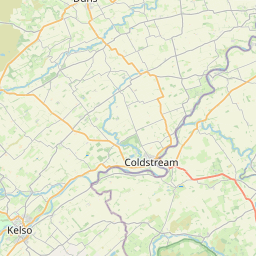
Blackadder Map, Satellite view of Blackadder, Berwickshire, Scotland
Blackadder is located in Berwickshire County, Scottish Borders, Scotland, Scotland, United Kingdom.
Location informations of Blackadder
Latitude of city of Blackadder is 55.76414 and longitude of city of Blackadder is -2.24517. Blackadder has 1 postcode / zip code, in county of Berwickshire.The County of Blackadder is Berwickshire.
Postcode / zip code of Blackadder
TD11 3Administrative division of Blackadder
County :BerwickshireGPS coordinates of Blackadder
Latitude : 55.76414Longitude : -2.24517
Online Map of Blackadder - road map, satellite view and street view


Leaflet | © OpenStreetMap contributors
Search distance between two cities
The weather for Blackadder in the United Kingdom
Get today and tomorrow's weather forecasts for Blackadder. Find out the weather forecast for the week ahead and the weekend for Blackadder in the UK.Blackadder weather forecast 15 days
What is the nearest train station to Blackadder?
List of Railway Stations near to BlackadderThe nearest railway stations to Blackadder are listed below. Tickets are available at the train station ticket office or ticket machines.
| Name | Distances from Blackadder |
|---|---|
| Berwick-Upon-Tweed Station | 14.69 Km |
What is the nearest Public Transport Stops to Blackadder?
List of Stops near to BlackadderGetting there by public transport (nearest train, tube, overground line station and bus stops). The nearest stops to Blackadder are listed below.
| Stop Name | Distances from Blackadder |
|---|---|
| Whitsome Laws Rd End Bus Stop (At) | 2.11 Km |
| Whitsome Laws Rd End Bus Stop (Opp) | 2.12 Km |
| Post Office Bus Stop (at) | 2.42 Km |
| Allanbank Court Bus Stop (At) | 2.42 Km |
| Post Office Bus Stop (opp) | 2.43 Km |
| Allanbank Court Bus Stop (Opp) | 2.44 Km |
| Allanton Inn Bus Stop (Opp) | 2.69 Km |
| Allanton Inn Bus Stop (At) | 2.70 Km |
| Craigswalls Rd End Bus Stop (Opp) | 2.96 Km |
| Craigswalls Rd End Bus Stop (At) | 2.98 Km |
Historic Places to Visit near Blackadder
List of Historic places near to Blackadder
| Name | Distances from Blackadder |
|---|---|
| Edrom Aisle | 4.01 Km |
| Manderston House | 4.56 Km |
| Norham, St Cuthberts Church | 7.07 Km |
| Norham Castle | 7.92 Km |
| Paxton House | 8.57 Km |
| Union Chain Bridge | 8.81 Km |
| Foulden Tithe Barn | 9.12 Km |
| Edins Hall Broch | 10.93 Km |
| The Hirsel Estate & Homestead Museum | 11.75 Km |
| Duddo Stone Circle | 11.97 Km |
| Ayton Castle | 12.34 Km |
| Coldstream Museum | 12.64 Km |
| Berwick Castle | 14.68 Km |
| Coldingham Priory | 14.76 Km |
| Flodden Battlefield Site | 14.92 Km |
| Etal Castle | 14.99 Km |
Cities or Towns near Blackadder
List of places near to
| Name | Distance |
|---|---|
| Whitsome | 2.26 Km |
| Allanton | 2.79 Km |
| Whitsomehill | 3.35 Km |
| Sinclair's Hill | 3.53 Km |
| Edrom | 3.70 Km |
| Chirnsidebridge | 4.26 Km |
| Blanerne | 4.33 Km |
| Buxley | 4.72 Km |
| Swinton | 4.77 Km |
| Chirnside | 4.80 Km |
| Nisbet Hill | 5.36 Km |
| Cheeklaw | 5.77 Km |
| Horndean | 5.83 Km |
| Swinton Hill | 5.84 Km |
| New Ladykirk | 6.12 Km |
| Ladykirk | 6.24 Km |
| Hutton | 6.25 Km |
| Duns | 6.34 Km |
| Cumledge | 6.66 Km |
| Upsettlington | 7.07 Km |
| Fishwick | 7.08 Km |
| West Foulden | 7.21 Km |
| Swintonmill | 7.24 Km |
| Norham | 7.32 Km |
| Fogo | 7.58 Km |
| Preston | 7.58 Km |
| Norham West Mains | 7.78 Km |
| Clockmill | 7.95 Km |
| Gavinton | 7.99 Km |
| Foulden Newton | 8.10 Km |
| Auchencrow | 8.34 Km |
| Horncliffe | 8.57 Km |
| Paxton | 8.77 Km |
| Foulden | 9.15 Km |
| Prenderguest | 9.85 Km |
| Leitholm | 9.90 Km |
| Loanend | 9.94 Km |
| Grindon | 10.13 Km |
| Reston | 10.22 Km |
| Polwarth | 10.26 Km |
| Mordington Holdings | 10.61 Km |
| Shoreswood | 10.80 Km |
| Melkington | 11.18 Km |
| Thornton | 11.29 Km |
| Lennel | 11.39 Km |
| Ayton | 11.58 Km |
| Houndwood | 11.61 Km |
| Ayton Castle | 12.00 Km |
| New Heaton | 12.41 Km |
| Shoresdean | 12.42 Km |