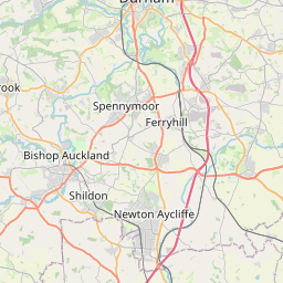
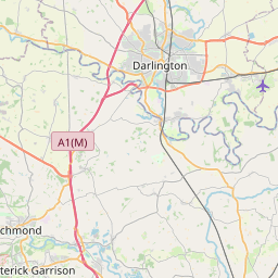
Barmpton Map, Satellite view of Barmpton, Durham, England
Barmpton is located in Durham County, Darlington, North East, England, United Kingdom.
Location informations of Barmpton
Latitude of city of Barmpton is 54.55562 and longitude of city of Barmpton is -1.51272. Barmpton has 1 postcode / zip code, in county of Durham.The County of Barmpton is Durham.
Postcode / zip code of Barmpton
DL1 3Administrative division of Barmpton
County :DurhamGPS coordinates of Barmpton
Latitude : 54.55562Longitude : -1.51272
Online Map of Barmpton - road map, satellite view and street view


Leaflet | © OpenStreetMap contributors
Search distance between two cities
The weather for Barmpton in the United Kingdom
Get today and tomorrow's weather forecasts for Barmpton. Find out the weather forecast for the week ahead and the weekend for Barmpton in the UK.Barmpton weather forecast 15 days
What is the nearest train station to Barmpton?
List of Railway Stations near to BarmptonThe nearest railway stations to Barmpton are listed below. Tickets are available at the train station ticket office or ticket machines.
| Name | Distances from Barmpton |
|---|---|
| North Road Station | 3.43 Km |
| Darlington Station | 4.50 Km |
| Dinsdale Station | 5.42 Km |
| Heighington Station | 6.40 Km |
| Teesside Airport Station | 7.01 Km |
| Newton Aycliffe Station | 8.14 Km |
| Allen's West Station | 10.37 Km |
| Eaglescliffe Station | 10.93 Km |
| Shildon Station | 11.19 Km |
| Yarm Station | 12.46 Km |
Durham Tees Valley Airport , UK (7.45 Km)
What is the nearest Public Transport Stops to Barmpton?
List of Stops near to BarmptonGetting there by public transport (nearest train, tube, overground line station and bus stops). The nearest stops to Barmpton are listed below.
| Stop Name | Distances from Barmpton |
|---|---|
| Rossway Bus Stop (I) | 692 m |
| Barmpton Mews Bus Stop (O) | 723 m |
| Rossway Bus Stop (O) | 749 m |
| Torrance Drive Bus Stop (I) | 839 m |
| Torrance Drive Bus Stop (O) | 849 m |
| Caledonian Way Bus Stop (I) | 867 m |
| Caledonian Way Bus Stop (O) | 888 m |
| Gleneagles Road Bus Stop (I) | 1.05 Km |
| Beech Road Bus Stop (O) | 1.08 Km |
| Gleneagles Road Bus Stop (O) | 1.12 Km |
Historic Places to Visit near Barmpton
List of Historic places near to Barmpton
| Name | Distances from Barmpton |
|---|---|
| Piercebridge Roman Fort and Bridge | 10.25 Km |
| Stanwick. St Johns Church | 14.43 Km |
| Stanwick Iron Age Fort | 14.77 Km |
Cities or Towns near Barmpton
List of places near to
| Name | Distance |
|---|---|
| Whinfield | 1.08 Km |
| Great Burdon | 1.34 Km |
| Haughton Le Skerne | 1.90 Km |
| Beaumont Hill | 2.30 Km |
| Harrowgate Hill | 2.40 Km |
| Harrowgate Village | 2.44 Km |
| Newton Ketton | 2.61 Km |
| Red Hall | 2.65 Km |
| Sadberge | 2.83 Km |
| Albert Hill | 3.04 Km |
| Drinkfield | 3.18 Km |
| Rise Carr | 3.34 Km |
| Coatham Mundeville | 3.36 Km |
| Whessoe | 3.42 Km |
| Hope Town | 3.60 Km |
| Eastbourne | 3.79 Km |
| Brafferton | 3.83 Km |
| Little Stainton | 3.86 Km |
| Bank Top | 4.26 Km |
| Firth Moor | 4.36 Km |
| Darlington | 4.46 Km |
| Faverdale | 4.49 Km |
| Pierremont | 4.53 Km |
| Great Stainton | 4.54 Km |
| Cockerton | 5.04 Km |
| Middleton St George | 5.23 Km |
| Coal Bank | 5.27 Km |
| Branksome | 5.39 Km |
| Skerne Park | 5.47 Km |
| Bishopton | 5.75 Km |
| Aycliffe Village | 5.77 Km |
| Black Banks | 5.82 Km |
| Mowden | 5.93 Km |
| Oak Tree | 6.14 Km |
| Archdeacon Newton | 6.20 Km |
| Preston-le-Skerne | 6.20 Km |
| Elstob | 6.23 Km |
| Blackwell | 6.29 Km |
| Hummersknott | 6.41 Km |
| Longnewton | 6.64 Km |
| Middleton One Row | 6.67 Km |
| Old Stillington | 6.70 Km |
| Whinny Hill | 7.04 Km |
| Over Dinsdale | 7.15 Km |
| Low Dinsdale | 7.47 Km |
| Merrybent | 7.60 Km |
| Hurworth Place | 7.72 Km |
| Redmarshall | 7.72 Km |
| Low Coniscliffe | 7.72 Km |
| Neasham | 7.76 Km |