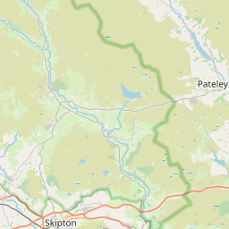
Bank Top Map, Satellite view of Bank Top, West Yorkshire, England
Bank Top is located in West Yorkshire County, Bradford District, Yorkshire and the Humber, England, United Kingdom.
Location informations of Bank Top
Latitude of city of Bank Top is 53.82209 and longitude of city of Bank Top is -1.72340. Bank Top has 1 postcode / zip code, in county of West Yorkshire.The County of Bank Top is West Yorkshire.
Postcode / zip code of Bank Top
BD10 8Administrative division of Bank Top
County :West YorkshireGPS coordinates of Bank Top
Latitude : 53.82209Longitude : -1.72340
Online Map of Bank Top - road map, satellite view and street view


Leaflet | © OpenStreetMap contributors
Search distance between two cities
The weather for Bank Top in the United Kingdom
Get today and tomorrow's weather forecasts for Bank Top. Find out the weather forecast for the week ahead and the weekend for Bank Top in the UK.Bank Top weather forecast 15 days
What is the nearest train station to Bank Top?
List of Railway Stations near to Bank TopThe nearest railway stations to Bank Top are listed below. Tickets are available at the train station ticket office or ticket machines.
| Name | Distances from Bank Top |
|---|---|
| Apperley Bridge Station | 2.47 Km |
| Frizinghall Station | 3.00 Km |
| Bradford Forster Square Station | 3.41 Km |
| New Pudsey Station | 3.41 Km |
| Shipley Station | 3.51 Km |
| Baildon Station | 3.70 Km |
| Bradford Interchange Station | 3.85 Km |
| Saltaire Station | 4.77 Km |
| Bramley (West Yorkshire) Station | 5.96 Km |
| Guiseley Station | 6.01 Km |
Leeds Bradford Airport , UK (6.38 Km)
What is the nearest Public Transport Stops to Bank Top?
List of Stops near to Bank TopGetting there by public transport (nearest train, tube, overground line station and bus stops). The nearest stops to Bank Top are listed below.
Historic Places to Visit near Bank Top
List of Historic places near to Bank Top
| Name | Distances from Bank Top |
|---|---|
| Colour Experience | 3.76 Km |
| National Media Museum | 4.09 Km |
| Farnley Hall | 11.59 Km |
| Bagshaw Museum | 11.64 Km |
| East Riddlesden Hall | 11.89 Km |
| Leeds, St John the Evangelist | 12.19 Km |
| Halifax, All Souls Church | 13.64 Km |
| Stainburn, St Marys Church | 14.18 Km |
Cities or Towns near Bank Top
List of places near to
| Name | Distance |
|---|---|
| Eccleshill | 0.30 Km |
| Thorpe Edge | 0.39 Km |
| Springfield | 0.72 Km |
| Ravenscliffe | 0.85 Km |
| Bolton Outlanes | 0.86 Km |
| Greengates | 0.88 Km |
| Haigh Fold | 1.04 Km |
| Moor End | 1.06 Km |
| Swain House | 1.16 Km |
| Fourlands | 1.34 Km |
| Moorside | 1.35 Km |
| Thorpe | 1.36 Km |
| Idle | 1.47 Km |
| Upper Fagley | 1.50 Km |
| Lower Fagley | 1.54 Km |
| Undercliffe | 1.56 Km |
| Fagley | 1.62 Km |
| Bolton | 1.63 Km |
| Apperley Bridge | 1.80 Km |
| Simpson Green | 1.85 Km |
| Woodhall | 1.93 Km |
| Low Fold | 1.94 Km |
| Idle Moor | 2.02 Km |
| Low Ash | 2.23 Km |
| Wrose | 2.27 Km |
| Priesthorpe | 2.31 Km |
| Woodhall Hills | 2.31 Km |
| Calverley | 2.41 Km |
| Thackley | 2.47 Km |
| West Royd | 2.49 Km |
| Bolton Woods | 2.53 Km |
| Thornbury | 2.53 Km |
| Bradford Moor | 2.57 Km |
| Thackley End | 2.66 Km |
| Barkerend | 2.69 Km |
| Owlet | 2.70 Km |
| Pollard Park | 2.91 Km |
| Wapping | 3.03 Km |
| Wood End | 3.04 Km |
| Windhill | 3.19 Km |
| Hillfoot | 3.19 Km |
| Eastbrook | 3.38 Km |
| Wellroyd | 3.43 Km |
| Charlestown | 3.44 Km |
| Laisterdyke | 3.45 Km |
| Heaton Grove | 3.49 Km |
| Baildon Holmes | 3.52 Km |
| Farsley | 3.58 Km |
| Manningham | 3.61 Km |
| Baildon Wood Bottom | 3.62 Km |