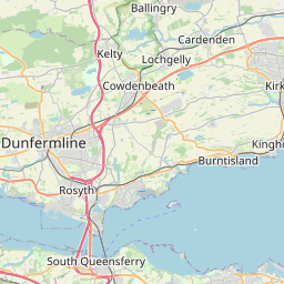
Baltilly Map, Satellite view of Baltilly, Fife, Scotland
Baltilly is located in Fife County, Fife, Scotland, Scotland, United Kingdom.
Location informations of Baltilly
Latitude of city of Baltilly is 56.29207 and longitude of city of Baltilly is -2.97902. Baltilly has 1 postcode / zip code, in county of Fife.The County of Baltilly is Fife.
Postcode / zip code of Baltilly
KY15 5Administrative division of Baltilly
County :FifeGPS coordinates of Baltilly
Latitude : 56.29207Longitude : -2.97902
Online Map of Baltilly - road map, satellite view and street view

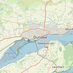


Leaflet | © OpenStreetMap contributors
Search distance between two cities
The weather for Baltilly in the United Kingdom
Get today and tomorrow's weather forecasts for Baltilly. Find out the weather forecast for the week ahead and the weekend for Baltilly in the UK.Baltilly weather forecast 15 days
What is the nearest train station to Baltilly?
List of Railway Stations near to BaltillyThe nearest railway stations to Baltilly are listed below. Tickets are available at the train station ticket office or ticket machines.
| Name | Distances from Baltilly |
|---|---|
| Cupar Station | 3.32 Km |
| Springfield Station | 4.54 Km |
| Ladybank Station | 9.07 Km |
| Leuchars Station | 10.63 Km |
| Markinch Station | 13.80 Km |
| Glenrothes with Thornton Station | 17.63 Km |
| Dundee Station | 18.29 Km |
| Invergowrie Station | 18.91 Km |
| Broughty Ferry Station | 20.53 Km |
| Balmossie Station | 22.05 Km |
RAF Leuchars , UK (11.28 Km)
What is the nearest Public Transport Stops to Baltilly?
List of Stops near to BaltillyGetting there by public transport (nearest train, tube, overground line station and bus stops). The nearest stops to Baltilly are listed below.
| Stop Name | Distances from Baltilly |
|---|---|
| Wemysshall Road Bus Stop (adj) | 366 m |
| Meldrums Hotel Bus Stop (adj) | 393 m |
| Meldrums Hotel Bus Stop (opp) | 421 m |
| Bow Butts Bus Stop (adj) | 465 m |
| Bow Butts Bus Stop (opp) | 476 m |
| Wemysshall Road Bus Stop (opp) | 512 m |
| Main Street Bus Stop (adj) | 576 m |
| Moor Road Bus Stop (adj) | 634 m |
| Main Street Bus Stop (opp) | 635 m |
| Schoolhill Bus Stop (adj) | 670 m |
Historic Places to Visit near Baltilly
List of Historic places near to Baltilly
| Name | Distances from Baltilly |
|---|---|
| Hill of Tarvit Mansion | 1.62 Km |
| Scotstarvit Tower | 2.45 Km |
| Lundin Links Standing Stones | 8.59 Km |
| St Athernase Church | 11.49 Km |
| St Andrews, West Port | 12.15 Km |
| Blackfriars Chapel | 12.24 Km |
| British Golf Museum | 12.49 Km |
| St Andrews Castle | 12.77 Km |
| Kirkheugh, St Marys Church | 13.08 Km |
| Balmerino Abbey | 13.56 Km |
| Kellie Castle | 14.03 Km |
| Falkland Palace | 14.76 Km |
Cities or Towns near Baltilly
List of places near to
| Name | Distance |
|---|---|
| Bridgend | 0.41 Km |
| Ceres | 0.53 Km |
| Craigrothie | 1.64 Km |
| Chance Inn | 2.52 Km |
| Pitscottie | 2.76 Km |
| Bellbrae | 2.82 Km |
| Baldinnie | 3.31 Km |
| Cupar | 3.65 Km |
| Cupar Muir | 3.89 Km |
| Kemback | 4.31 Km |
| Woodside | 4.36 Km |
| New Gilston | 4.92 Km |
| Blebocraigs | 5.02 Km |
| Foodieash | 5.33 Km |
| Springfield | 5.34 Km |
| Kirkton of Cults | 5.37 Km |
| Mills | 5.37 Km |
| Clatto | 5.65 Km |
| Peat Inn | 6.05 Km |
| Dairsie / Osnaburgh | 6.18 Km |
| Pitlessie | 6.33 Km |
| Lawhead | 6.82 Km |
| Moonzie | 7.28 Km |
| Radernie | 7.29 Km |
| Denhead | 7.30 Km |
| Bow of Fife | 7.52 Km |
| Coaltown of Burnturk | 7.74 Km |
| Strathkinness | 7.95 Km |
| Kettlehill | 8.03 Km |
| Kedlock | 8.05 Km |
| Largoward | 8.12 Km |
| Balmalcolm | 8.15 Km |
| Kedlock Feus | 8.24 Km |
| Lathones | 8.42 Km |
| Upper Largo / Kirkton of Largo | 8.56 Km |
| Baintown | 8.79 Km |
| Bonnybank | 8.89 Km |
| Logie | 8.92 Km |
| Fernie | 8.92 Km |
| Lundin Links | 8.92 Km |
| Ladybank | 9.08 Km |
| Drummochy | 9.15 Km |
| Kingskettle | 9.17 Km |
| Monkstown | 9.19 Km |
| Lower Largo | 9.20 Km |
| Letham | 9.20 Km |
| Parbroath | 9.20 Km |
| Easter Kinsleith | 9.20 Km |
| Guardbridge | 9.24 Km |
| Kincaple | 9.44 Km |